
(Photo: Logo from the Northwest Habitat Institute web site)
Monday, January 31, 2011
Using Interactive Biodiversity Information System (IBIS) Data in Decision Making
(Photo: Logo from the Northwest Habitat Institute web site)
Pacific Biodiversity Infromation Forum (PBIF) Pacific Islands Roundtable
 The Pacific Islands Roundtable for Nature Conservation and Protected Areas met in Apia, Samoa, this past summer. A key topic for the meeting was the monitoring and reporting of conservation efforts in the Pacific. PBIF currently chairs the monitoring working group. PBIF also supports the monitoring effort by providing online access to the reporting form(s) and maintaining the database for review and analysis. The Roundtable reviewed the results and supports the nascent reporting program.
(Photo: Lobelias in the understory of a native Hawaiian wet forest, Puu Kukui, Maui. Image: Elizabeth Speith (Public Domain))
Monday, January 24, 2011
Pacific Islands Climate Change Cooperative (PICCC)
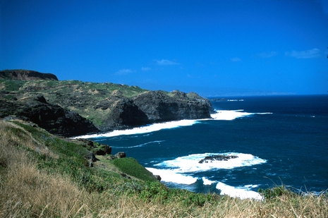
(Photo: Maui, Hawaii Coast Line. Credit: John J. Mosesso /life.nbii.gov)
NBII Central Southwest Gulf Coast Information Node Partners With Gulf of Mexico Alliance

Central Southwest Gulf Coast Information Node (CSWGCIN) continues to work with their partners in the Gulf of Mexico Alliance (GOMA). USGS National Wetlands Research Center librarians Linda Broussard and Cassie Thibodeaux participated in the GOMA Governors’ Action Plan II Implementation and Integration Workshop held in Biloxi, MS, on August 3–5, 2010. The workshop brought Gulf Coast State resource mangers together to work on regionally identified issues of major environmental concern. Teams focused on issues related to coastal community resilience, ecosystems integration and assessment, habitat conservation and restoration, managing nutrient inputs, water quality, and environmental education. CSWGCIN has worked with the Environmental Education Team since the Alliance was formed in 2005. Along with a partner from the Coastal Wetlands Planning, Protection and Restoration Act (CWPPRA), they gave a presentation on finding Web resources. Broussard is a member of the GOMA Environmental Education Steering Committee. For more information, see http://www.nbii.gov/gomaeen.
Tuesday, January 18, 2011
USGS-NBII Library of Images From the Environment (LIFE) Featured in Science.gov

 Thumbnails of LIFE's 28,000 scientific images are available through Science.gov, with direct links back to the LIFE Web site for detailed information and original image sizes. The debut of Science.gov's image search is being featured in online news and blog sites such as Information Today, Knowledge Speak, the Intellogist Blog, the Special Libraries Association, LibraryJournal.com, the NASA wiki, and others. LIFE will soon upload an additional 30,000 images contributed by the USGS and partner agencies to its Web site; those images will also be available to Science.gov's search tool.
(Photos: Top left: screen shot of the science.gov web site; bottom right: Alabama State butterfly: Tiger Swallowtail. Photograph: Elizabeth A. Sellers /NBII.Gov.)
Friday, January 14, 2011
Vegetation Characterization Products Now Available for Fort Donelson National Battlefield and Stones River National Battlefield

(Photo: Fort Donelson National Battlefield, courtesy of the USGS Vegetation Characterization Program website.)
Tuesday, January 11, 2011
Metadata Training To Be Offered in Alaska

(Photo: Black-footed ferret. Photo credit: Paul Marinari.)
Subscribe to:
Posts (Atom)
