Managed by the National Geospatial Program (NGP), The National Map Viewer provides data visualization and download of all eight The National Map Data sets and US Topo products.The viewer platform is extended upon the National Geospatial Intelligence Agency (NGA)'s Palanterra x3 Viewer.
Below, please find mashup examples of how The National Map Services and other Science, National, Local, or Emergency services can be used to create online maps in The National Map viewer or using other viewers.
The first three featured mashups are the top recognized mashup submissions that were part of The National Map User Conference (2011) Mashathon event as recognized by their peers. The categories were: Earth Science; Local, Tribal, Project Case Study; and Innovative Technology.
Other examples are featured collaborations between The National Map and the project area. >> more
Event Mashups highlight Emergency Response, Special Event, or Conferences Demonstrations. These mashups are not necessarily hosted or made by, but are using The National Map. For finding The National Map Hazard Digital Data Special Products library as hosted on HDDS, click more. >> more
These are legacy The National Map viewers that either have been retired or will be retired soon. The popular functionality and capability of these viewers will be maintained in the new viewers


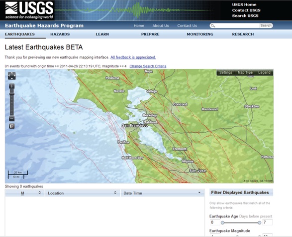 Earth Science: New USGS Earthquake basemap service using The National Map base data
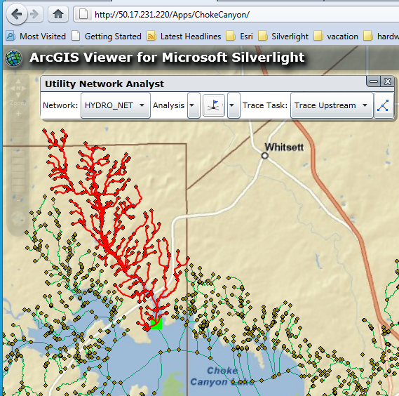 Innovative Tech : Re-Usable Web based The National Map NHD Network Tracing Components
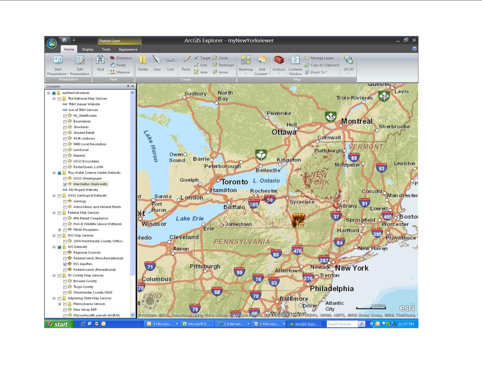 Local, Tribal, Project Case Study: WestChester County, New York, using The National Map Services in ArcGIS Explorer
 U.S. - Mexico Border Environmental Health Initiative - borderhealth.cr.usgs.gov
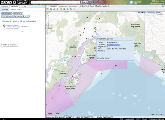 Active Hazards USGS is tracking
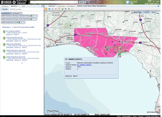 Weather & Warnings
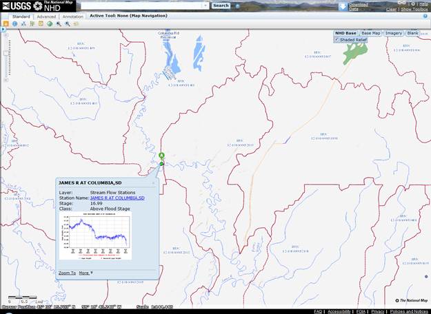 USGS Stream Gauge Status with TNM Hydrographic Basemap Service
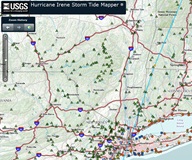 Hurricane Irene Flex Mapping Viewer by USGS WiM Group with TNM Basemap Services Option
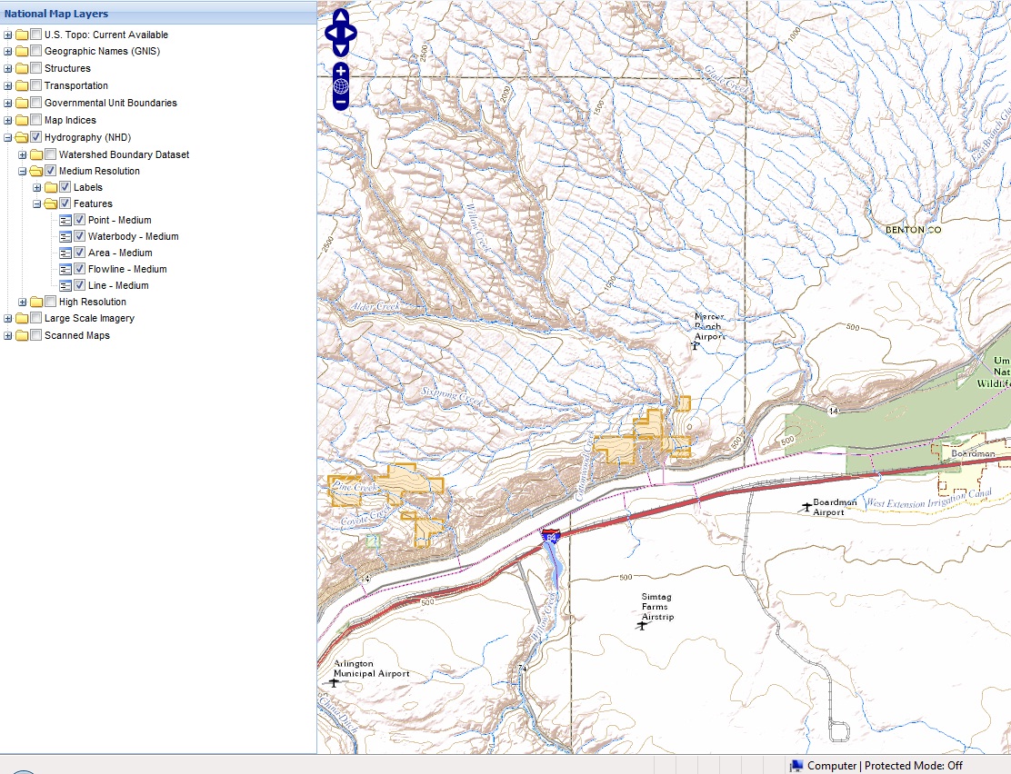 The National Map in Openlayers Demo
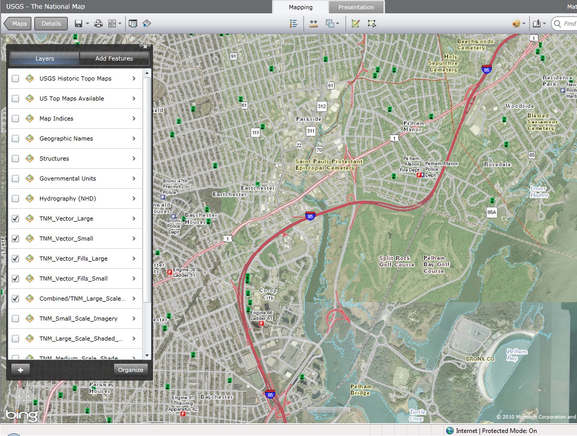 The National Map in ArcGIS.com
![National Hydrographic Dataset (NHD) [TNM Viewer]](https://cybercemetery.unt.edu/archive/nbii/20120111173613im_/http://viewer.nationalmap.gov/example/gallery/images/national/tnm-nhd.jpg) National Hydrographic Dataset (NHD) [TNM Viewer]
National Hydrographic Dataset (NHD) [TNM Viewer]![US Topo Download View [TNM Viewer]](https://cybercemetery.unt.edu/archive/nbii/20120111173613im_/http://viewer.nationalmap.gov/example/gallery/images/national/tnm-ustopopdf.jpg) US Topo Download View [TNM Viewer]
US Topo Download View [TNM Viewer]![Historical Scanned maps [TNM Viewer]](https://cybercemetery.unt.edu/archive/nbii/20120111173613im_/http://viewer.nationalmap.gov/example/gallery/images/national/tnm-ustopo.jpg) Historical Scanned maps [TNM Viewer]
Historical Scanned maps [TNM Viewer]![Federal Lands [TNM Viewer]](https://cybercemetery.unt.edu/archive/nbii/20120111173613im_/http://viewer.nationalmap.gov/example/gallery/images/national/tnm-fedlands.jpg) Federal Lands [TNM Viewer]
Federal Lands [TNM Viewer]![Public Land Survey (BLM PLSS) [TNM Viewer]](https://cybercemetery.unt.edu/archive/nbii/20120111173613im_/http://viewer.nationalmap.gov/example/gallery/images/national/tnm-plss.jpg) Public Land Survey (BLM PLSS) [TNM Viewer]
Public Land Survey (BLM PLSS) [TNM Viewer]![National Land Cover Dataset [TNM Viewer]](https://cybercemetery.unt.edu/archive/nbii/20120111173613im_/http://viewer.nationalmap.gov/example/gallery/images/national/tnm-nlcd.png) National Land Cover Dataset [TNM Viewer]
National Land Cover Dataset [TNM Viewer]![Start with a blank canvas [TNM Viewer]](https://cybercemetery.unt.edu/archive/nbii/20120111173613im_/http://viewer.nationalmap.gov/example/gallery/images/national/tnm-blank.png) Start with a blank canvas [TNM Viewer]
Start with a blank canvas [TNM Viewer]![USGS GAP Land Cover [TNM Viewer]](https://cybercemetery.unt.edu/archive/nbii/20120111173613im_/http://viewer.nationalmap.gov/example/gallery/images/science/tnm-padus-cons.jpg) USGS GAP Land Cover [TNM Viewer]
USGS GAP Land Cover [TNM Viewer]![Sciencebase.gov - the USGS Science Data Catalog [USGS Viewer]](https://cybercemetery.unt.edu/archive/nbii/20120111173613im_/http://viewer.nationalmap.gov/example/gallery/images/science/tnm-sciencebase.jpg) Sciencebase.gov - the USGS Science Data Catalog [USGS Viewer]
Sciencebase.gov - the USGS Science Data Catalog [USGS Viewer]![National Ground Water Monitoring Network Data Portal (BETA) [USGS Viewer]](https://cybercemetery.unt.edu/archive/nbii/20120111173613im_/http://viewer.nationalmap.gov/example/gallery/images/science/tnm-gdp.jpg) National Ground Water Monitoring Network Data Portal (BETA) [USGS Viewer]
National Ground Water Monitoring Network Data Portal (BETA) [USGS Viewer]![USDA Soil Survey Geographic (SSURGO) [ArcGIS.com]](https://cybercemetery.unt.edu/archive/nbii/20120111173613im_/http://viewer.nationalmap.gov/example/gallery/images/science/tnm-soils.png) USDA Soil Survey Geographic (SSURGO) [ArcGIS.com]
USDA Soil Survey Geographic (SSURGO) [ArcGIS.com]![Geologic Map of North America [ArcGIS.com]](https://cybercemetery.unt.edu/archive/nbii/20120111173613im_/http://viewer.nationalmap.gov/example/gallery/images/science/tnm-geology.png) Geologic Map of North America [ArcGIS.com]
Geologic Map of North America [ArcGIS.com]![Use of TNM Data to Detect Significant Topographic Changes [USGS Viewer]](https://cybercemetery.unt.edu/archive/nbii/20120111173613im_/http://viewer.nationalmap.gov/example/gallery/images/science/tnm-topo-change.jpg) Use of TNM Data to Detect Significant Topographic Changes [USGS Viewer]
Use of TNM Data to Detect Significant Topographic Changes [USGS Viewer]![View the USGS Vegetation Characterization data by National Park [TNM Viewer]](https://cybercemetery.unt.edu/archive/nbii/20120111173613im_/http://viewer.nationalmap.gov/example/gallery/images/science/tnm-vegparks.gif) View the USGS Vegetation Characterization data by National Park [TNM Viewer]
View the USGS Vegetation Characterization data by National Park [TNM Viewer]![USGS Terresterial Ecosystems [TNM Viewer]](https://cybercemetery.unt.edu/archive/nbii/20120111173613im_/http://viewer.nationalmap.gov/example/gallery/images/science/tnm-eco.jpg) USGS Terresterial Ecosystems [TNM Viewer]
USGS Terresterial Ecosystems [TNM Viewer]![US FWS Wetlands and Riparian Status [TNM Viewer]](https://cybercemetery.unt.edu/archive/nbii/20120111173613im_/http://viewer.nationalmap.gov/example/gallery/images/science/tnm-wetlands.jpg) US FWS Wetlands and Riparian Status [TNM Viewer]
US FWS Wetlands and Riparian Status [TNM Viewer]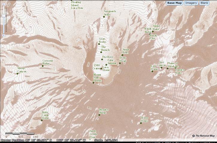 Mount St. Helens
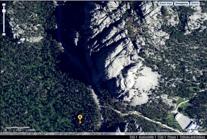 Mount Rushmore, South Dakota
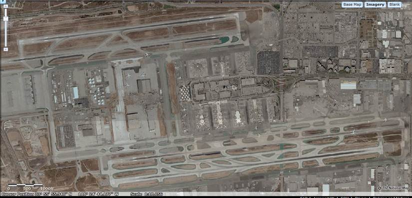 Los Angeles International Airport, Los Angeles, California
 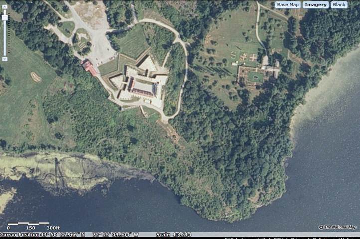 Fort Ticonderoga, New York
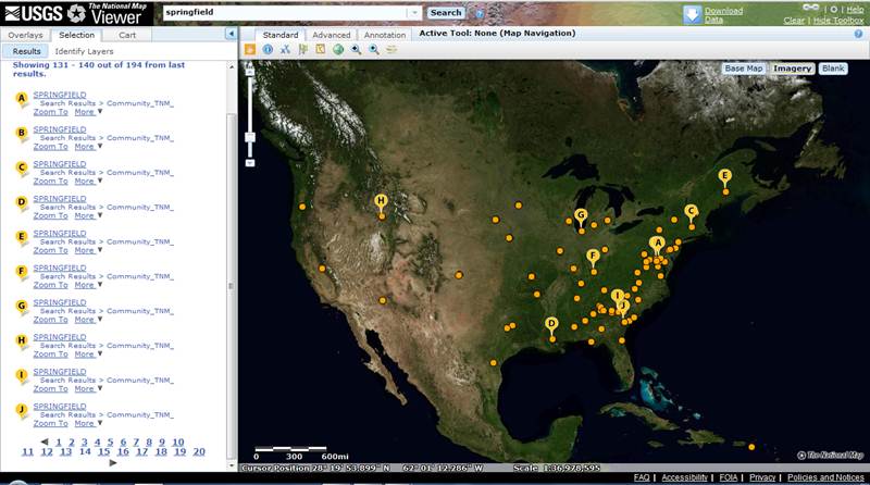 Search all the 'Springfields' across the country
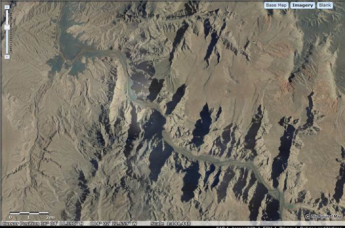 Grand Canyon
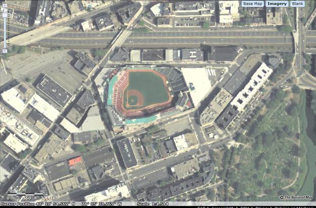 Fenway Park
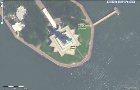 Statue of Liberty
![Being Migrated - Legacy 'TNM Seamless' Raster Download Viewer [NOTE: Functionality now supported in main TNM Viewer]](https://cybercemetery.unt.edu/archive/nbii/20120111173613im_/http://viewer.nationalmap.gov/example/gallery/images/legacy/tnm-seamless.jpg) Being Migrated - Legacy 'TNM Seamless' Raster Download Viewer [NOTE: Functionality now supported in main TNM Viewer]
Being Migrated - Legacy 'TNM Seamless' Raster Download Viewer [NOTE: Functionality now supported in main TNM Viewer]![Replaced - The National Map Legacy Viewer [NOTE: Functionality now supported in main TNM Viewer]](https://cybercemetery.unt.edu/archive/nbii/20120111173613im_/http://viewer.nationalmap.gov/example/gallery/images/legacy/tnm-viewer.jpg) Replaced - The National Map Legacy Viewer [NOTE: Functionality now supported in main TNM Viewer]
Replaced - The National Map Legacy Viewer [NOTE: Functionality now supported in main TNM Viewer] Replaced - The National Map 'National Hydrography Dataset' Viewer contains our most up-to-date, full featured hydrography data