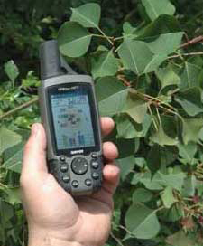
Invasive Species Mapping Made Easy!

Tallow Tree Collecting GPS Coordinates

EDDMapS, started in 2005 with Southeastern U.S. focus, is now providing a picture of the distribution of invasive species across the U.S.

  • Fast and easy to use - no knowledge of GIS required
  • Web-based mapping of invasive species distribution to help fill gaps and identify "leading edge" ranges
  • Facilitates Early Detection and Rapid Response implementation with online data entry forms, e-mail alerts and network of expert verifiers
  • One Database for both local and national data
  • Data can be searched, queried and downloaded in a variety of formats
  • Cooperates with and aggregates data from other invasive species mapping projects
  • Custom/hosted applications can be quickly and inexpensively developed

Data Sharing Partners
Statistics

261,633 Reports
1,017 Species

Bugwood Center Developed by The University of Georgia - Center for Invasive Species and Ecosystem Health.
Last updated on Wednesday, December 21, 2011 at 04:57 PM