Southern

 Search the Resource Catalog:
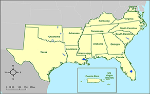
Search the Resource Catalog

Geographic Areas > Southern > About the SFP

Southern Fire Portal (SFP) Overview

The goal of the Southern Fire Portal (SFP) is to provide single point access to fire data, documents, tools, and other information resources in support of fire and natural resource management for the southern United States. Originally funded by the Joint Fire Science Program (JFSP) in 2003, project collaborators include the Tall Timbers Research Station (TTRS), The Nature Conservancy (TNC), USDA Forest Service Southern Research Station, USGS National Biological Information Infrastructure (NBII) program, and FRAMES. Resources that were targeted for inclusion into the portal include:


fireline image
  • - Regional deliverables funded by the JFSP and the National Fire Plan
  • - The TTRS E. V. Komarek Fire Ecology Database
  • - The Encyclopedia of Southern Fire Science
The southern region is geographically defined by the 13 states that are covered by the Southern Area Coordination Center (SACC). SACC is one of eleven geographic areas established to collaboratively manage wildland fire and other incident management activities. The SFP supports SACC by providing access to consolidated and organized fire research deliverables and other services necessary for effective fire and fuels management within this region.


SACC map

The Southern GACC Region

The Southern Area is one of eleven geographic areas across the United States and Alaska established to collaboratively manage wildland fire and other incident management activities. The regions are organized into GACCs (Geographic Area Coordination Centers). In addition to Puerto Rico and the U.S. Virgin Islands, the Southern Area includes 13 states. These range from Virginia in the north, south to the Gulf states, and west to Texas. In western Oklahoma and Texas, only private lands and state units participate as part of the Southern Area. Federal lands in this area coordinate activities through the Southwest Coordination Center in Albuquerque, NM.

Within the Southern Area, there are 35 National Forests, 2 National Grasslands, 1 Forest Service Institute, 143 National Wildlife Refuges, 98 National Park units, 13 State Forestry organizations, one Commonwealth, one Territory, 27 Tribal/Bureau of Indian Affairs units, two Bureau of Land Management units, 12 Regional Agency units, one Government Law Enforcement Training Center, six Department of Defense units, and one State Authority area - for a total of 348 units supported.

For more information on the Southern Area, including wildland fire predictive services visit the Southern Area Coordination Center (SACC) website.


Partners & Sponsors

TTRS logo FEN logo TNC logo
NBII logo JFSP logo SREF logo

UI logo
SRS logo SEFEP logo