Showing posts with label fishes. Show all posts

Monday, February 7, 2011

New Datasets Available Online at Biogeographic Information and Observation System (BIOS)

Five new datasets have been submitted to the Biogeographic Information and Observation System (BIOS). BIOS is the California Department of Fish and Game hosted infrastructure in the state to provide access from a single location to key biological datasets for habitat conservation planning and other activities by researchers and managers. Four datasets from CalTrans San Diego of vegetation mapping and sensitive species surveys from 2006 were submitted as well as a dataset of Wandering Skipper survey data conducted by the San Diego Association of Governments (SANDAG).

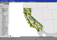
(Photo: Screen capture of the BIOS online's California Department of Fish and Game - IMAPS Viewer)

Friday, September 10, 2010

Announcing the Texas Coastal Fisheries Mapping Application


Gulf of Mexico coastal fisheries populations have tremendous value in ecological, economic, and social terms. As a result, each coastal state within the NBII Central Southwest Gulf Coast Information Node (CSWGCIN) region is involved in coastal fisheries management. Each agency that collects fisheries-independent (non-harvest) data in the Gulf of Mexico coastal waters does so according to agency-specific missions and goals; this leads to differing sampling methodologies and database formats. Each separate database tells part of the story about the state of Gulf of Mexico coastal fisheries resources. Combining them into a cohesive and complete data record is a difficult, yet important, task.

The goal is to combine coastal fisheries monitoring data from multiple Gulf states into an online mapping application. As a first step, CSWGCIN has acquired fisheries-independent monitoring data from the Texas Parks and Wildlife Department (TPWD) Coastal Fisheries Division and made the data accessible through the Texas Coastal Fisheries Mapping Application. The TPWD coastal fisheries resource database dates back to 1977 and is based on a randomized sampling method. The database includes information on a host of estuarine species sampled using a variety of sampling gears: bag seine, shrimp trawl, gill net, and oyster dredge. Each gear type is used by TPWD to sample particular habitat types, species, and life history stages. Bag seines collect juveniles and small adult species that inhabit estuarine edge habitat along shoreline and marsh fringes. Shrimp trawls collect small- to medium-sized species inhabiting bottom habitat of the open bay. Gill nets capture large adult specimens that move along the shore. Oyster dredges are used to collect shellfish from oyster reef habitats.
 
Data include catch numbers, lengths of specimens captured, hydrological data (e.g., salinity, dissolved oxygen, water temperature), and metadata describing location, date/time, and other characteristics (e.g., depth, sampling effort, etc.) of the sampling event. The TPWD coastal fisheries database is unique in that it contains data for all species captured in the various sampling gears, regardless of recreational or commercial importance.


Data were analyzed to determine time series trends in relative abundance for multiple estuarine fisheries species. Indicator species for this project were chosen based on commercial, recreational, or ecological importance. The list below provides examples of species included in the mapping application:


Common Name
Latin Name
Atlantic croaker
Micropogonias undulatus
Bay anchovy
Anchoa mitchilli
Black drum
Pogonias cromis
Blue catfish
Ictalurus furcatus
Blue crab
Callinectes sapidus
Brown shrimp
Farfantepenaeus aztecus
Gafftopsail catfish
Bagre marinus
Southern flounder
Paralichthys lethostigma
“The goal is to combine coastal fisheries monitoring data from multiple Gulf states into an online mapping application.”
Abundance was reported as relative abundance (the proportion of individuals of one species relative to the total number of individuals of all species captured at one location or time). Relative abundances were displayed in an online mapping interface and made available to users via the CSWGCIN portal.


In addition to viewing the time series fisheries abundance data in an online mapping interface, users can view physical characterization data for each estuary. The mapping interface provides hydrological information detailing average salinity, dissolved oxygen, turbidity, and water temperatures for the eight major bay systems in Texas. The data portal also includes an option to download the coastal fisheries data, hydrological data, and supporting metadata.
Tuesday, June 29, 2010

Organization of Fish and Wildlife Information Managers (OFWIM) Annual Conference and Business Meeting

October 17-21 OFWIM Annual Conference and Business Meeting: Partnerships and Collaboration in Public Land Management -  The Organization of Fish and Wildlife Information Managers (OFWIM), founded in 1993, is a non-profit association dedicated to the management and conservation of natural resources through technology and information exchange. OFWIM holds an annual conference and business meeting to bring together practitioners in the community to share activities and network with colleagues. The NBII has been actively involved in OFWIM to promote its data and technology sharing activities that support many of OFWIM’s member organizations. The 2010 OFWIM conference will take place on October 17-21 in Lake Barkley State Park at the Land Between the Lakes in Kentucky. The theme of the conference this year is “Partnerships and Collaboration in Public Land Management”. Submit your abstract for a presentation or poster by July 30th that highlights examples of successful partnerships dealing with any aspect of natural resource and public land management. Some of the areas that might be of interest as conference subtopics include:

• State Wildlife Action Plans Updates
• Climate Change
• Mobile Technology – GPS, GIS, Smart Phones, etc.
• Emerging Technology
• Interagency Cooperation
• Using Technology to Overcome Cutbacks

Lake Barkley State Park Resort is located in western Kentucky, approximately 2 hours northwest of Nashville, TN, which has the nearest major airport. In addition to general sessions, panels, and a poster session, the conference will also offer a field trip led by federal, state, and local agency managers that includes a boat ride to Duck Island in Kentucky Lake and a tour of the Land Between the Lakes, where the trip participants will get a first hand view of cooperative management efforts in the region.

Visit www.ofwim.org to submit presentations and posters, apply for travel grants, and get more information about the conference. Click here to register.

Friday, April 16, 2010

U.S. Fish and Wildlife Service Partners with Integrated Taxonomic Information System (ITIS)

On March 23, 2010, the U.S. Fish and Wildlife Service (USFWS) signed a partnership agreement with the Integrated Taxonomic Information System (ITIS). As a USGS-led partnership of federal agencies, international partners, and non-governmental organizations, ITIS meets the shared need of scientifically credible taxonomic information by providing an easily accessible database with reliable information on species names and their hierarchical classification. The scope of ITIS is global, providing authoritative taxonomy of the world's biota with a special emphasis on North American species. ITIS has also dedicated resources to maintain accurate and current information on protected species, which is integral to supporting the mission of the USFWS and other Department of Interior bureaus. Other U.S. federal agencies in partnership with ITIS include the U. S. Department of Agriculture (USDA), National Oceanic and Atmospheric Administration (NOAA), U.S. Geological Survey (USGS), Smithsonian Institution, U.S. Environmental Protection Agency (EPA), and the National Biological Information Infrastructure (NBII).


(Photo: American alligator (Alligator mississippiensis) near the surface of the water with turtles on its back. © 2008 Bruce Avera Hunter, NBII LIFE.)

Thursday, February 4, 2010

NBII Designated Home for National Fish Habitat Action Plan Data System

The USGS-NBII was designated by the National Fish Habitat Board to house the data delivery system supporting the National Fish Habitat Action Plan. The first phase of the data system will be completed by the end of 2010 to facilitate the transfer of data between and among the Fish Habitat Partnerships and the Board. This accomplishment will further the progress of development to enable visualization of these data and Web mapping capabilities, which will support the states, non-governmental organizations, industry, and federal agencies within and external to DOI that are working to improve the Nation’s fish habitat.

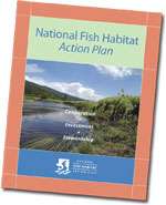
The National Fish Habitat Action Plan (PDF 2.2 MB) is an unprecedented attempt to address an unseen crisis for fish nationwide: loss and degradation of their watery homes.


(Photo: courtesy of the National Fish Habitat Action Plan website)

Wednesday, June 17, 2009

OFWIM 2009 Conference and Annual Meeting

The Organization of Fish and Wildlife Information Managers (OFWIM), is an international non-profit association takes advantage of technology and information exchange to management and conservation of natural resources. OFWIM is holding its annual conference on September 14-17 in Seattle, Washington. For more information, go the the OFWIM website or visit the registration website.

OFWIM's mission is to:

"promote the management and conservation of natural resources by facilitating technology and information exchange among managers of fish and wildlife information."
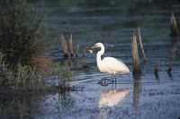
(Photo: Great Egret (Ardea alba) Photographer: John J. Mosesso/NBII)