 USGS-National Park Service (NPS) Vegetation Characterization Program
 (VCP) documentation for
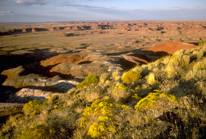
Petrified Forest National Park has been completed and is available on the
VCP Web site. Products include aerial photography - graphic of orthophoto mosaic, and spatial orthophoto data; project report - photointerpretation key, vegetation descriptions, vegetation key, photos of map class, and accuracy assessment; field data - graphic of field plots, spatial field plots data, field database, physical descriptive for plots and species list for plots; geospatial vegetation information - graphics of vegetation communities, spatial vegetation data, spatial boundary data and plots and AA photos; accuracy assessment information - graphic of accuracy assessment points, spatial AA points data, and contingency matrix; metadata, and a link to NPS information about Petrified Forest National Park. The goal of the VCP is to classify and map the vegetation communities of National Parks that have a natural resource component. Complete documentation is currently available for sixty-seven park units and two U.S. Fish and Wildlife refuge units. The VCP is managed by the USGS Center for Biological Informatics in cooperation with the NPS Inventory and Monitoring Program. The USGS Vegetation Characterization effort includes the management and upkeep of the VCP protocols, Web-based access to the standards, and the Web-based access to NPS Vegetation Characterization program finished products.

 USGS-National Park Service (NPS) Vegetation Characterization Program (VCP) documentation for Petrified Forest National Park has been completed and is available on the VCP Web site
0 comments:
Post a Comment