-
images/goes_11_15.png

-
images/space_to_you.jpg
Low Bandwith >>High Bandwith >>
-
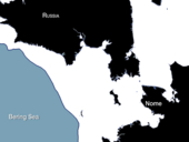
images/sarsat_feature_2011.jpg
-
images/jpss_feature.jpg
transition status, instrument breakdown, and more >>
NSOF processes the first VIIRS
images from NPP

An image taken by the NPP Visible Infrared Imager Radiometer Suite (VIIRS) on Nov. 21, 2011.Credit:NASA [click image to enlarge]
On November 21, 2011, the first images were acquired by the Visible Infrared Imager Radiometer Suite (VIIRS), which shows a broad swath of Eastern North America from Canada’s Hudson Bay past Florida to the northern coast of Venezuela. The information from VIIRS was processed at the NOAA Satellite Operations Facility (NSOF) in Suitland, Md. VIIRS is one of five instruments onboard the recently launched National Polar-orbiting Environmental Satellite System (NPOESS) Preparatory Project (NPP) spacecraft.
By far the largest instrument onboard NPP, VIIRS weighs about 556 pounds (252 kilograms). Its data, collected from 22 channels across the electromagnetic spectrum, will be used to observe the Earth’s surface including fires, ice, ocean color, vegetation, clouds, and land and sea surface temperatures.
The NPP satellite, a joint effort by NOAA and NASA, launched from Vandenberg Air Force Base, California, on October 28, 2011. NPP has reached its final orbit at an altitude of 512 miles (824 kilometers), powered on all instruments and is traveling around the Earth at 16,640 miles an hour (eight kilometers per second). The other instruments onboard NPP include the Cross-track Infrared Sounder, the Advanced Technology Microwave Sounder, the Ozone Mapper Profiler Suite, and the Clouds and the Earth’s Radiant Energy System.
Important Links:
- NOAA Prepares for NPP- http://www.nesdis.noaa.gov/npp_launch.html
- NPP Launch Information- http://www.nasa.gov/mission_pages/NPP/launch/index.html
- NASA Guest Operations- http://guestops.hq.nasa.gov/
- Kennedy Space Center News- http://www.nasa.gov/centers/kennedy/launchingrockets/status/2011/elvstatus-20111019.html
----
News Makers
 Dave McAdoo:2011 Administrator's Award-Arctic Sea Ice Research
-
 Prasanjit Dash: (CIRA) Research and Service Initiative Award
 -
 Lidia Cucurull: 2010 NOAA David Johnson Award
 -
 Gary Davis: AMS Award- Meteorology, Oceanography, Climatology
 -
 Syd Levitus: Elected Fellow-(AAAS)
 -
 Shobha Kondragunta: Gold Medal for Scientific / Engineering