Butterflies and Moths of North America Recently Verified Sightings in the Pacific Northwest Region
ryDLar - Nymphalis antiopa - 2005-02-24 [Sat Dec 03 14:49:32 EST 2011]
RaisingButterfl... - Euphyes vestris - 2010-07-10 [Tue Nov 29 14:55:07 EST 2011]
er2982 - Triphosa haesitata - 2011-11-28 [Mon Nov 28 23:24:39 EST 2011]
plex1ppus - Lycaena rubidus - 2011-07-17 [Mon Nov 28 16:49:20 EST 2011]
ryDLar - Colias occidentalis - 2008-07-14 [Tue Nov 22 23:22:59 EST 2011]
Christopher Christie - Euphydryas gillettii - 2011-07-28 [Mon Nov 21 23:41:14 EST 2011]
Christopher Christie - Euphydryas gillettii - 2011-07-28 [Mon Nov 21 23:26:44 EST 2011]
Christopher Christie - Euphydryas editha - 2011-07-28 [Mon Nov 21 23:10:22 EST 2011]
Christopher Christie - Euphydryas editha - 2011-07-28 [Mon Nov 21 21:42:45 EST 2011]
4oclockwatch - Antheraea polyphemus - 2011-07-08 [Mon Nov 21 17:15:35 EST 2011]
plex1ppus - Speyeria zerene - 2010-08-29 [Sun Nov 20 13:17:18 EST 2011]
rfeins - Pachysphinx modesta - 2011-08-24 [Wed Nov 09 17:21:07 EST 2011]
Sarahlane04 - Nymphalis antiopa - 2011-11-08 [Tue Nov 08 15:05:28 EST 2011]
lhrobinson9672 - Euphydryas editha - 2011-07-10 [Tue Nov 01 01:40:07 EDT 2011]
plex1ppus - Cercyonis sthenele - 2009-09-12 [Fri Oct 28 22:58:40 EDT 2011]
bnewell - Scoliopteryx libatrix - 2011-10-26 [Thu Oct 27 16:26:29 EDT 2011]
RaisingButterfl... - Speyeria cybele - 2009-07-25 [Thu Oct 20 16:24:03 EDT 2011]
kassidy - Aglais milberti - 2011-10-07 [Thu Oct 20 16:01:05 EDT 2011]
Thomas Paine - Strymon melinus - 2011-08-11 [Sun Oct 16 19:53:48 EDT 2011]
JulieR - Spilosoma virginica - 2011-09-09 [Sun Oct 09 00:25:48 EDT 2011]
JulieR - Spilosoma virginica - 2011-09-09 [Sun Oct 09 00:23:54 EDT 2011]
JulieR - Lophocampa maculata - 2011-10-08 [Sun Oct 09 00:05:57 EDT 2011]
plex1ppus - Campaea perlata - 2011-08-11 [Fri Oct 07 17:55:41 EDT 2011]
plex1ppus - Orgyia pseudotsugata - 2011-10-01 [Thu Oct 06 13:28:01 EDT 2011]
plex1ppus - Tolype distincta - 2011-09-04 [Thu Oct 06 11:35:52 EDT 2011]
plex1ppus - Pyralis farinalis - 2011-10-01 [Thu Oct 06 11:29:37 EDT 2011]
Wscott - Polygonia satyrus - 2011-09-03 [Wed Oct 05 15:55:18 EDT 2011]
lofree - Papilio rutulus - 2011-09-30 [Sat Oct 01 01:52:31 EDT 2011]
kab1@whidbey.com - Hyles lineata - 2011-09-30 [Fri Sep 30 19:02:44 EDT 2011]
carissadillow - Ascalapha odorata - 2011-09-29 [Fri Sep 30 14:16:51 EDT 2011]


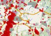
![MEAP-VHSV Database Interface [Image: NACSE]](https://cybercemetery.unt.edu/archive/nbii/20120111065155im_/http://www.nbii.gov/portal/server.pt/gateway/PTARGS_0_2_26277_810_2284_43/http%3B/cbi-lap7.cbi.cr.usgs.gov%3B7097/publishedcontent/publish/geographic/pacific_northwest/pnwin_vhsv_highlight/pnwin_meap_vhsv_highlight_1.jpg)


![Lahontan Cutthroat Trout [Photo: U.S. Bureau of Reclamation]](https://cybercemetery.unt.edu/archive/nbii/20120111065155im_/http://www.nbii.gov/portal/server.pt/gateway/PTARGS_0_2_25276_810_2284_43/http%3B/cbi-lap7.cbi.cr.usgs.gov%3B7097/publishedcontent/publish/geographic/pacific_northwest/pnwin_live_maps_and_data_intro__wide__new/lmd_cutthroat_lahontan_cutthroat_usbr.jpg)


![IHNV [Photo: NOAA]](https://cybercemetery.unt.edu/archive/nbii/20120111065155im_/http://www.nbii.gov/portal/server.pt/gateway/PTARGS_0_2_25276_810_2284_43/http%3B/cbi-lap7.cbi.cr.usgs.gov%3B7097/publishedcontent/publish/geographic/pacific_northwest/pnwin_live_maps_and_data_intro__wide__new/lmd_ihnv_noaa2.jpg)
![[Photo: Andy Noyes, South Dakota Division of Wildlife]](https://cybercemetery.unt.edu/archive/nbii/20120111065155im_/http://www.nbii.gov/portal/server.pt/gateway/PTARGS_0_2_25276_810_2284_43/http%3B/cbi-lap7.cbi.cr.usgs.gov%3B7097/publishedcontent/publish/geographic/pacific_northwest/pnwin_live_maps_and_data_intro__wide__new/vhs_sdinfo.jpg)


![[Photo: USGS]](https://cybercemetery.unt.edu/archive/nbii/20120111065155im_/http://www.nbii.gov/portal/server.pt/gateway/PTARGS_0_2_25276_810_2284_43/http%3B/cbi-lap7.cbi.cr.usgs.gov%3B7097/publishedcontent/publish/geographic/pacific_northwest/pnwin_live_maps_and_data_intro__wide__new/lmd_teco_usgs.jpg)
![Tree Ring [Photo: NOAA]](https://cybercemetery.unt.edu/archive/nbii/20120111065155im_/http://www.nbii.gov/portal/server.pt/gateway/PTARGS_0_2_25276_810_2284_43/http%3B/cbi-lap7.cbi.cr.usgs.gov%3B7097/publishedcontent/publish/geographic/pacific_northwest/pnwin_live_maps_and_data_intro__wide__new/lmd_tring_noaa.jpg)

 The
The 
