Announcements
The NGS Map and Shoreline Data Explorer Applications will be unavailable Tuesday, January 10th from 9am until 12pm Eastern Time due to security patching. If you have any questions, please contact the NGS Webmaster.
NGS Releases Beta LOCUS for Testing
NGS has released a Beta version of the Leveling Online Computations User Service, LOCUS, for a 90-day comment period. Through the end of March 2012, NGS is requesting our stakeholders and constituents to test their leveling projects with LOCUS and provide feedback to us at...more
NGS Announces New Photo Submission Guidelines:
http://geodesy.noaa.gov/web/surveys/photo_submissions/
NGS Releases Final Report for Floodplain Mapping Pilot Project
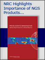
As NGS moves closer to 2022 and replacing the North American Datum of 1983 (NAD 83) and the North American Vertical Datum of 1988 (NAVD 88), NGS is interacting closely with agencies that use the datums to assist in the transition...more
Notice: Planned Updates to NGS Datasheet Format
In response to stakeholder and NGS staff concerns, NGS has developed several modifications to the format of the NGS datasheet—the primary method for accessing the passive control network of the National Spatial Reference System (NSRS)...more
Trial Version of the New NOAA Shoreline Data Explorer Available:
http://beta.ngs.noaa.gov/shoreline_raster
2010 Federal Geospatial Summit Proceedings on Improvements to the National Spatial Reference System available:
http://www.ngs.noaa.gov/2010Summit/proceedings.shtml
A 2009 independent study shows the benefits to the U.S. economy from NOAA's positioning products and services are in the billions of dollars.
Click here for a one page overview of the study
Click here for a copy of the full report
In The News
12/21/2011 - Public Release of Emergency Response Imagery Mobile Website
NGS has released a new mobile Web application that makes it possible for emergency responders to access emergency response imagery in the field...more
12/15/2011 - National Geodetic Survey Releases Initial Gravimetric Geoid Validation Results (NGS)
In partnership with international colleagues and state, local, and university partners, NOAA validated an important component of the latest gravity surface model (the "geoid") in 2011 and presented initial survey results...more
12/08/2011 - NGS and Partners Study Bench Mark Stability in Massachusetts Coastal Marshes
From December 5-9, the National Geodetic Survey will lead an investigation at Waquoit Bay, Massachusetts into optimal installation techniques for deep rod type bench marks set in wetland sediments, as well as...more