How do I use this site?
This website allows you to see populations of 13 different birds for various bays & counties in Texas. To view the populations first click on a bay (Bay Color) or county (County Color) on the map. As you move your mouse over each location you will see its name displayed.

You can navigate around the map by clicking and dragging with your mouse. You can also zoom in using your mouse wheel or using the zoom control on the top left side of the map.

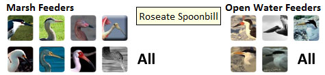
Once you click on a location on the map a small popup will be displayed with icons for each of the available species of birds. Click on their icon to display a graph of their population over time. You can view a graph of multiple birds at the same time by pressing shift and then clicking on a bird's icon.

Additional help information about the graphs and map is available under the help section on the left.

Click anywhere to close this help information
Graphs
After you select a location a small popup will appear. At the bottom of this popup are icons of all available species. (shown below)
Available Species
As you move your mouse over each species, their name will be displayed. Population data for some species is not available at every location. When a species is not available their icon is grayed out.
Combination Graphs
You can compare up to 4 species simultaneously on the same graph. To add a species to the current graph press and hold the shift key and then click on another species icon.
Utilities
There are 4 icons in the top right corner of the popup. They allow you to change between bar & line graphs, print the graph, download the raw data, and to display this help information.
Click anywhere to close this help information
Using the Map
This website uses Google Maps to display the bays & counties that you can view bird populations for. If you've used Google Maps before, you can use this page just like you use Google Maps. If you haven't used Google Maps before, here are some tips:

Moving Around the Map
Navigation Buttons You can move around the map by clicking your mouse anywhere on the map and dragging. You can also use the navigation buttons (shown on the right) to move around.
Zooming
You can also zoom in and out on the map by using your mouse wheel. You can also use the zoom control located underneath the navigation buttons.
Note: If you zoom out too far the map icons will disappear. They will be displayed again if you zoom in closer.
Change the Map Type
You can also change the map type from a map to a satellite view to a hybrid between the two by clicking their corresponding icons in the top right corner of the map.
Click anywhere to close this help information
Contact & Sponsor Information
For questions contact:
Texas Fish and Wildlife Service Houston Advanced Research Center
Dr. Stephanie Glenn
Houston Advanced Research Center
sglenn@harc.edu

Thanks to the Texas Fish and Wildlife Service for Census data

Click anywhere to close this help information
Texas Coastal Waterbirds NBII Central Southwest / Gulf Coast Information Node
Hide Tools
Welcome
This website contains details regarding the population of waterbirds for various bays & counties in Texas.
How do I use this site?
Contact & Sponsor Information
To Get Started
Click a bay (Bay Color) or
county (County Color) on the map
Help
If you are having trouble using this website click on a help section below: