The National Map

|
News you can use about USGS Mapping ProductsJanuary 9, 2012 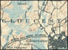
Missouri and New Hampshire Historical Maps added: The complete series of USGS Historical Topographic Maps for Missouri and New Hampshire have been loaded for free download from the USGS Store Map Locator. The addition of these quadrangles brings the total number of historical, legacy topographic maps to more than 141,000 , covering 41 states. The historical maps are available in a GeoPDF format and can be searched by state name, scale or map name. The goal of the Historical Topographic Map Collection is to scan all scales and all editions of the more than 200,000 topographic maps published by the USGS since the inception of the topographic mapping program in 1884. http://1.usa.gov/oSPTDv
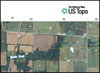
US Topo Increasing Numbers: The loading of updated US Topo maps for Missouri and Nevada has exceed 30% each! More than 36 states containing more than 41,400 quadrangles are now partially or almost totally covered by the new USGS digital electronic topographic map, the US Topo. The program is now replacing the former "Digital Map-Beta" maps with US Topo maps. Free download from the USGS Store. Complete listing. Is your state covered? http://1.usa.gov/lvbSol

Trail Running, Kiwi-Style: NGTOC employee Paul Jurasin recently celebrated his 50th birthday in a rather unique fashion. His story can be found at: http://www.runningtimes.com/Article.aspx?ArticleID=24699
Connecticut Historical Maps added: The complete series of USGS Historical Topographic Maps for Connecticut has been loaded for free download from the USGS Store Map Locator. That brings the total number of historical, legacy topographic maps to more than 149,190, covering 39 states. The historical maps are available in a GeoPDF format and can be searched by state name, scale or map name. The goal of the Historical Topographic Map Collection is to scan all scales and all editions of the more than 200,000 topographic maps published by the USGS since the inception of the topographic mapping program in 1884. http://1.usa.gov/oSPTDv
Nebraska Historical Maps added: The complete series of USGS Historical Topographic Maps for Nebraska has been loaded for free download from the USGS Store Map Locator. That brings the total number of historical, legacy topographic maps to more than 132,200, covering 38 states. The historical maps are available in a GeoPDF format and can be searched by state name, scale or map name. The goal of the Historical Topographic Map Collection is to scan all scales and all editions of the more than 200,000 topographic maps published by the USGS since the inception of the topographic mapping program in 1884. http://1.usa.gov/oSPTDv

620+:We are happy to announce more than 620 tweeters now follow The National Map Twitter site. Account name @USGSTNM. Sign up today and join in the conversation!
US Topo Update: Production and release of the US Topo started in October 2009. The US Topo is an enhancement of the previous "Digital Map–Beta" product, with the addition on the hydrography and contour layers. The new mapping product was formally introduced at the "125th Anniversary of Topographic Mapping" Celebration on December 3, 2009. The National Geospatial Technical Operations Center reports the following:
*Current "Digital Map - Beta" maps that are being updated to US Topo specifications Note: As of October 25, 2010, the percentage of US Topos complete and total quadrangles loaded will include U.S. Forest Service lands.
Arizona Historical Maps added: The complete series of USGS Historical Topographic Maps for Arizona has been loaded for free download from the USGS Store Map Locator. That brings the total number of historical, legacy topographic maps to nearly 130,000, covering 37 states. The historical maps are available in a GeoPDF format and can be searched by state name, scale or map name. The goal of the Historical Topographic Map Collection is to scan all scales and all editions of the more than 200,000 topographic maps published by the USGS since the inception of the topographic mapping program in 1884. http://1.usa.gov/oSPTDv
Digital Map–Beta Update: In a little more than 19 months since the release of the "Digital Map–Beta" web site, the National Geospatial Technical Operations Center can report the following:
Note: Forest Service quads in the above states are currently not included, which often gives a "missing quad" look. The USGS is working with the Forest Service so that maps made in 2010 and beyond will include lands administered by USFS. The "Digital Map–Beta" is the initial electronic digital map. With the integration of the hydrography and contour layers, the maps produced after October 2009, and starting with Kansas, will be classified as US Topo. 
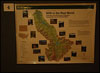
Geospatial Websites Upgraded: The US Topo and Historical Topographic Map Collection websites have added an interactive map application to their home pages. Thumbnail images of actual maps display all available versions of the featured series in an animated format. The display allows the user to view the maps in chronological order, view larger versions of each map, and an option to download the full-resolution version directly. This first showcase features six topographic maps from the Boothbay, Maine area - ranging from 1893 to the present.

Historical Map Video: The USGS has released the "Historical Topographic Map Collection-Distribution of USGS Maps- Old and New" video presentation. It features team lead Greg Allord at the recent International Map Trade Association (IMTA) Conference. The video covers the project history, goals, updates and examples.
US Topo Moving Forward: Nevada has started and Missouri is continuing! More than 36 states containing more than 41,000 quadrangles are now partially or almost totally covered by the new USGS digital electronic topographic map, the US Topo. The program is now replacing the former "Digital Map-Beta" maps with US Topo maps. Free download from the USGS Store. Complete listing. Is your state covered? http://1.usa.gov/lvbSol

New Heights of Accuracy for World Topography: The U.S. Geological Survey (USGS) and the National Geospatial-Intelligence Agency (NGA) have collaborated in the development of a much improved global elevation model, the Global Multi-resolution Terrain Elevation Data 2010 (GMTED2010). GMTED2010 replaces the widely used, 15-year-old GTOPO30 terrain model as the best available global digital elevation model. All of the GMTED2010 data products are publicly available online with no redistribution restrictions. http://on.doi.gov/v0sreR

USGS Geospatial Data Contract Website: The National Geospatial Technical Operations Center (NGTOC) has linked a new Geospatial Data Contract website to The National Map website. The Geospatial Product and Service Contracts (GPSC) is a suite of contracts, broad in scope, that can accommodate activities related to standard, nonstandard, graphic, and digital cartographic products. Services provided may include: photogrammetric mapping and aerotriangulation; orthophotography; thematic mapping (for example, land characterization); digital imagery applications; IFSAR and LiDAR; geographic information systems development; surveying and control acquisition, including ground-based and airborne GPS; and much more.
Historical Maps Now Covering 36 States: The release of more than 13,688 historical topographic maps covering California highlights the rapid pace of the USGS Historical Topographic Map Collection. Nearly 124,000 high resolution scans of historical USGS maps, some dating as far back as 1884, are now available online for free from the USGS Store. The electronic maps are georeferenced and can be used in conjunction with the new USGS digital topographic map, the US Topo.

FGDC Launches New Geospatial Website: The Federal Geographic Data Committee (FGDC), in conjunction with several geospatial partners has released a prototype Geospatial Platform website providing an initial view of the future of user-friendly, integrated, federal data collections on common geographic maps. Through the website, users can create their own maps by combining their data with public domain data and can collaborate in public and private groups with others who share their interests. Maps assembled through the Geospatial Platform can be shared with others through web browsers and mobile technologies. All of this is possible without requiring users to install software on their own computers. News Release.

Volunteer Geographic Information: Since 1994, citizen volunteers have helped the USGS improve its topographic maps. A new fact sheet has been released to explain the current status of volunteer map data collection, pilot projects and the possible future of The National Map Corps.
Historical Topographic Map Collection Update – over half way: More than 102,300high resolution scans of the more than 200,000 historical USGS topographic maps, some dating as far back as 1884, are now available online. The Historical Topographic Map Collection includes published U.S. maps of all scales and editions, and are offered as a georeferenced digital download or as a scanned print from the USGS Store.

There's A (M)app For That: Topographic maps from the USGS are now available as an app for Apple iOS devices including the iPhone, iPad and iPod Touch. The new app, called PDF Maps, has been released though the iTunes App Store and allows free download of any available US Topo or USGS Historical maps from the USGS Store or Map Locator tool.

US Topo – Exceeding Goals: The US Topo crested an important milestone as the staff exceeded the ambitions goal of producing 18,500 digital quadrangles in one year. This brings the total of US Topos available for no-cost download to more than 36,200 maps covering 33 states. Recently, the program has started to replace the former "Digital Map Beta" prototypes with US Topo maps and have included a land cover layer. Also, the US Topo website has been updated to reflect significant product additions.

Geospatial Summit and Radio Interview: Mark DeMulder, the Director of the National Geospatial Program gave a keynote presentation on "Mapping the Future" at the inaugural Geospatial Summit, September13 in Herndon, VA. Prior to the Summit, he was featured in a radio interview on Federal News Radio. NGP Standards: Standards and specifications are essential to facilitate the development and sharing of geospatial data and products. The USGS standards and specifications that define the requirements to ensure that all products and data prepared by the USGS under the National Geospatial Program are consistent in accuracy, structure, format, style, and content can now be found on The National Map website.

Bridging the Gap – The National Map Now Serving Complete Data for the US-Canadian Border: Since 2007 the USGS has partnered with the International Joint Commission of Canada and the U.S. (IJC) to extend National Hydrography Dataset (NHD) and WBD interpretations into Canada. This effort involves complex negotiations between State, Provincial and Federal agencies, resulting in the ability for users of the National Map to view, download and use Hydrologic Units and Hydrographic layers that were previously limited to the International Boundary. Identical interpretations are currently available on Natural Resources Canada's data portal GeoBase.
The National Map Corps Update: The USGS National Geospatial Program (NGP) sponsored volunteer map data collection projects for 20+ years. Citizen mappers revised many maps, but the program was suspended in 2008 due to funding.
New technologies and social media have made volunteered geographic information (VGI) a possibility.
As a result, the USGS has launched a pilot project to explore the future citizen participation. http://1.usa.gov/pkNgfi

Emergency Response Fact Sheet: The USGS National Geospatial Program (NGP) has released a new fact sheet listing the most popular web based resources for emergency responders and others to get timely and relevant information concerning earthquakes, floods, hurricanes, landslides, tsunamis, volcanoes, wildfires, terrorist attacks and accidental oil spills. http://on.doi.gov/iEmVfo

New Website Face: An updated version of The National Map website (nationalmap.gov) was rolled out in conjunction with The National Map Users Conference. The new home page includes an user-specified map selection menu, easier to read navigation tabs, a search box, refined news section and a real-time Twitter feed. Check it out – comments welcome!
|
|

![]() U.S. Department of the Interior |
U.S. Geological Survey
U.S. Department of the Interior |
U.S. Geological Survey
URL: http://nationalmap.gov/index.html
Page Contact Information: The National Map
Page Last Modified: Thursday, 10-Nov-2011 18:46:54 EST