USGS - science for a changing world

Kansas Water Science Center

Current Streamflow Conditions

Welcome to the U.S. Geological Survey (USGS) Web page for the water resources of Kansas. Here you'll find information on Kansas's rivers and streams. You'll also find information about groundwater, water quality, and many other topics. The USGS operates the most extensive satellite network of stream-gaging stations in the state, many of which form the backbone of flood-warning systems.

The Kansas Water Science Center provides current ("real-time") stream stage in Kansas and streamflow, water-quality, and groundwater levels for over 200 sites.
The USGS provides National ("real-time") stream stage and streamflow, water-quality, and groundwater levels for over 7000 sites.

Of Current Interest

New: Status of Groundwater Levels and Storage Volume in the Equus Beds Aquifer near Wichita, Kansas, July 2011

News Release: Kanopolis and Tuttle Creek Lakes Losing Storage Capacity

USGS WaterAlert Service WaterAlert

Now you can receive instant, customized updates about water conditions by subscribing to WaterAlert, a new service from the U.S. Geological Survey. WaterAlert allows you to receive daily or hourly updates about current conditions in rivers, lakes and groundwater when they match conditions of concern to you.

Highlighted Publications

The Kansas Water Science Center produces publications about water resources.   Search our publications

USGS Home Water Resources Biology Geography Geology Geospatial

Accessibility FOIA Privacy Policies and Notices

Take Pride in America logo USA.gov logo U.S. Department of the Interior | U.S. Geological Survey
URL: /index.shtml
Page Contact Information: GS-W-KS_info@usgs.gov
Page Last Modified:Tuesday, 01-Nov-2011 16:40:15 CDT
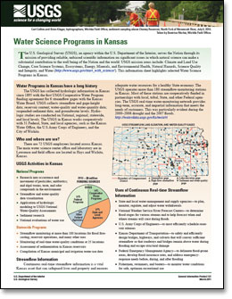
07157500: Flow=2.9cfs,Stage=2.71ft,Floodstage=6.5ft,2012-01-12 12:30,Low,CROOKED C NR ENGLEWOOD, KS 07156900: Flow=26cfs,Stage=2.10ft,Floodstage=5ft,2012-01-12 12:00,Low,Cimarron River near Forgan, OK 07144910: Flow=7.9cfs,Stage=2.67ft,Floodstage=9ft,2012-01-12 12:00,Low,SF NINNESCAH R NR PRATT, KS 06862700: Flow=0.02cfs,Stage=3.06ft,2012-01-12 12:30,Low,SMOKY HILL R NR SCHOENCHEN, KS 06893000: Flow=42900cfs,Stage=10.77ft,Floodstage=32ft,2012-01-12 12:30,>90,Missouri River at Kansas City, MO 06872500: Flow=117cfs,Stage=4.76ft,Floodstage=15ft,2012-01-12 12:30,>90,NF SOLOMON R AT PORTIS, KS 06818000: Flow=40900cfs,Stage=7.47ft,Floodstage=17ft,2012-01-12 12:30,>90,Missouri River at St. Joseph, MO 06813500: Flow=37900cfs,Stage=8.86ft,Floodstage=17ft,2012-01-12 12:30,>90,Missouri River at Rulo, NE 07180500: Flow=1.1cfs,Stage=4.24ft,2012-01-12 12:15,<10,CEDAR C NR CEDAR POINT, KS 07179795: Flow=0.76cfs,Stage=4.69ft,2012-01-12 12:00,<10,N COTTONWOOD R BL MARION LK, KS 07143300: Flow=3.1cfs,Stage=4.36ft,Floodstage=18ft,2012-01-12 12:00,<10,COW C NR LYONS, KS 07142300: Flow=0.48cfs,Stage=2.86ft,Floodstage=9ft,2012-01-12 12:00,<10,RATTLESNAKE C NR MACKSVILLE, KS 07141300: Flow=2.1cfs,Stage=1.25ft,Floodstage=12ft,2012-01-12 12:30,<10,ARKANSAS R AT GREAT BEND, KS 07139000: Flow=0.00cfs,Stage=5.05ft,Floodstage=10ft,2012-01-12 12:30,<10,ARKANSAS R AT GARDEN CITY, KS 06866500: Flow=21cfs,Stage=4.00ft,Floodstage=20ft,2012-01-12 12:45,<10,SMOKY HILL R NR MENTOR, KS 06864500: Flow=11cfs,Stage=1.32ft,Floodstage=20ft,2012-01-12 12:30,<10,SMOKY HILL R AT ELLSWORTH, KS 07144550: Flow=117cfs,Stage=1.38ft,Floodstage=12ft,2012-01-12 13:00,<10,ARKANSAS R AT DERBY, KS 07143665: Flow=3.2cfs,Stage=0.00ft,Floodstage=22ft,2012-01-12 12:15,<10,L ARKANSAS R AT ALTA MILLS, KS 06865500: Flow=8.8cfs,Stage=2.82ft,2012-01-12 12:30,<10,SMOKY HILL R NR LANGLEY, KS 06857100: Flow=28cfs,Stage=5.09ft,2012-01-12 12:45,<10,REPUBLICAN R AT JUNCTION CITY, KS 06821500: Flow=0.00cfs,Stage=3.92ft,Floodstage=12ft,2012-01-12 11:30,<10,Arikaree River at Haigler, Nebr. 07145200: Flow=190cfs,Stage=4.25ft,Floodstage=8ft,2012-01-12 13:00,76-90,SF NINNESCAH R NR MURDOCK, KS 06876900: Flow=301cfs,Stage=5.72ft,Floodstage=24ft,2012-01-12 12:30,76-90,SOLOMON R AT NILES, KS 06875900: Flow=259cfs,Stage=9.03ft,Floodstage=21ft,2012-01-12 12:30,76-90,SOLOMON R NR GLEN ELDER, KS 06856000: Flow=335cfs,Stage=5.45ft,Floodstage=15ft,2012-01-12 12:30,76-90,REPUBLICAN R AT CONCORDIA, KS 07185000: Flow=195cfs,Stage=2.59ft,Floodstage=15ft,2012-01-12 12:00,10-24,Neosho River near Commerce, OK 07184000: Flow=0.07cfs,Stage=0.79ft,Floodstage=14ft,2012-01-12 12:45,10-24,LIGHTNING C NR MCCUNE, KS 07169500: Flow=13cfs,Stage=2.91ft,Floodstage=17ft,2012-01-12 12:00,10-24,FALL R AT FREDONIA, KS 07151500: Flow=57cfs,Stage=2.23ft,Floodstage=10ft,2012-01-12 13:00,10-24,CHIKASKIA R NR CORBIN, KS 07147070: Flow=9.0cfs,Stage=1.75ft,Floodstage=21ft,2012-01-12 12:00,10-24,WHITEWATER R AT TOWANDA, KS 07146500: Flow=421cfs,Stage=9.66ft,Floodstage=17ft,2012-01-12 12:00,10-24,ARKANSAS R AT ARKANSAS CITY, KS 07145500: Flow=155cfs,Stage=3.67ft,Floodstage=17ft,2012-01-12 13:00,10-24,NINNESCAH R NR PECK, KS 07144300: Flow=117cfs,Stage=2.47ft,2012-01-12 12:45,10-24,ARKANSAS R AT WICHITA, KS 07144200: Flow=24cfs,Stage=0.95ft,2012-01-12 12:00,10-24,L ARKANSAS R AT VALLEY CENTER, KS 07143330: Flow=103cfs,Stage=2.59ft,Floodstage=10ft,2012-01-12 12:00,10-24,ARKANSAS R NR HUTCHINSON, KS 06916600: Flow=113cfs,Stage=4.39ft,Floodstage=27ft,2012-01-12 12:45,10-24,MARAIS DES CYGNES R NR KS-MO ST LINE, KS 06884400: Flow=132cfs,Stage=3.93ft,Floodstage=21ft,2012-01-12 12:30,10-24,L BLUE R NR BARNES, KS 06882000: Flow=128cfs,Stage=3.42ft,Floodstage=20ft,2012-01-12 12:00,10-24,Big Blue River at Barneston, Nebr. 07188000: Flow=624cfs,Stage=5.99ft,Floodstage=20ft,2012-01-12 12:00,25-75,Spring River near Quapaw, OK 07186000: Flow=170cfs,Stage=1.79ft,Floodstage=19ft,2012-01-12 12:30,25-75,Spring River near Waco, MO 07183000: Flow=155cfs,Stage=6.97ft,Floodstage=15ft,2012-01-12 12:00,25-75,NEOSHO R NR IOLA, KS 07182510: Flow=150cfs,Stage=6.11ft,Floodstage=27ft,2012-01-12 12:15,25-75,NEOSHO R AT BURLINGTON, KS 07182250: Flow=154cfs,Stage=2.98ft,Floodstage=32ft,2012-01-12 12:00,25-75,COTTONWOOD R NR PLYMOUTH, KS 07180400: Flow=49cfs,Stage=3.21ft,Floodstage=22ft,2012-01-12 12:00,25-75,COTTONWOOD R NR FLORENCE, KS 07179730: Flow=16cfs,Stage=2.65ft,Floodstage=26ft,2012-01-12 12:15,25-75,NEOSHO R NR AMERICUS, KS 07179500: Flow=4.3cfs,Stage=7.88ft,2012-01-12 13:00,25-75,NEOSHO R AT COUNCIL GROVE, KS 07172000: Flow=29cfs,Stage=1.77ft,2012-01-12 13:00,25-75,CANEY R NR ELGIN, KS 07170700: Flow=0.11cfs,Stage=3.11ft,2012-01-12 12:00,25-75,BIG HILL C NR CHERRYVALE, KS 07170500: Flow=53cfs,Stage=2.32ft,Floodstage=30ft,2012-01-12 13:00,25-75,VERDIGRIS R AT INDEPENDENCE, KS 07169800: Flow=6.3cfs,Stage=2.71ft,2012-01-12 12:00,25-75,ELK R AT ELK FALLS, KS 07167500: Flow=6.0cfs,Stage=2.33ft,2012-01-12 12:15,25-75,OTTER C AT CLIMAX, KS 07166500: Flow=28cfs,Stage=3.31ft,Floodstage=19.0ft,2012-01-12 12:45,25-75,VERDIGRIS R NR ALTOONA, KS 07149000: Flow=71cfs,Stage=1.12ft,Floodstage=10ft,2012-01-12 12:30,25-75,MEDICINE LODGE R NR KIOWA, KS 07147800: Flow=125cfs,Stage=1.55ft,Floodstage=18ft,2012-01-12 12:00,25-75,WALNUT R AT WINFIELD, KS 07144795: Flow=0.23cfs,Stage=1.14ft,2012-01-12 12:00,25-75,NF NINNESCAH R AT CHENEY DAM, KS 07144780: Flow=78cfs,Stage=7.41ft,2012-01-12 12:00,25-75,NF NINNESCAH R AB CHENEY RE, KS 07141780: Flow=1.3cfs,Stage=6.68ft,Floodstage=29ft,2012-01-12 12:15,25-75,WALNUT C AT NEKOMA, KS 07138000: Flow=88cfs,Stage=3.81ft,Floodstage=10ft,2012-01-12 12:15,25-75,ARKANSAS R AT SYRACUSE, KS 07137500: Flow=91cfs,Stage=2.82ft,Floodstage=8ft,2012-01-12 12:15,25-75,ARKANSAS R NR COOLIDGE, KS 06917500: Flow=30cfs,Stage=7.82ft,Floodstage=38ft,2012-01-12 12:30,25-75,MARMATON R NR FORT SCOTT, KS 06917000: Flow=11cfs,Stage=3.21ft,Floodstage=22ft,2012-01-12 12:15,25-75,L OSAGE R AT FULTON, KS 06915000: Flow=4.5cfs,Stage=2.00ft,2012-01-12 12:30,25-75,BIG BULL C NR HILLSDALE, KS 06913500: Flow=46cfs,Stage=3.65ft,Floodstage=31ft,2012-01-12 12:30,25-75,MARAIS DES CYGNES R NR OTTAWA, KS 06913000: Flow=47cfs,Stage=1.18ft,2012-01-12 12:30,25-75,MARAIS DES CYGNES R NR POMONA, KS 06912500: Flow=19cfs,Stage=2.94ft,2012-01-12 12:45,25-75,HUNDRED AND TEN MILE C NR QUENEMO, KS 06911900: Flow=3.5cfs,Stage=7.90ft,2012-01-12 12:00,25-75,DRAGOON C NR BURLINGAME, KS 06910800: Flow=3.8cfs,Stage=2.17ft,Floodstage=19ft,2012-01-12 12:45,25-75,MARAIS DES CYGNES R NR READING, KS 06893500: Flow=54cfs,Stage=4.35ft,Floodstage=34ft,2012-01-12 12:45,25-75,Blue River at Kansas City, MO 06893300: Flow=14cfs,Stage=5.68ft,Floodstage=14.00ft,2012-01-12 12:15,25-75,INDIAN C AT OVERLAND PARK, KS 06893080: Flow=5.9cfs,Stage=3.79ft,Floodstage=16ft,2012-01-12 12:45,25-75,BLUE R NR STANLEY, KS 06892350: Flow=2120cfs,Stage=5.04ft,Floodstage=26ft,2012-01-12 12:45,25-75,KANSAS R AT DESOTO, KS 06892000: Flow=42cfs,Stage=2.74ft,Floodstage=23ft,2012-01-12 12:30,25-75,STRANGER C NR TONGANOXIE, KS 06891500: Flow=5.1cfs,Stage=4.20ft,Floodstage=23ft,2012-01-12 12:30,25-75,WAKARUSA R NR LAWRENCE, KS 06891000: Flow=2150cfs,Stage=2.63ft,Floodstage=17ft,2012-01-12 12:30,25-75,KANSAS R AT LECOMPTON, KS 06890900: Flow=53cfs,Stage=27.84ft,2012-01-12 12:00,25-75,DELAWARE R AT PERRY, KS 06890100: Flow=26cfs,Stage=2.25ft,Floodstage=27ft,2012-01-12 12:45,25-75,DELAWARE R NR MUSCOTAH, KS 06889500: Flow=36cfs,Stage=0.54ft,Floodstage=29ft,2012-01-12 13:00,25-75,SOLDIER C NR TOPEKA, KS 06889200: Flow=18cfs,Stage=7.48ft,Floodstage=26ft,2012-01-12 12:30,25-75,SOLDIER C NR DELIA, KS 06889000: Flow=1950cfs,Stage=5.07ft,Floodstage=26ft,2012-01-12 12:30,25-75,KANSAS R AT TOPEKA, KS 06888500: Flow=45cfs,Stage=2.94ft,Floodstage=21.0ft,2012-01-12 12:45,25-75,MILL C NR PAXICO, KS 06888000: Flow=13cfs,Stage=4.33ft,2012-01-12 12:45,25-75,VERMILLION C NR WAMEGO, KS 06887500: Flow=1720cfs,Stage=4.28ft,Floodstage=19ft,2012-01-12 12:30,25-75,KANSAS R AT WAMEGO, KS 06887000: Flow=603cfs,Stage=1.95ft,2012-01-12 12:00,25-75,BIG BLUE R NR MANHATTAN, KS 06885500: Flow=23cfs,Stage=3.56ft,Floodstage=19ft,2012-01-12 12:30,25-75,BLACK VERMILLION R NR FRANKFORT, KS 06884200: Flow=7.9cfs,Stage=1.69ft,Floodstage=18ft,2012-01-12 12:45,25-75,MILL C AT WASHINGTON, KS 06884025: Flow=117cfs,Stage=2.33ft,Floodstage=19ft,2012-01-12 12:00,25-75,Little Blue River at Hollenberg, KS 06879100: Flow=575cfs,Stage=5.78ft,Floodstage=21ft,2012-01-12 12:30,25-75,KANSAS R AT FORT RILEY, KS 06878000: Flow=21cfs,Stage=4.44ft,Floodstage=19ft,2012-01-12 12:45,25-75,CHAPMAN C NR CHAPMAN, KS 06877600: Flow=381cfs,Stage=7.00ft,Floodstage=26ft,2012-01-12 12:45,25-75,SMOKY HILL R AT ENTERPRISE, KS 06874000: Flow=22cfs,Stage=3.79ft,Floodstage=14ft,2012-01-12 12:30,25-75,SF SOLOMON R AT OSBORNE, KS 06873460: Flow=4.6cfs,Stage=4.04ft,Floodstage=12ft,2012-01-12 12:30,25-75,SF SOLOMON R AT WOODSTON, KS 06861000: Flow=1.2cfs,Stage=0.23ft,Floodstage=7ft,2012-01-12 12:30,25-75,SMOKY HILL R NR ARNOLD, KS 06860000: Flow=1.4cfs,Stage=4.03ft,Floodstage=9ft,2012-01-12 12:30,25-75,SMOKY HILL R AT ELKADER, KS 06856600: Flow=321cfs,Stage=7.35ft,Floodstage=15ft,2012-01-12 12:30,25-75,REPUBLICAN R AT CLAY CENTER, KS 06853500: Flow=264cfs,Stage=2.83ft,Floodstage=11ft,2012-01-12 12:30,25-75,REPUBLICAN R NR HARDY, NE 06815000: Flow=83cfs,Stage=4.07ft,Floodstage=23ft,2012-01-12 12:45,25-75,Big Nemaha River at Falls City, Nebr. 06814000: Flow=6.6cfs,Stage=1.70ft,Floodstage=21ft,2012-01-12 12:45,25-75,TURKEY C NR SENECA, KS 385608094380300: Flow=9.4cfs,Stage=3.64ft,2012-01-12 12:00,Not ranked,INDIAN C AT INDIAN C PKWY, OVERLAND PARK, KS 385520094420000: Flow=19cfs,Stage=1.89ft,2012-01-12 12:15,Not ranked,INDIAN C AT COLLEGE BLVD, JOHNSON CO, KS 385446094430700: Flow=2.7cfs,Stage=2.56ft,2012-01-12 12:15,Not ranked,INDIAN C AT 119TH ST, OVERLAND PARK, KS 375350097262800: Stage=4.47ft,2012-01-12 12:30,Not ranked,L ARKANSAS R UPSTREAM OF ASR FAC NR SEDGWICK, KS 07187600: Flow=572cfs,Stage=3.25ft,Floodstage=14ft,2012-01-12 12:30,Not ranked,SPRING R NR BAXTER SPRINGS, KS 07185090: Flow=9.5cfs,Stage=7.38ft,2012-01-12 12:15,Not ranked,Tar Creek near Commerce, OK 07183500: Flow=207cfs,Stage=7.37ft,Floodstage=21ft,2012-01-12 02:00,Not ranked,NEOSHO R NR PARSONS, KS 07182390: Flow=185cfs,Stage=1.10ft,Floodstage=22ft,2012-01-12 12:30,Not ranked,NEOSHO R AT NEOSHO RAPIDS, KS 07182280: Flow=137cfs,Stage=5.18ft,2012-01-12 12:15,Not ranked,COTTONWOOD R NR NEOSHO RAPIDS, KS 07180200: Stage=5.08ft,2012-01-12 12:00,Not ranked,COTTONWOOD R AT MARION, KS 07179750: Flow=11cfs,Stage=3.34ft,2012-01-12 12:30,Not ranked,NEOSHO R AT BURLINGAME RD NR EMPORIA, KS 07179710: Stage=10.80ft,2012-01-12 12:00,Not ranked,NEOSHO R NR DUNLAP, KS 07170990: Flow=63cfs,Stage=2.82ft,2012-01-12 12:45,Not ranked,VERDIGRIS R AT COFFEYVILLE, KS 07155590: Flow=0.00cfs,Stage=6.18ft,Floodstage=12ft,2012-01-12 12:15,Not ranked,CIMARRON R NR ELKHART, KS 07147900: Stage=2.79ft,Floodstage=18ft,2012-01-12 12:00,Not ranked,WALNUT R AT ARKANSAS CITY, KS 07147190: Stage=3.93ft,Floodstage=21ft,2012-01-12 12:15,Not ranked,WHITEWATER R AT AUGUSTA, KS 07146800: Flow=2.0cfs,Stage=5.55ft,Floodstage=21ft,2012-01-12 12:00,Not ranked,WB WALNUT R NR EL DORADO, KS 07145700: Stage=4.04ft,2012-01-12 13:00,Not ranked,SLATE C AT WELLINGTON, KS 07144790: Stage=1417.36ft,2012-01-12 12:00,Not ranked,CHENEY RE NR CHENEY, KS 07144490: Flow=3.5cfs,Stage=7.48ft,2012-01-12 12:15,Not ranked,COWSKIN C AT KELLOGG ST, WICHITA, KS 07144486: Flow=0.05cfs,Stage=5.01ft,2012-01-12 13:00,Not ranked,CALFSKIN C AT 119TH ST, WICHITA, KS 07144480: Flow=3.3cfs,Stage=7.13ft,Floodstage=18ft,2012-01-12 12:00,Not ranked,COWSKIN C AT 119TH ST AT WICHITA, KS 07144470: Stage=11.43ft,2012-01-12 12:15,Not ranked,COWSKIN C AT 29TH ST NORTH OF WICHITA, KS 07144301: Flow=0.00cfs,Stage=6.51ft,2012-01-12 12:00,Not ranked,FLOODWAY AT ARKANSAS R AT WICHITA, KS 07144201: Flow=0.00cfs,2012-01-12 12:00,Not ranked,FLOODWAY AT L ARKANSAS R AT VALLEY CENTER, KS 07144100: Flow=15cfs,Stage=2.28ft,Floodstage=22ft,2012-01-12 12:00,Not ranked,L ARKANSAS R NR SEDGWICK, KS 07143672: Flow=5.5cfs,Stage=5.58ft,Floodstage=25ft,2012-01-12 12:00,Not ranked,L ARKANSAS R AT HWY 50 NR HALSTEAD, KS 07143375: Flow=43cfs,Stage=5.39ft,2012-01-12 12:00,Not ranked,ARKANSAS R NR MAIZE, KS 07143350: Flow=86cfs,Stage=12.23ft,2012-01-12 12:00,Not ranked,ARKANSAS R NR BENTLEY, KS 07143310: Stage=2.94ft,2012-01-12 12:15,Not ranked,COW C NR HUTCHINSON, KS 07142680: Flow=50cfs,Stage=8.86ft,2012-01-12 12:00,Not ranked,ARKANSAS R NR NICKERSON, KS 07142575: Stage=12.38ft,2012-01-12 12:00:00,Floodstage=17ft,Not ranked,Ice affected,RATTLESNAKE C NR ZENITH, KS 07142019: Flow=0.02cfs,Stage=1.95ft,2012-01-12 12:00,Not ranked,CHEYENNE BOTTOMS DV NR GREAT BEND, KS 07141900: Not ranked,Ice affected,WALNUT C AT ALBERT, KS 07141770: Stage=2.12ft,2012-01-12 12:00:00,Floodstage=31ft,Not ranked,Ice affected,WALNUT C NR ALEXANDER, KS 07141220: Flow=0.00cfs,Stage=2.19ft,2012-01-12 13:00,Not ranked,ARKANSAS R NR LARNED, KS 07141200: Flow=0.00cfs,Stage=5.90ft,Floodstage=31ft,2012-01-12 12:30,Not ranked,PAWNEE R AT ROZEL, KS 07141175: Flow=0.00cfs,Stage=4.18ft,Floodstage=16ft,2012-01-12 12:30,Not ranked,BUCKNER C NR BURDETT, KS 07141000: Flow=0.00cfs,Stage=2.73ft,2012-01-12 12:45,Not ranked,BUCKNER C AT HANSTON, KS 07140900: Flow=0.23cfs,Stage=2.49ft,2012-01-12 12:15,Not ranked,BUCKNER C NR JETMORE, KS 07140890: Flow=4.0cfs,Stage=3.15ft,2012-01-12 12:45,Not ranked,BUCKNER C BL HORSETHIEF RE NR JETMORE, KS 07140880: Flow=0.76cfs,Stage=3.54ft,2012-01-12 12:15,Not ranked,BUCKNER C AB HORSETHIEF RE NR JETMORE, KS 07140850: Flow=0.00cfs,Stage=2.39ft,Floodstage=30ft,2012-01-12 12:00,Not ranked,PAWNEE R NR BURDETT, KS 07139500: Stage=6.00ft,Floodstage=11ft,2012-01-12 12:00,Not ranked,ARKANSAS R AT DODGE CITY, KS 07138070: Flow=0.00cfs,Stage=5.78ft,Floodstage=14ft,2012-01-12 12:45,Not ranked,ARKANSAS R AT DEERFIELD, KS 07138020: Flow=83cfs,Stage=6.03ft,2012-01-12 12:45,Not ranked,ARKANSAS R AT KENDALL, KS 07137000: Flow=0.00cfs,Stage=9.09ft,2012-01-12 12:45,Not ranked,FRONTIER DITCH NR COOLIDGE, KS 07134990: Not ranked,Seasonal site,WILD HORSE CREEK ABOVE HOLLY, CO 06917630: Flow=0.88cfs,Stage=1.65ft,2012-01-12 12:15,Not ranked,East Drywood Creek at Prairie State Park 06917560: Flow=27cfs,Stage=2.46ft,Floodstage=25ft,2012-01-12 12:15,Not ranked,Marmaton River near Richards, MO 06917240: Flow=9.0cfs,Stage=0.00ft,2012-01-12 12:00,Not ranked,MARMATON R NR UNIONTOWN, KS 06915800: Flow=115cfs,Stage=4.23ft,Floodstage=25ft,2012-01-12 12:15,Not ranked,MARAIS DES CYGNES R AT LA CYGNE, KS 06914995: Stage=915.29ft,2012-01-12 12:30,Not ranked,HILLSDALE LK NR HILLSDALE, KS 06914990: Flow=1.1cfs,Stage=2.84ft,2012-01-12 12:30,Not ranked,L BULL C NR SPRING HILL, KS 06914950: Flow=0.17cfs,Stage=1.80ft,2012-01-12 12:00,Not ranked,BIG BULL C NR EDGERTON, KS 06914100: Flow=13cfs,Stage=3.09ft,Floodstage=23ft,2012-01-12 12:45,Not ranked,POTTAWATOMIE C NR SCIPIO, KS 06912490: Stage=973.27ft,2012-01-12 12:45,Not ranked,POMONA LK NR QUENEMO, KS 06911490: Flow=1.7cfs,Stage=0.59ft,Floodstage=10ft,2012-01-12 12:30,Not ranked,SALT C AT LYNDON, KS 06911000: Stage=2.43ft,2012-01-12 12:45,Not ranked,MARAIS DES CYGNES R AT MELVERN, KS 06910997: Stage=1033.75ft,2012-01-12 12:00,Not ranked,MELVERN LK NR MELVERN, KS 06893578: Flow=73cfs,Stage=5.07ft,Floodstage=33ft,2012-01-12 12:30,Not ranked,Blue River at Stadium Drive in Kansas City, MO 06893562: Flow=0.00cfs,Stage=4.44ft,2012-01-12 11:45,Not ranked,Brush Creek at Rockhill Road in Kansas City, MO 06893557: Flow=0.41cfs,Stage=36.21ft,Floodstage=47ft,2012-01-12 12:15,Not ranked,Brush Creek at Ward Parkway in Kansas City, MO 06893400: Flow=19cfs,Stage=83.05ft,2012-01-12 12:30,Not ranked,Indian Creek at 103rd St in Kansas City, MO 06893390: Flow=22cfs,Stage=10.21ft,2012-01-12 12:30,Not ranked,INDIAN C AT STATE LINE RD, LEAWOOD, KS 06893350: Flow=3.3cfs,Stage=2.49ft,2012-01-12 12:15,Not ranked,TOMAHAWK C NR OVERLAND PARK, KS 06893150: Flow=10cfs,Stage=24.81ft,Floodstage=35ft,2012-01-12 12:00,Not ranked,Blue River at Blue Ridge Blvd Ext in KC, MO 06893100: Flow=13cfs,Stage=5.23ft,2012-01-12 12:30,Not ranked,BLUE R AT KENNETH RD, OVERLAND PARK, KS 06892950: Stage=11.29ft,Floodstage=33ft,2012-01-12 12:45,Not ranked,KANSAS R AT KANSAS CITY, KS 06892513: Flow=14cfs,Stage=48.60ft,2012-01-12 12:30,Not ranked,MILL C AT JOHNSON DRIVE, SHAWNEE, KS 06892495: Flow=19cfs,Stage=57.38ft,2012-01-12 12:30,Not ranked,CEDAR C NR DESOTO, KS 06892360: Flow=3.6cfs,Stage=4.83ft,2012-01-12 12:30,Not ranked,KILL C AT 95TH ST NR DESOTO, KS 06891810: Flow=15cfs,Stage=2.97ft,2012-01-12 12:30,Not ranked,STRANGER C NR POTTER, KS 06891478: Stage=873.66ft,2012-01-12 12:00,Not ranked,CLINTON LK NR LAWRENCE, KS 06891260: Flow=2.1cfs,Stage=3.15ft,2012-01-12 12:30,Not ranked,WAKARUSA R NR RICHLAND, KS 06891200: Stage=3.05ft,2012-01-12 12:15,Not ranked,WAKARUSA R AT WAKARUSA, KS 06890898: Stage=891.64ft,2012-01-12 12:30,Not ranked,PERRY LK NR PERRY, KS 06889630: Flow=2.9cfs,Stage=4.49ft,Floodstage=24ft,2012-01-12 12:15,Not ranked,SHUNGANUNGA C AT TOPEKA, KS 06889585: Stage=5.04ft,Floodstage=15ft,2012-01-12 12:15,Not ranked,SHUNGANUNGA C AT GAGE BLVD, TOPEKA, KS 06888700: Stage=7.16ft,Floodstage=25ft,2012-01-12 12:30,Not ranked,CROSS C AT ROSSVILLE, KS 06888350: Flow=1830cfs,Stage=6.47ft,Floodstage=20ft,2012-01-12 12:30,Not ranked,KANSAS R NR BELVUE, KS 06886900: Stage=1075.26ft,2012-01-12 12:00,Not ranked,TUTTLE C LK NR MANHATTAN, KS 06884700: Stage=15.05ft,Floodstage=26ft,2012-01-12 12:00,Not ranked,BIG BLUE R AT BLUE RAPIDS, KS 06882510: Flow=162cfs,Stage=10.85ft,Floodstage=35ft,2012-01-12 12:30,Not ranked,BIG BLUE R AT MARYSVILLE, KS 06879820: Stage=5.73ft,Floodstage=18ft,2012-01-12 13:00,Not ranked,KANSAS R AT MANHATTAN, KS 06879650: Flow=0.00cfs,Stage=2.99ft,2012-01-12 12:45,Not ranked,KINGS C NR MANHATTAN, KS 06876700: Stage=4.29ft,2012-01-12 12:45:00,Floodstage=18ft,Not ranked,Ice affected,SALT C NR ADA, KS 06876070: Stage=8.57ft,2012-01-12 12:15,Not ranked,SOLOMON R NR SIMPSON, KS 06873000: Stage=3.20ft,2012-01-12 12:15:00,Floodstage=7ft,Not ranked,Ice affected,SF SOLOMON R AB WEBSTER RE, KS 06871500: Stage=4.18ft,2012-01-12 12:45:00,Floodstage=9ft,Not ranked,Ice affected,BOW C NR STOCKTON, KS 06871000: Stage=4.09ft,2012-01-12 12:30:00,Floodstage=11ft,Not ranked,Ice affected,NF SOLOMON R AT GLADE, KS 06870300: Stage=4.71ft,Floodstage=15ft,2012-01-12 12:30,Not ranked,GYPSUM C NR GYPSUM, KS 06870200: Stage=5.16ft,Floodstage=27ft,2012-01-12 12:45,Not ranked,SMOKY HILL R AT NEW CAMBRIA, KS 06869950: Flow=1.0cfs,Stage=3.12ft,Floodstage=24ft,2012-01-12 12:00,Not ranked,MULBERRY C NR SALINA, KS 06869500: Stage=6.06ft,2012-01-12 12:30:00,Floodstage=25ft,Not ranked,Ice affected,SALINE R AT TESCOTT, KS 06868200: Stage=2.65ft,2012-01-12 12:45:00,Not ranked,Ice affected,SALINE R AT WILSON DAM, KS 06868100: Stage=1515.56ft,2012-01-12 12:30,Not ranked,WILSON LK NR WILSON, KS 06867000: Stage=4.31ft,2012-01-12 12:30:00,Floodstage=18ft,Not ranked,Ice affected,SALINE R NR RUSSELL, KS 06866900: Stage=2.40ft,2012-01-12 12:00:00,Floodstage=13ft,Not ranked,Ice affected,SALINE R NR WAKEENEY, KS 06865000: Stage=1462.50ft,2012-01-12 12:30,Not ranked,KANOPOLIS LK NR KANOPOLIS, KS 06864000: Stage=3.57ft,2012-01-12 12:30:00,Not ranked,Ice affected,SMOKY HILL R NR RUSSELL, KS 06863500: Stage=4.90ft,2012-01-12 12:45:00,Floodstage=26ft,Not ranked,Ice affected,BIG C NR HAYS, KS 06863420: 2012-01-12 12:15,Not ranked,BIG C NR ELLIS, KS 06863000: Flow=0.00cfs,Stage=0.34ft,2012-01-12 13:00,Not ranked,SMOKY HILL R AT PFEIFER, KS 06862850: Flow=0.00cfs,Stage=1.48ft,Floodstage=11ft,2012-01-12 12:00,Not ranked,SMOKY HILL R BL SCHOENCHEN, KS 06861500: Stage=2126.33ft,2012-01-12 12:15,Not ranked,CEDAR BLUFF RE NR ELLIS, KS 06857050: Stage=1144.86ft,2012-01-12 12:30,Not ranked,MILFORD LK NR JUNCTION CITY, KS 06854000: Stage=1.12ft,2012-01-12 12:45,Not ranked,WHITE ROCK C AT LOVEWELL, KS 06853800: Stage=2.79ft,2012-01-12 12:45:00,Floodstage=16ft,Not ranked,Ice affected,WHITE ROCK C NR BURR OAK, KS 06852500: Not ranked,Seasonal site,Courtland Canal at Nebraska-Kansas Stateline 06848500: Stage=3.06ft,2012-01-12 12:30:00,Floodstage=21ft,Not ranked,Ice affected,PRAIRIE DOG C NR WOODRUFF, KS 06847900: Stage=3.69ft,2012-01-12 12:45:00,Not ranked,Ice affected,PRAIRIE DOG C AB KEITH SEBELIUS LAKE, KS 06846500: Flow=0.00cfs,Stage=2.79ft,Floodstage=16ft,2012-01-12 12:00,Not ranked,BEAVER C AT CEDAR BLUFFS, KS 06845110: Stage=5.26ft,2012-01-12 12:30:00,Floodstage=17ft,Not ranked,Ice affected,SAPPA C NR LYLE, KS 06827500: Stage=2.18ft,2012-01-12 11:30:00,Floodstage=9ft,Not ranked,Ice affected,South Fork Republican River near Benkelman, Nebr. 06827000: Stage=3.84ft,2012-01-12 12:45:00,Not ranked,Ice affected,SF REPUBLICAN R NR CO-KS ST LINE, KS 06824000: Stage=0.88ft,2012-01-12 11:45:00,Not ranked,Ice affected,Rock Creek at Parks, Nebr. 06823500: Stage=1.20ft,2012-01-12 11:45:00,Floodstage=11ft,Not ranked,Ice affected,Buffalo Creek near Haigler, Nebr. Go to WaterWatch (offsite) for a larger map with additional options