|
|
About the Consortium
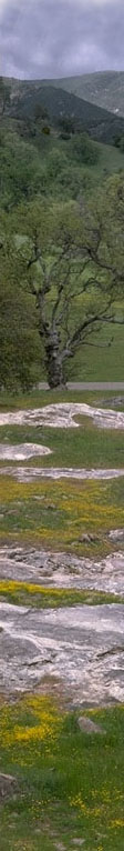
The Consortium of California Herbaria was developed to serve as a gateway to information from California vascular plant specimens that are housed in herbaria throughout the state.
The database now (December 2011) includes information from more than 1.4 million specimens, all searchable through a single interface.
Originally developed in 2003 around botanical collections from University of California herbaria, the Consortium continues to grow as more collections are added.
Currently, collections from twenty institutions are accessible through this interface.
The participating institutions cooperate under the guidelines of a Memorandum of Understanding.
Participation as a data provider to the Consortium database is open to California herbaria that meet these Minimum Requirements for data inclusion.
The data included in this database are a snapshot of the California vascular plant collections at partner institutions.
More recent data may be available through the individual herbaria.
Some participating herbaria have collections of fungi, lichens, and bryophytes; those specimens are not included here. The holdings of the participant herbaria are listed in a bar graph and a chart; the county record breakdown is depicted in a set of bar graphs.
Operational details are available on a separate page.
Please send any feedback regarding the specimen data directly to the curator of each participating herbarium.
Geographic Data
Another goal of the consortium is to provide coordinate data (latitude/longitude) for as many California specimens as possible. Currently, specimens from all sixteen participating institutions are being georeferenced on a county-by-county basis.
As of December, 2011, ~720,000
records include latitude and longitude. Using BerkeleyMapper, the georeferenced records returned from any Consortium search can be mapped directly from the Consortium accession results page. Additional search options are available from the draft georeferencing tools page.
Curatorial Tools
Lists of new records, new determinations, duplicate records, graphs, comments, links.
Additional Information
More information on California plants may be found through the Jepson Online Interchange for California Floristics, a project of the Jepson Herbarium, UC Berkeley. The following information is available through the Interchange:
Nomenclature and taxonomy
·
Maps
·
Specimen records
·
Horticultural database
·
Photographs
·
Links from species pages to pertinent sites
Acknowledgements
California Digital Library; initial funding (2003–2006)
National Science Foundation; planning meeting (2006)
USDA Forest Service; georeferencing (2006 & 2007:
Tehama, Trinity, Shasta, and Siskiyou counties)
Andrew W. Mellon Foundation; digitization of type specimens (2008–2010)
Global Biodiversity Information Facility; georeferencing records of non-native specimens (2008–2009)
Institute of Museum and Library Services (Museums for America program); databasing and georeferencing historical specimens collected in San Diego County (2005–2009).
National Science Foundation; databasing, georeferencing, and technical support (2010-2014)
Citation
Please cite data retrieved from the Consortium database: Data provided by the participants of the Consortium of California Herbaria (ucjeps.berkeley.edu/consortium/).
Consortium Contacts
Staci Markos, Administrative Chair (smarkos@berkeley.edu)
Richard L. Moe, Technical Editor (rlmoe@berkeley.edu)
Ellen Dean, CCH representative to US Virtual Herbarium (eadean@ucdavis.edu)
Please send questions or comments regarding the development and use of these pages to Richard Moe (rlmoe@berkeley.edu).
|
|
