INTRODUCTION

Flower Garden Banks National Marine Sanctuary is one of 14 federally designated underwater areas protected by NOAA's Office of National Marine Sanctuaries, and the only site located in the Gulf of Mexico.
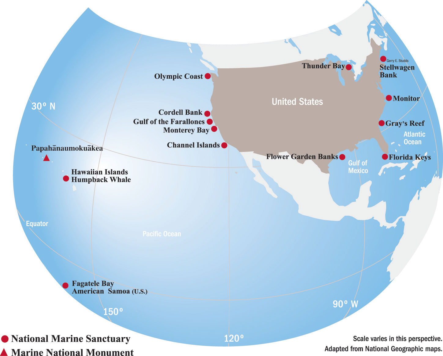 |
Map showing the location of all 14 sites protected by the Office of National Marine Sanctuaries.
Click map for larger image. |
Situated 70 to 115 miles off the coasts of Texas and Louisiana, the Flower Garden Banks sanctuary includes underwater communities that rise from the depths of the Gulf of Mexico atop underwater mountains called salt domes.
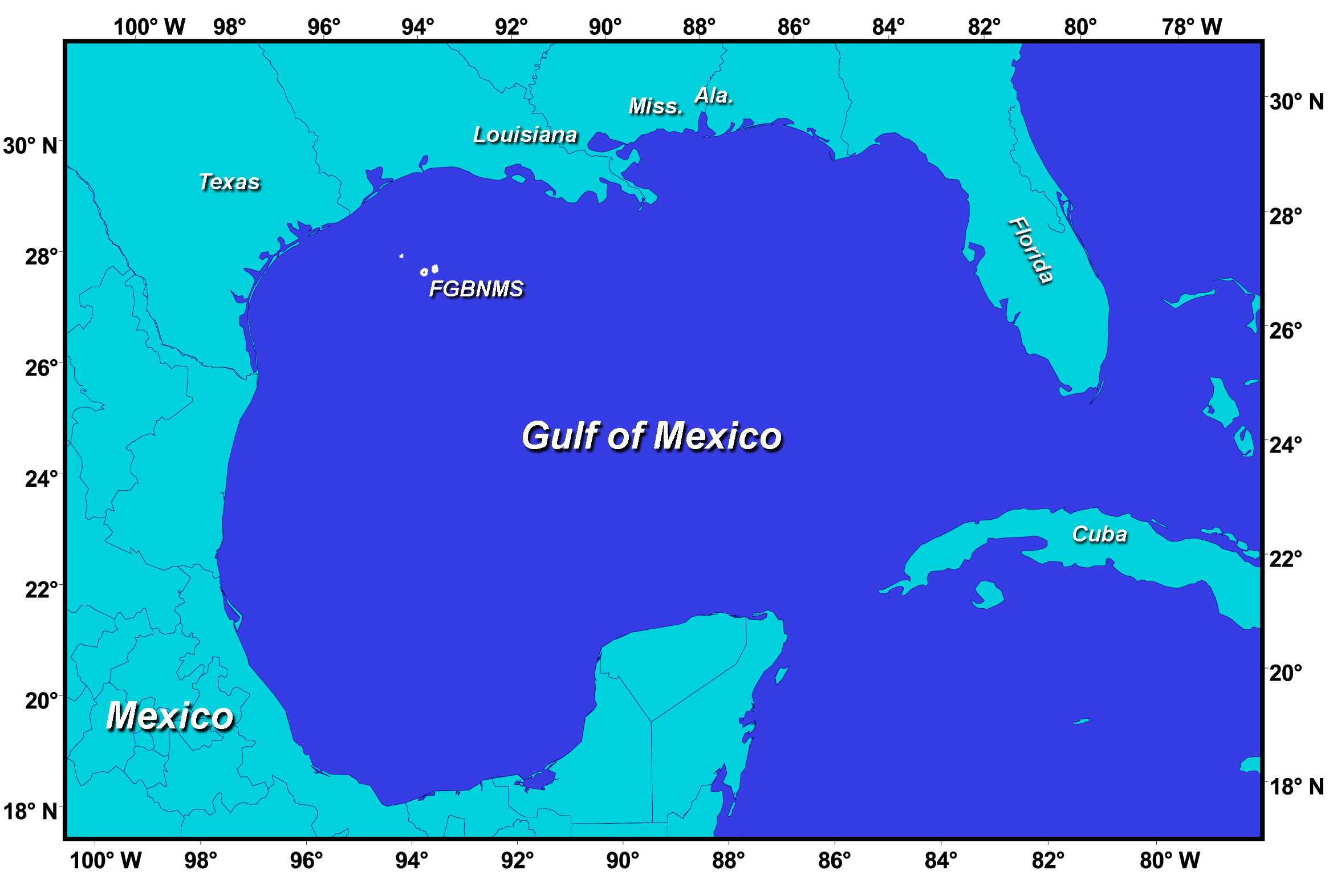 |
Map of the Gulf of Mexico surrounded by the Gulf states, Mexico, and Cuba. The sanctuary location is marked by three white dots in the northwestern part of the Gulf.
Click map for larger image. |
 |
Atlas map of Flower Garden Banks National Marine Sanctuary showing contours of the sea floor.
Click map for larger image. |
The sanctuary actually protects three separate areas: East Flower Garden Bank, West Flower Garden Bank, and Stetson Bank. These banks are separated from each other by miles of open ocean ranging from 200 to 400 feet (61-122 meters) deep, and each bank has its own set of boundaries.
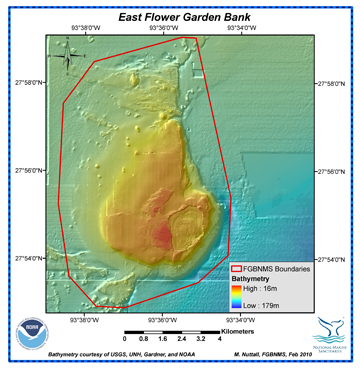 |
EAST FLOWER GARDEN BANK
Click map for larger image. |
|
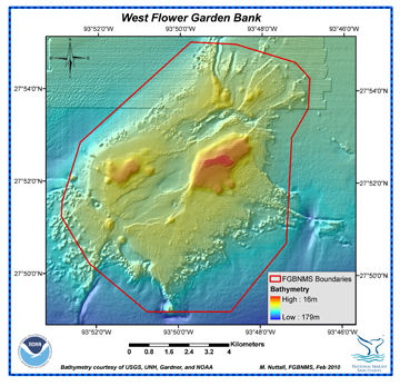 |
WEST FLOWER GARDEN BANK
Click map for larger image. |
|
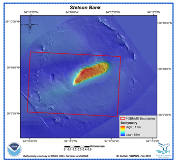 |
STETSON BANK
Click map for larger image. |
|
Management of the sanctuary is accomplished through a combination of education, science, resource protection and regulatory programs.
top of page
HISTORY
The Flower Garden Banks were discovered by snapper and grouper fishermen in the late 1800's. They named the banks after the brightly colored sponges, plants, and other marine life they could see on the colorful reefs below their boats.
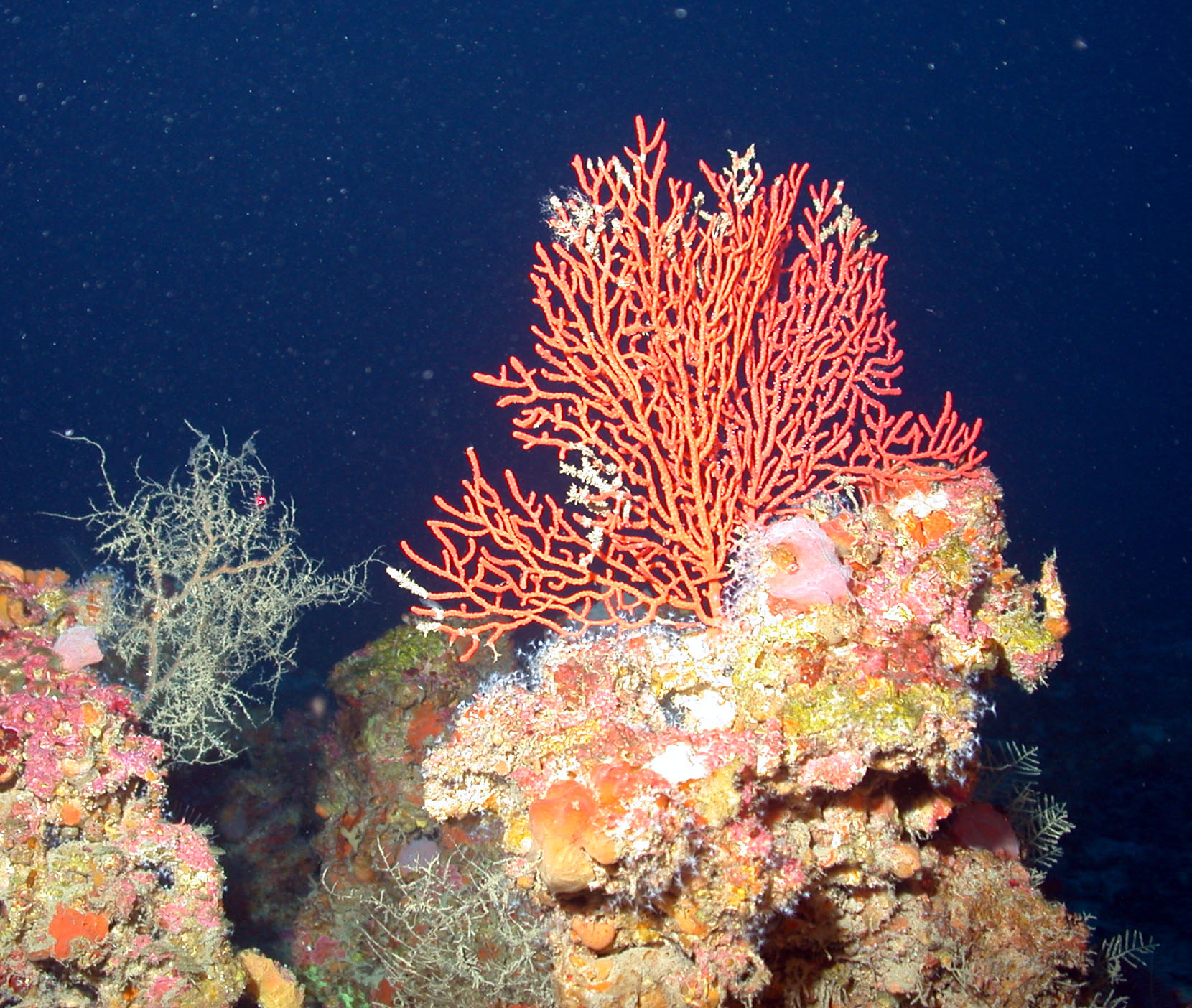 |
| Deep coral habitat around the banks. |
Continued interest in the biological diversity and breathtaking beauty of the reefs at East and West Flower Garden Banks led to their designation as a sanctuary under the National Marine Sanctuary Act (NMSA) (160kb pdf) in 1992. The coral-sponge communities of Stetson Bank were added to the sanctuary in 1996.
Federal Register Notice of Sanctuary Designation and Regulations, December 5, 1991, 56 FR 63634 (2.1MB pdf)
More about the sanctuary's history...
top of page
NATURAL SETTING
Understanding the complexities of the sanctuary's local ecosystems requires learning about all of the components in its natural setting. This includes the underlying geology, a variety of habitats, the larger context of the Gulf of Mexico ecosystem and its watersheds, as well as the specific plants and animals found within the sanctuary.
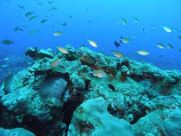 |
| Schooling fish above the coral cap. |
More about the sanctuary's setting...
top of page