Click on the tabs above to explore our map viewers.
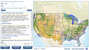
Land cover viewer:
The Gap Analysis Program (GAP) national land cover viewer displays data on the vegetation and land use patterns of the continental United States. It combines land cover data generated for the Southwest Regional Gap Analysis project completed in 2004, the Southeast Regional Gap Analysis Project completed in 2007, the Northwest Regional Gap project, and the updated California Gap project completed in 2009. For areas of the country without an Ecological System level Gap project, data created by the Landfire Project was used. All these projects use consistent base satellite imagery, the same classification systems and similar mapping methodology allowing for the creation of a seamless national land cover map.
Citation: US Geological Survey, National Biological Information Infrastructure, Gap Analysis Program (GAP). February 2010. National Land Cover, Version 1.
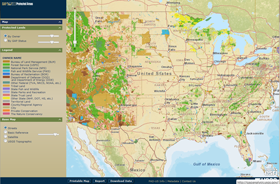
Protected Areas of the United States viewer:
The Protected Areas Database of the United States (PAD-US) is a national database of federal and state conservation lands. It contains the most current information about publicly held conservation lands (with conservation measures available) in the U.S. It was first published for delivery to the UNEP-World Conservation Monitoring Center's (WCMC) World Database for Protected Areas (WDPA) in April 2009 by USGS GAP, on behalf of the PAD-US Partnership.
Citation: US Geological Survey, National Biological Information Infrastructure, Gap Analysis Program (GAP). May 2010. Protected Areas Database of the United States (PAD-US), Version 1.1.