The Great Basin Metadata Server includes information about spatial and biological data that overlay the extent of the Great Basin and Columbia Plateau. Metadata servers allow data users to search, retrieve, and evaluate data sets by providing standardized descriptions of geospatial and biological data. These descriptions convey such things as content, quality, lineage, contact, and other characteristics.
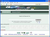
This metadata server is a Node of the NBII Metadata Clearinghouse. Users can query just the Great Basin Metadata Server or they can select additional Nodes to query.
|
Hints for searching using Advanced Search:
|
- To search just the Great Basin Metadata Server, in the 'Data Providers' section choose:
Great Basin Information Project
- To search all metadata using a suitable geographic extent, in the 'geographic Search' section enter:
North:47; West: -122; East: -110; South: 33.

Search for metadata.
USGS
|
Click here to search the NBII Metadata Clearinghouse.