Southeast Watershed Forum Community Resource Mapper

Southeast Watershed Forum Community Resource Mapper Banner
[Copyright: Southeast Watershed Forum]

In partnership with the U.S. Geological Survey's Southeast Information Node of the National Biological Information Infrastructure (NBII), the Southeast Watershed Forum offers a bio-geospatial data visualization tool for land and water resource protection. The Community Resource Mapper provides a free, easy to use on-line mapping service that can help communities integrate natural resource protection into their land use planning efforts.


Click "More..." below for further details.

more...

Live Maps and Data

The Live Maps and Data community site features searchable databases and mapping applications. From the navigation menu to the left, the following resources may be accessed:

  • Datasets resulting from biodiversity studies
  • Map layers representing species distribution, habitat, and other environmental elements
  • Data and information products from an array of biodiversity data sources

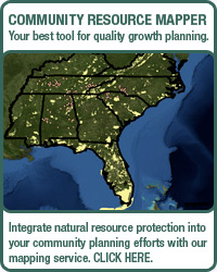
"Maps of the Region" allows users to preview project related map layers that available through interoperable web map services.

Computer mapping data for Geographic Information Systems (GIS) are downloadable from "Regional GIS Layers" and "More Online Geospatial Data" resource areas.

The "Searchable Databases" resource area contains searchable datasets on aquatic biota, invasive plants, and water quality.

High Quality Mapping Resources

National Atlas Logo[Image: U.S. DOI ]
The National Atlas
National Atlas Map Layers
In the National Atlas Map Maker, you can assemble, view, and print your own maps. You can choose from hundreds of layers of geographic information to make maps. Each map layer can be displayed individually or mixed with others as you tailor a map to your needs.

Selectable layer categories include:

  • Agriculture
  • Biology
  • Boundaries
  • Climate
  • Environment
  • Geology
  • History
  • Map Reference
  • People
  • Transportation
  • Water
National Map Logo
National Map Logo
[Image: USGS ]
The National Map: The Nation's Topographical Map for the 21st Century
The USGS National Map
The National Map is a consistent framework for geographic knowledge needed by the Nation. It provides public access to high-quality, geospatial data and information from multiple partners to help support decisionmaking by resource managers and the public.

The NBII Program is administered by the Biological Informatics Program of the U.S. Geological Survey
About NBII | Accessibility Statement | NBII Disclaimer, Attribution & Privacy Statement | FOIA
Science.gov Logo       USGS Logo       USAgov Logo