In the 2012 President's Budget Request, the National Biological Information Infrastructure (NBII) is terminated. As a result, all resources, databases, tools, and applications within this web site will be removed on January 15, 2012. For more information, please refer to the NBII Program Termination page.
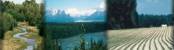
Water and drought play important roles in the Southwest's predominantly arid or semi-arid ecosystems. All biological organisms require water in order to function, and many of the region's animals and plants are well-adapted to the daily, seasonal, and annual cycles of this essential resource. Water serves critical roles in agriculture, industry, recreation, transportation, and maintenance of our environment, as well as our very quality of life.
Drought is a period of unusually persistent dry weather that lasts long enough to cause serious problems such as crop damage and/or water supply shortages. The severity of the drought depends upon the degree of moisture deficiency, the duration, and the size of the affected area (source: National Weather Service). A drought can be defined by the amount of precipitation in an area, by the amount of moisture in the soil, by surface and subsurface water supplies, or by water shortages affecting people.
Follow the links below and throughout the page to explore water and drought resources for the southwestern United States.
State Resources:
Arizona's Sustainability of Semi-Arid Hydrology and Riparian Areas (SAHRA) organization promotes sustainable management of water resources in semi-arid regions, through stakeholder-driven interdisciplinary research, aggressive public outreach and strong education initiatives, leading to rapid dissemination and application of cutting-edge scientific knowledge.
The Drought Impacts on Regional Ecosystems Network (DIREnet) is an association of researchers and land managers interested in documenting impacts on major ecosystems of the western United States resulting from drought-related processes.
The Lower Colorado River Aquatic Gap Analysis Project examines the current level of aquatic biodiversity within a system to identify gaps in distribution and protection of species so managers, planners, scientists, and policy makers may use these data to make better-informed decisions or to focus future research.
The National Integrated Drought Information System (NIDIS), implemented by the National Oceanic and Atmospheric Administration (NOAA), provides an integrated drought monitoring and forecasting system at federal, state, and local levels, including an "early warning system."
The Vegetation Drought Response Index (VegDRI) is a valuable addition to the field of drought monitoring, with applications for the agricultural community. VegDRI, updated biweekly, combines information from historical and current satellite observations, climate indicators, ecological settings, and soil characteristics to show drought's effect on vegetation.
The USGS has Biomonitoring of Environmental Status and Trends (BEST) reports available for the Columbia, Mississippi, and Rio Grande River basins that analyze the environmental contaminants and associated fisheries impacts for these major river basins of the West.
U.S. Environmental Protection Agency: Surf Your Watershed
The U.S. Environmental Protection Agency's "Surf Your Watershed" program integrates environmental information available by geographic units including state, watershed, county, metro area, and tribe.
The site provides access to three main databases:
1. Adopt Your Watershed, a database of watershed groups,
2. Wetlands Restoration Projects, which displays ongoing wetlands restoration,
3. Environmental Websites Database, a directory of websites dedicated to environmental issues and information.
The goal of the GAP Analysis Program is to keep common species common by identifying those species and plant communities that are not adequately represented in existing conservation lands. Common species are those not currently threatened with extinction. By identifying their habitats, GAP Analysis gives land managers and policy makers the information they need to make better-informed decisions when identifying priority areas for conservation.
About the NAWQA Data Warehouse:
The USGS began its NAWQA program in 1991, systematically collecting chemical, biological, and physical water quality data from 42 study units (basins) across the nation. The Data Warehouse contains and links the following data:
Chemical concentrations in water, bed sediment, and aquatic organism tissues for about 2000 chemical constituents
Biological community data for 16,000 fish, algae and invertebrate samples
Site, basin, well and network characteristics with many descriptive variables
Daily stream flow information for fixed sampling sites
Ground water levels for sampled wells
7,600 surface water sites and 8,100 wells
49,000 nutrient samples and 31,000 pesticide samples as well as 9,000 VOC samples
2,500 samples of bed sediment and aquatic organism tissues