New Mexico Water Science Center

DATA CENTER
INFORMATION CENTERABOUT THE NEW MEXICO WSCUSGS IN YOUR STATEUSGS Water Science Centers are located in each state. 
|
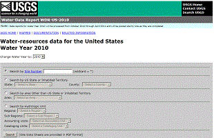
Welcome to the U.S. Geological Survey (USGS) Web page for the water resources of New Mexico; this is your direct link to all kinds of water-resource information. Here you'll find information on New Mexico's rivers and streams. You'll also find information about groundwater, water quality, and many other topics. The USGS operates the most extensive satellite network of stream-gaging stations in the state, many of which form the backbone of flood-warning systems. The USGS provides current ("real-time") stream stage and streamflow, water-quality, and groundwater levels for over 130 sites in New Mexico. New Mexico Data Highlights2010 Water Data Report Now Available Instantaneous Data Archive (IDA) Featured Project
StreamStats interface New Mexico StreamStats - A Web-based GIS (Geographic Information System) that provides users with access to an assortment of analytical tools that are useful for water-resources planning and management, and for engineering design applications, such as the design of bridges. StreamStats allows users to easily obtain streamflow statistics, drainage-basin characteristics, and other information for user-selected sites on streams. StreamStats is implemented for a pilot area in northwestern New Mexico. The implemented area is indicated by the aqua-colored boundary on the map in the user interface. The development is ongoing and expected to be completed for all New Mexico watersheds. Highlighted PublicationsThe New Mexico Water Science Center produces publications about water resources.
Data via GoogleMapsNew Maps Deliver Current Streamflow Conditions We recently added a Google-Map based Web page to deliver map-based current surface-water-resources conditions in New Mexico. We recently added a Google-Map based Web page to deliver map-based current surface-water-resources conditions in New Mexico. (References to non-U.S. Department of the Interior (DOI) products do not constitute an endorsement by the DOI. By viewing the Google Maps API on this web site the user agrees to these TERMS of Service set forth by Google.) The maps utilize zoom and pan to allow you to focus in on the water-monitoring sites that interest you. The maps show current streamflow as compared to historical records. By hovering your mouse over a site, a popup box shows the most recent stage and streamflow. |

![]() U.S. Department of the Interior |
U.S. Geological Survey
U.S. Department of the Interior |
U.S. Geological Survey
URL: http://nm.water.usgs.gov/index.htm
Page Contact Information: webmaster@nm.water.usgs.gov
Page Last Modified: Tuesday, 03-Jan-2012 13:53:56 EST