Jump to main content.


Arizona

Use the state map or Places Involving this State watershed links below to zoom in to find more information about your watershed.
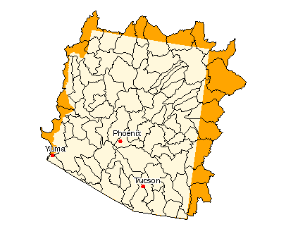
Image of State

State Profile
Find general information integrated for this specific state

Assessments of Watershed Health

Environmental Information

Air Pollution Data (Provided by Office of Air Quality Planning and Standards)

Beach Monitoring Sites

Bioassessment Projects

Drinking Water Information (Source: EPA's Office of Ground Water & Drinking Water)

Environmental Websites

Federal and State Government Regulation and Program References

National Priorities List Sites

Section 319 Success Stories (Source: EPA's 319 Grant Program)

Volunteer Monitoring Efforts for Arizona

Watershed Groups for this State (Provided by Adopt Your Watershed)


Information provided by United States Geological Survey (USGS) Exit EPA Disclaimer

Science in Your State
Water Resources
Real-time Streamflow Data
Fact Sheets

Places Involving this State

Watersheds: 84
Counties: 15
American Heritage Rivers: 0
National Estuary Programs: 0
EPA Regional Office

The following sites exit the EPA Website Exit EPA Disclaimer

Agriculture Statistics Service (USDA)

Energy Data (DOE)

Natural Resources Conservation Service (USDA)

State and Local Government on the Net

State Government

USDA State Fact Sheet (Source USDA Economic Research Service)

14070006, Lower Lake Powell 14070007, Paria 14080105, Middle San Juan 14080106, Chaco 14080201, Lower San Juan-Four Corners 14080204, Chinle 14080205, Lower San Juan 15010001, Lower Colorado-Marble Canyon 15010002, Grand Canyon 15010003, Kanab 15010004, Havasu Canyon 15010005, Lake Mead 15010006, Grand Wash 15010007, Hualapai Wash 15010009, Fort Pierce Wash 15010010, Lower Virgin 15010014, Detrital Wash 15020001, Little Colorado Headwaters 15020002, Upper Little Colorado 15020003, Carrizo Wash 15020004, Zuni 15020005, Silver 15020006, Upper Puerco 15020007, Lower Puerco 15020008, Middle Little Colorado 15020009, Leroux Wash 15020010, Chevelon Canyon 15020011, Cottonwood Wash 15020012, Corn-Oraibi 15020013, Polacca Wash 15020014, Jadito Wash 15020015, Canyon Diablo 15020016, Lower Little Colorado 15020017, Dinnebito Wash 15020018, Moenkopi Wash 15030101, Havasu-Mohave Lakes 15030103, Sacramento Wash 15030104, Imperial Reservoir 15030105, Bouse Wash 15030106, Tyson Wash 15030107, Lower Colorado 15030108, Yuma Desert 15030201, Big Sandy 15030202, Burro 15030203, Santa Maria 15030204, Bill Williams 15040002, Upper Gila-Mangas 15040003, Animas Valley 15040004, San Francisco 15040005, Upper Gila-San Carlos Reservoir 15040006, San Simon 15040007, San Carlos 15050100, Middle Gila 15050201, Willcox Playa 15050202, Upper San Pedro 15050203, Lower San Pedro 15050301, Upper Santa Cruz 15050302, Rillito 15050303, Lower Santa Cruz 15050304, Brawley Wash 15050305, Aguirre Valley 15050306, Santa Rosa Wash 15060101, Black 15060102, White 15060103, Upper Salt 15060104, Carrizo 15060105, Tonto 15060106, Lower Salt 15060201, Big Chino-Williamson Valley 15060202, Upper Verde 15060203, Lower Verde 15070101, Lower Gila-Painted Rock Reservoir 15070102, Agua Fria 15070103, Hassayampa 15070104, Centennial Wash 15070201, Lower Gila 15070202, Tenmile Wash 15070203, San Cristobal Wash 15080101, San Simon Wash 15080102, Rio Sonoyta 15080103, Tule Desert 15080200, Rio De La Concepcion 15080301, Whitewater Draw 15080302, San Bernardino Valley

Disclaimer | Comments


Local Navigation


Jump to main content.