Jump to main content.


New Mexico

Use the state map or Places Involving this State watershed links below to zoom in to find more information about your watershed.
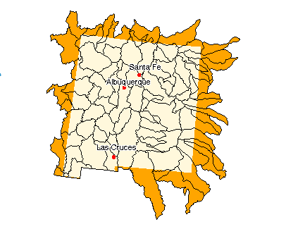
Image of State

State Profile
Find general information integrated for this specific state

Assessments of Watershed Health

Environmental Information

Air Pollution Data (Provided by Office of Air Quality Planning and Standards)

Beach Monitoring Sites

Bioassessment Projects

Drinking Water Information (Source: EPA's Office of Ground Water & Drinking Water)

Environmental Websites

Federal and State Government Regulation and Program References

National Priorities List Sites

Section 319 Success Stories (Source: EPA's 319 Grant Program)

Volunteer Monitoring Efforts for New Mexico

Watershed Groups for this State (Provided by Adopt Your Watershed)


Information provided by United States Geological Survey (USGS) Exit EPA Disclaimer

Science in Your State
Water Resources
Real-time Streamflow Data
Fact Sheets

Places Involving this State

Watersheds: 84
Counties: 33
American Heritage Rivers: 0
National Estuary Programs: 0
EPA Regional Office

The following sites exit the EPA Website Exit EPA Disclaimer

Agriculture Statistics Service (USDA)

Energy Data (DOE)

Natural Resources Conservation Service (USDA)

State and Local Government on the Net

State Government

USDA State Fact Sheet (Source USDA Economic Research Service)

11020010, Purgatoire 11040001, Cimarron Headwaters 11040002, Upper Cimarron 11080001, Canadian Headwaters 11080002, Cimarron 11080003, Upper Canadian 11080004, Mora 11080005, Conchas 11080006, Upper Canadian-Ute Reservoir 11080007, Ute 11080008, Revuelto 11090101, Middle Canadian-Trujillo 11090102, Punta De Agua 11090103, Rita Blanca 11090104, Carrizo 11100101, Upper Beaver 11100103, Coldwater 11120101, Tierra Blanca 11120102, Palo Duro 12050001, Yellow House Draw 12050002, Blackwater Draw 12050005, Running Water Draw 12080001, Lost Draw 12080003, Monument-Seminole Draws 12080004, Mustang Draw 12080006, Sulphur Springs Draw 13010002, Alamosa-Trinchera 13010005, Conejos 13020101, Upper Rio Grande 13020102, Rio Chama 13020201, Rio Grande-Santa Fe 13020202, Jemez 13020203, Rio Grande-Albuquerque 13020204, Rio Puerco 13020205, Arroyo Chico 13020206, North Plains 13020207, Rio San Jose 13020208, Plains Of San Agustin 13020209, Rio Salado 13020210, Jornada Del Muerto 13020211, Elephant Butte Reservoir 13030101, Caballo 13030102, El Paso-Las Cruces 13030103, Jornada Draw 13030201, Playas Lake 13030202, Mimbres 13050001, Western Estancia 13050002, Eastern Estancia 13050003, Tularosa Valley 13050004, Salt Basin 13060001, Pecos Headwaters 13060002, Pintada Arroyo 13060003, Upper Pecos 13060004, Taiban 13060005, Arroyo Del Macho 13060006, Gallo Arroyo 13060007, Upper Pecos-Long Arroyo 13060008, Rio Hondo 13060009, Rio Felix 13060010, Rio Penasco 13060011, Upper Pecos-Black 13070001, Lower Pecos-Red Bluff Reservoir 13070002, Delaware 13070007, Landreth-Monument Draws 14080101, Upper San Juan 14080103, Blanco Canyon 14080104, Animas 14080105, Middle San Juan 14080106, Chaco 14080107, Mancos 14080201, Lower San Juan-Four Corners 14080204, Chinle 15020001, Little Colorado Headwaters 15020002, Upper Little Colorado 15020003, Carrizo Wash 15020004, Zuni 15020006, Upper Puerco 15040001, Upper Gila 15040002, Upper Gila-Mangas 15040003, Animas Valley 15040004, San Francisco 15040006, San Simon 15080302, San Bernardino Valley 15080303, Cloverdale

Disclaimer | Comments


Local Navigation


Jump to main content.