Jump to main content.


Wyoming

Use the state map or Places Involving this State watershed links below to zoom in to find more information about your watershed.
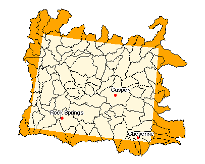
Image of State

State Profile
Find general information integrated for this specific state

Assessments of Watershed Health

Environmental Information

Air Pollution Data (Provided by Office of Air Quality Planning and Standards)

Beach Monitoring Sites

Bioassessment Projects

Drinking Water Information (Source: EPA's Office of Ground Water & Drinking Water)

Environmental Websites

Federal and State Government Regulation and Program References

National Priorities List Sites

Section 319 Success Stories (Source: EPA's 319 Grant Program)

Volunteer Monitoring Efforts for Wyoming

Watershed Groups for this State (Provided by Adopt Your Watershed)


Information provided by United States Geological Survey (USGS) Exit EPA Disclaimer

Science in Your State
Water Resources
Real-time Streamflow Data
Fact Sheets

Places Involving this State

Watersheds: 83
Counties: 23
American Heritage Rivers: 0
National Estuary Programs: 1
EPA Regional Office

The following sites exit the EPA Website Exit EPA Disclaimer

Agriculture Statistics Service (USDA)

Energy Data (DOE)

Natural Resources Conservation Service (USDA)

State and Local Government on the Net

State Government

USDA State Fact Sheet (Source USDA Economic Research Service)

10020007, Madison 10020008, Gallatin 10070001, Yellowstone Headwaters 10070002, Upper Yellowstone 10070006, Clarks Fork Yellowstone 10080001, Upper Wind 10080002, Little Wind 10080003, Popo Agie 10080004, Muskrat 10080005, Lower Wind 10080006, Badwater 10080007, Upper Bighorn 10080008, Nowood 10080009, Greybull 10080010, Big Horn Lake 10080011, Dry 10080012, North Fork Shoshone 10080013, South Fork Shoshone 10080014, Shoshone 10080016, Little Bighorn 10090101, Upper Tongue 10090201, Middle Fork Powder 10090202, Upper Powder 10090203, South Fork Powder 10090204, Salt 10090205, Crazy Woman 10090206, Clear 10090207, Middle Powder 10090208, Little Powder 10110201, Upper Little Missouri 10120101, Antelope 10120102, Dry Fork Cheyenne 10120103, Upper Cheyenne 10120104, Lance 10120105, Lightning 10120106, Angostura Reservoir 10120107, Beaver 10120108, Hat 10120201, Upper Belle Fourche 10120202, Lower Belle Fourche 10120203, Redwater 10150002, Niobrara Headwaters 10180002, Upper North Platte 10180003, Pathfinder-Seminoe Reservoirs 10180004, Medicine Bow 10180005, Little Medicine Bow 10180006, Sweetwater 10180007, Middle North Platte-Casper 10180008, Glendo Reservoir 10180009, Middle North Platte-Scotts Bluff 10180010, Upper Laramie 10180011, Lower Laramie 10180012, Horse 10180013, Pumpkin 10190007, Cache La Poudre 10190008, Lone Tree-Owl 10190009, Crow 10190015, Upper Lodgepole 10190016, Lower Lodgepole 10190017, Sidney Draw 14040101, Upper Green 14040102, New Fork 14040103, Upper Green-Slate 14040104, Big Sandy 14040105, Bitter 14040106, Upper Green-Flaming Gorge Reservoir 14040107, Blacks Fork 14040108, Muddy 14040109, Vermilion 14040200, Great Divide Closed Basin 14050003, Little Snake 14050004, Muddy 16010101, Upper Bear 16010102, Central Bear 16020101, Upper Weber 17040101, Snake Headwaters 17040102, Gros Ventre 17040103, Greys-Hobock 17040104, Palisades 17040105, Salt 17040202, Upper Henrys 17040203, Lower Henrys 17040204, Teton

Disclaimer | Comments


Local Navigation


Jump to main content.