USGS - science for a changing world

South Dakota Water Science Center

orange dotHome orange dotScience Topics orange dotOur Cooperators orange dotPublications orange dotGIS/Geospatial Resources orange dotNewsroom orange dotOutreach orange dotContact
USGS 05049000 MUSTINKA RIVER ABOVE WHEATON, MN USGS 06481500 SKUNK CR AT SIOUX FALLS,SD USGS 06478500 JAMES R NEAR SCOTLAND,SD USGS 06477000 JAMES R NEAR FORESTBURG,SD USGS 06472000 JAMES R NEAR STRATFORD,SD USGS 05051600 WILD RICE RIVER NR RUTLAND, ND USGS 05050000 BOIS DE SIOUX RIVER NEAR WHITE ROCK, SD USGS 06412500 RAPID CR ABOVE CANYON LAKE NEAR RAPID CITY,SD USGS 06414000 RAPID CR AT RAPID CITY,SD USGS 06485500 BIG SIOUX R AT AKRON,IA USGS 06479500 BIG SIOUX R AT WATERTOWN,SD USGS 06479438 BIG SIOUX R NEAR WATERTOWN,SD USGS 06478690 WEST FORK VERMILLION R NEAR PARKER,SD USGS 06478540 LITTLE VERMILLION R NEAR SALEM,SD USGS 06477500 FIRESTEEL CR NEAR MOUNT VERNON,SD USGS 06471500 ELM R AT WESTPORT,SD USGS 06402000 FALL R AT HOT SPRINGS,SD USGS 06357800 GRAND R AT LITTLE EAGLE,SD USGS 05291000 WHETSTONE RIVER NEAR BIG STONE CITY, SD USGS 06486000 Missouri River at Sioux City, IA USGS 06447500 LITTLE WHITE R NEAR MARTIN,SD USGS 06438000  BELLE FOURCHE RIVER NEAR ELM SPRINGS,SD USGS 06437000 BELLE FOURCHE R NEAR STURGIS,SD USGS 06431500 SPEARFISH CR AT SPEARFISH,SD USGS 06425500 ELK CR NEAR ELM SPRINGS,SD USGS 06423500  CHEYENNE RIVER NEAR WASTA,SD USGS 06411500 RAPID CR BELOW PACTOLA DAM,SD USGS 06410500 RAPID CR ABOVE PACTOLA RES AT SILVER CITY,  SD USGS 06409000 CASTLE CR ABOVE DEERFIELD RES NEAR HILL CITY,SD USGS 06406000 BATTLE CR AT HERMOSA,SD USGS 06404000 BATTLE CR NEAR KEYSTONE,SD USGS 06402500 BEAVER CR NEAR BUFFALO GAP,SD USGS 06401500 CHEYENNE R BELOW ANGOSTURA DAM,SD USGS 06359500 MOREAU R NEAR FAITH,SD USGS 06482020 BIG SIOUX R AT NORTH CLIFF AVE AT SIOUX FALLS,SD USGS 06481000 BIG SIOUX R NEAR DELL RAPIDS,SD USGS 06480000 BIG SIOUX RIVER NEAR BROOKINGS,SD USGS 06471200 MAPLE R AT ND-SD STATE LINE USGS 06466500 Bazile Creek near Niobrara, Nebr. USGS 06464500 KEYA PAHA R AT WEWELA,SD USGS 06453600 Ponca Creek at Verdel, Nebr. USGS 06452000 WHITE R NEAR OACOMA,SD USGS 06450500 LITTLE WHITE R BELOW WHITE RIVER,SD USGS 06449500 LITTLE WHITE R NEAR ROSEBUD SD USGS 06449100 LITTLE WHITE R NEAR VETAL,SD USGS 06449000 LAKE CR BELOW REFUGE NEAR TUTHILL,SD USGS 06447000 WHITE R NEAR KADOKA,SD USGS 06436000 BELLE FOURCHE R NEAR FRUITDALE,SD USGS 06433000 REDWATER RIVER ABOVE BELLE FOURCHE,SD USGS 06430500 REDWATER CR AT WY-SD STATE LINE USGS 06428500 BELLE FOURCHE R AT WY-SD STATE LINE USGS 06422500 BOXELDER CR NEAR NEMO,SD USGS 06421500 RAPID CR NEAR FARMINGDALE,SD USGS 06400000 HAT CR NEAR EDGEMONT,SD USGS 06395000 CHEYENNE R AT EDGEMONT,SD USGS 06360500 MOREAU R NEAR WHITEHORSE,SD USGS 06356500 SOUTH FORK GRAND R NEAR CASH,SD USGS 06355500 NORTH FORK GRAND R NEAR WHITE BUTTE,SD USGS 06334500 LITTLE MISSOURI R AT CAMP CROOK,SD USGS 05293000 YELLOW BANK RIVER NEAR ODESSA, MN USGS 06600000 Perry Creek at 38th Street at Sioux City, IA USGS 06482610 SPLIT ROCK CR AT CORSON,SD USGS 06482010 SILVER CREEK AT SIOUX FALLS, SD USGS 06482000 BIG SIOUX R AT SIOUX FALLS SD USGS 06481497 WILLOW CREEK NEAR CROOKS, SD USGS 06481493 SKUNK CREEK NEAR HARTFORD, SD USGS 06481480 SKUNK CR NR CHESTER,SD USGS 06481400 BIG SIOUX RIVER BELOW DIVERSION AT SIOUX FALLS, SD USGS 06479770 BIG SIOUX RIVER NEAR BRUCE, SD USGS 06479525 BIG SIOUX R NEAR CASTLEWOOD,SD USGS 06479520 BIG SIOUX RIVER BELOW WATERTOWN, SD USGS 06479515 WILLOW CR NEAR WATERTOWN,SD USGS 06479512 BIG SIOUX R AT BROADWAY AT WATERTOWN, SD USGS 06479498 SOUTH BRANCH TRIB MUD CR NR RAUVILLE, SD USGS 06479490 MUD CREEK NEAR RAUVILLE, SD USGS 06479452 BIG SIOUX RIVER AT LAKE KAMPESKA NR WATERTOWN, SD USGS 06479449 LAKE KAMPESKA AT WATER PLANT AT WATERTOWN, SD USGS 06479215 BIG SIOUX RIVER NR FLORENCE,SD USGS 06479097 Missouri River near Ponca, Nebr. USGS 06479010 VERMILLION RIVER NR VERMILLION,SD USGS 06478600 EAST FORK VERMILLION RIVER NEAR PARKER, SD USGS 06478526 Missouri River near Maskell, Nebr. USGS 06478000 JAMES R NEAR MITCHELL,SD USGS 06476000 JAMES R AT HURON,SD USGS 06475000 JAMES R NEAR REDFIELD,SD USGS 06473000 JAMES R AT ASHTON,SD USGS 06471800 FOOT CREEK NEAR ABERDEEN, SD USGS 06471770 MOCCASIN CREEK AT ABERDEEN, SD USGS 06471510 ELM RIVER NEAR ORDWAY,SD USGS 06471065 ELM RIVER NEAR FREDERICK,SD USGS 06471000 JAMES R AT COLUMBIA,SD USGS 06470878 JAMES RIVER AT ND-SD STATE LINE USGS 06470875 DAKOTA LAKE NR LUDDEN, ND USGS 06467500 MISSOURI R AT YANKTON,SD USGS 06466700 LEWIS AND CLARK LAKE AT SPRINGFIELD,SD USGS 06466010 Missouri River at Niobrara, Nebr. USGS 06466000 Niobrara River at Niobrara, Nebr. USGS 06465700 Verdigre Creek near Verdigre, Nebr. USGS 06464100 KEYA PAHA R NEAR KEYAPAHA,SD USGS 06453620 Missouri River blw Ponca Creek nr Verdel, Nebr. USGS 06448000 LAKE CR ABOVE REFUGE NEAR TUTHILL,SD USGS 06447450 WHITE RIVER NEAR WHITE RIVER, SD USGS 06446500 WHITE R NEAR INTERIOR,SD USGS 06446000 WHITE R NEAR OGLALA SD USGS 06445685 WHITE R NR NE-SD STATE LINE USGS 06442996 LAKE FRANCIS CASE AT CHAMBERLAIN, SD USGS 06441595 MISSOURI R AT FARM ISLAND NR PIERRE, SD USGS 06441592 MISSOURI R BL LA FRAMBOISE ISLAND, AT PIERRE,SD USGS 06441590 MISSOURI R AT LAFRAMBOISE ISLAND AT PIERRE, SD USGS 06441500 BAD R NEAR FORT PIERRE,SD USGS 06440200 SOUTH FORK BAD R NEAR COTTONWOOD,SD USGS 06440000 MISSOURI R AT PIERRE,SD USGS 06439500 CHEYENNE R NEAR EAGLE BUTTE SD USGS 06437200 BEAR BUTTE CR NEAR GALENA,SD USGS 06437020 BEAR BUTTE CREEK NEAR DEADWOOD, SD USGS 06436760 HORSE CR ABOVE VALE,SD USGS 06436198 WHITEWOOD CR ABOVE VALE,SD USGS 06436190 WHITEWOOD CREEK NEAR WHITEWOOD,SD USGS 06436180 WHITEWOOD CR ABOVE WHITEWOOD,SD USGS 06436165 DEADWOOD CREEK AT CENTRAL CITY, SD USGS 06434505 INLET CANAL ABOVE BELLE FOURCHE RESERVOIR,SD USGS 06430900 SPEARFISH CREEK ABOVE SPEARFISH, SD USGS 06430850 LITTLE SPEARFISH CREEK NEAR LEAD, SD USGS 06430800 ANNIE CREEK NEAR LEAD, SD USGS 06430770 SPEARFISH CREEK NEAR LEAD, SD USGS 06429997 MURRAY DITCH AB HEADGATE AT WY-SD STATE LINE USGS 06429905 SAND CREEK NEAR RANCH A, NEAR BEULAH, WY USGS 06429500 COLD SPRINGS CREEK AT BUCKHORN, WY USGS 06425100 ELK CR NR RAPID CITY,SD USGS 06424000 ELK CR NEAR ROUBAIX,SD USGS 06423010 BOXELDER CR NEAR RAPID CITY,SD USGS 06418900 RAPID CR BL SEWAGE TREATMENT PL NR RAPID CITY, SD USGS 06416000 RAPID CR BELOW HAWTHORN DITCH AT RAPID CITY,SD USGS 06412810 CLEGHORN SPRINGS AT RAPID CITY, SD USGS 06412200 RAPID CREEK AB VICTORIA CR NR RAPID CITY, SD USGS 06408700 RHOADS FORK NEAR ROCHFORD,SD USGS 06408650 CHEYENNE RIVER NEAR SCENIC, SD USGS 06407500 SPRING CR NEAR KEYSTONE,SD USGS 06406500 BATTLE CR BELOW HERMOSA,SD USGS 06404998 GRACE COOLIDGE CR NR GAME LODGE NR CUSTER,SD USGS 06403700 CHEYENNE RIVER AT REDSHIRT, SD USGS 06403300 FRENCH CR ABOVE FAIRBURN SD USGS 06402600 CHEYENNE R NEAR BUFFALO GAP SD USGS 06400875 HORSEHEAD CR AT OELRICHS,SD USGS 06392950 STOCKADE BEAVER CREEK NEAR NEWCASTLE, WY USGS 06392900 BEAVER CREEK AT MALLO CAMP, NEAR FOUR CORNERS, WY USGS 06386500 CHEYENNE RIVER NEAR SPENCER, WY USGS 06354882 OAK CR NEAR WAKPALA,SD USGS 05292000 MINNESOTA RIVER AT ORTONVILLE, MN USGS 05049995 MUD LAKE ABOVE WHITE ROCK DAM NEAR WHITE ROCK, SD

DATA CENTER

INFORMATION CENTER

ABOUT THE SOUTH DAKOTA Water Science Center

Download the Acrobat Reader Software from the Adobe Acrobat Web site

USGS IN YOUR STATE

USGS Water Science Centers are located in each state.

There is a USGS Water Science Center office in each State. Washington Oregon California Idaho Nevada Montana Wyoming Utah Colorado Arizona New Mexico North Dakota South Dakota Nebraska Kansas Oklahoma Texas Minnesota Iowa Missouri Arkansas Louisiana Wisconsin Illinois Mississippi Michigan Indiana Ohio Kentucky Tennessee Alabama Pennsylvania West Virginia Georgia Florida Caribbean Alaska Hawaii New York Vermont New Hampshire Maine Massachusetts South Carolina North Carolina Rhode Island Virginia Connecticut New Jersey Maryland-Delaware-D.C.

Water Resources of South Dakota


Welcome to the USGS Web page for water resources in South Dakota. Here, you will find information on South Dakota's rivers and streams. You will also find information on ground water, water quality, and many other topics. The USGS operates the most extensive satellite network of stream-gaging stations in South Dakota, many of which form the backbone of flood-warning systems.


  • New2011 Flood Information


  • NewIntantaneous Data Archive - IDA: Since 1889, the U.S. Geological Survey has collected continuous stage, discharge, and other instantaneous time-series data on the nations rivers and streams. These time-series data have been and are typically recorded at intervals ranging from 5 to 60 minutes. These instantaneous data have been processed into and published as various daily values, such as the daily maximum, minimum, and/or mean. Because the published record are daily values, the original instantaneous data have not historically been officially approved, published, or made widely available. The IDA web site has been established to make available as much historical instantaneous data from USGS data collection stations as possible. Although this site currently serves instantaneous discharge (streamflow) data only, work is planned to extend it to other time-series parameters in the future.


  • NewWaterAlert: Now you can receive instant, customized updates about water conditions by subscribing to WaterAlert,a new service from the U.S. Geological Survey. Whether you are watching for floods, interested in recreational activities or concerned about the quality of water in your well, WaterAlert allows you to receive daily or hourly updates about current conditions in rivers, lakes and groundwater when they match conditions of concern to you. See press release for additional information.
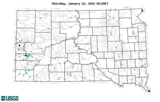
Realtime Streamflow

Stream gage levels in South Dakota, relative to 30 year average.
Colors based on percentile classes

Current Activities

Project Highlights

Black Hills Area Floods Since 1877

The U.S. Geological Survey (USGS), National Weather Service, and the South Dakota Department of Transportation have cooperated on compiling a chronology of flood events in the Black Hills area that have occurred since 1877. The Black Hills area of western South Dakota has a history of damaging flash floods that have resulted primarily from exceptionally strong rain-producing thunderstorms, such as the 1972 flood that claimed the lives of 238 people and the more recent 2007 flood in the Hermosa area. Many other notable floods have occurred in the Black Hills area since settlement of the Black Hills in the late 1800s. These notable floods include the 1883 flood in Deadwood, the 1907 flood in the Piedmont area, the 1924 flood in the Belle Fourche area, and the 1937 flood in the Hot Springs area. The project Web site provides the chronology of flood events that are documented in some way since 1877 in newspapers, books, photographs, and technical reports.

Railroad grade near Hermosa was breached during a flood on August 17, 2007 The purpose of the flood compilation is to provide documentation and a context for the frequency and relative magnitude of historical large floods in the Black Hills area. The improved knowledge of flooding in the Black Hills area will be used to aid in the application of paleoflood survey techniques that is being performed by the USGS in cooperation with the South Dakota Department of Transportation.

Other highlights are:

Featured Publication

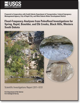
The report "Flood-Frequency Analyses from Paleoflood Investigations for Spring, Rapid, Boxelder, and Elk Creeks, Black Hills, Western South Dakota" was completed in cooperation with the South Dakota Department of Transportation, Federal Emergency Management Agency, City of Rapid City, and West Dakota Water Development District. The report provides improved flood-frequency estimates of low-probability floods for major streams in the central Black Hills through paleoflood investigations, which included analyses of stratigraphic evidence, timing, and magnitudes for large floods on Spring Creek, Rapid Creek (two reaches), Boxelder Creek (two subreaches), and Elk Creek. The stratigraphic records and resulting long-term flood chronologies, locally extending back more than 2,000 years, were combined with observed peak-flow records and historical flood observations to derive flood-frequency estimates. The report is available at http://pubs.usgs.gov/sir/2011/5131/.


Report cover


USGS in the News

Featured Videos

Streamgages: The Silent Superhero

Whether you drink water from your tap, use electricity or canoe down your local river, chances are you benefit from USGS streamgage information. So what is a streamgage and what does it do for you? This CoreCast episode gives you the inside scoop on your silent superhero.

Stream gaging corecast

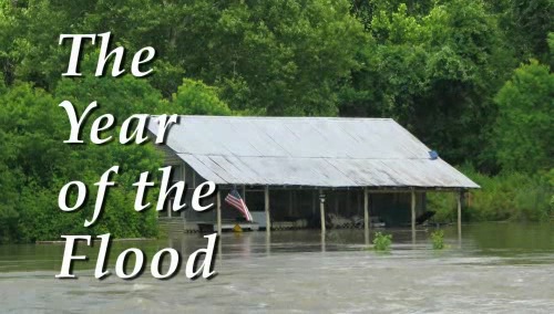
2011: The Year of the Flood

Devastating floods across much of the United States were severe and unrelenting during the spring and summer of 2011. When floods happen, USGS crews are among the first-responders. Often working in dangerous conditions, USGS scientists measure streamflow and river levels, repair and install streamgages, measure water quality and changes in sediment flow, and assess river changes. From flood forecasts to difficult decisions about flood management, science is critical for flood preparations and response.


Video: 2011, The year of the flood


If the Acrobat Reader does not appear when you click on a link for a PDF file, you can download the Acrobat Reader Software from the Adobe Acrobat web site

USGS Home Water Climate Change Core Science Ecosystems Energy&Env. Health Hazards

Accessibility FOIA Privacy Policies and Notices

Take Pride in America logo USA.gov logo U.S. Department of the Interior | U.S. Geological Survey
URL: http://sd.water.usgs.gov/index.html
Page Contact Information: Webmaster
Page Last Modified: Friday, 28-Oct-2011 10:56:59 EDT