


Welcome to Climate Reel, a collection of NASA's best videos and visualizations of climate change. At the top of the page is a selection of the most popular videos, followed by lists of videos organized by theme.
Top 10 Climate Movies
-

The Home Frontier
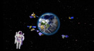
NASA explores. From its earliest days of sounding rockets and balloon-borne instruments, to Apollo and Hubble and missions to Mars. This mission of exploration has also always focused on our own corner of the universe, Earth - The Home Frontier. It is still the only planet we've ever been to.
Credit: NASA
› Play video › Download video -
Majestic Planet
Land. Water. Fire. Ice. These elements are basic ingredients that make up planet Earth. Take a moment to admire the magnificent spectacle of our stunning home planet from the perspective of space.
Credit: NASA JPL
› Play video › Download video -

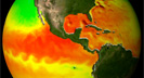
Piecing Together the Temperature Puzzle
The past decade has been the hottest ever recorded since global temperature records began 150 years ago. This video discusses the impacts of the sun's energy, Earth's reflectance and greenhouse gasses on global warming.
Credit: NASA
› Play video › Download video -
Frozen Earth
Ice covers 10 percent of Earth's surface and helps moderate the planet's temperature. Glaciers and ice sheets around the world are melting at an alarming rate. By keeping an eye on Earth's ice from space, NASA satellites help us understand the global effects of climate change.
Credit: NASA JPL
› Play video › Download video -

Feeling the Sting of Climate Change
By comparing bee data to satellite imagery, NASA research scientist Wayne Esaias uses honey bees as tiny data collectors to understand how climate change is affecting pollination and plants.
Credit: NASA Scientific Visualization Studio
› Play video › Download video -

A Tour of the Cryosphere 2009
The cryosphere is Earth's solid water: snow, sea ice, glaciers, permafrost, ice sheets, and icebergs. Direct measurements can be difficult to obtain, so scientists use satellites to observe the cryosphere and to monitor changes.
Credit: NASA Scientific Visualization Studio
› Play video › Download video -
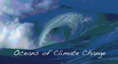
Oceans of Climate Change
Oceanographer Josh Willis discusses the heat capacity of water, performs an experiment to demonstrate heat capacity using a water balloon and describes how water's ability to store heat affects Earth's climate.
Credit: NASA JPL
› Play video › Download video -
Aquarius: Salt of the Sea
Salinity plays a major role in global ocean circulation and changes in salinity may impact regional and global climates. NASA's Aquarius mission is painting a global picture of our planet's salty waters.
Credit: NASA
› Play video › Download video -

Carbon and Climate Change in 90 Seconds
By burning coal and oil, people are adding old carbon to the atmosphere faster than plants and the oceans can take it out. The carbon in the atmosphere acts like a blanket trapping heat and making the planet warmer. NASA carbon expert Peter Griffiths explains.
Credit: NASA
› Play video › Download video -

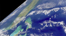
27 Storms: Arlene to Zeta
27 named storms formed in the 2005 Atlantic hurricane season, which broke many records including the most hurricanes, the most category 5 hurricanes, and the most intense hurricane ever recorded in the Atlantic.
Credit: NASA Scientific Visualization Studio
› Play video › Download video
Water
-
Earth: The Water Planet
The ocean is responsible for Earth's mild climate and makes life on Earth possible for all creatures. As global ocean temperatures increase, the ocean water expands causing sea level rise which can have disastrous impacts on low-lying coastal regions.
Credit: NASA JPL
› Play video › Download video -
Oceans of Climate Change
Oceanographer Josh Willis discusses the heat capacity of water, performs an experiment to demonstrate heat capacity using a water balloon and describes how water's ability to store heat affects Earth's climate.
Credit: NASA JPL
› Play video › Download video -

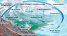
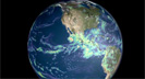
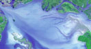
Climate Change and the Global Ocean
One of the best ways to understand Earth's ocean is from the perspective of space. NASA's Earth observing satellites gather data including ocean surface temperature, surface winds, sea level, circulation, and marine life.
Credit: NASA
› Play video › Download video -

NASA 360 with ocean scientists Josh Willis and Bill Patzert
Josh Willis at the beach and Bill Patzert at JPL talk about the TOPEX/Poseidon, Jason-1 and Jason-2 satellites, which monitor sea level and climate change.
Credit: NASA 360
› Play video › Download video -
Water, Water Everywhere
This video discusses the water cycle, which is the movement of water around the Earth, and its importance to life. Changes to the water cycle affect climate and vice versa.
Credit: NASA
› Play video › Download video -

Meet Molecule Max
Join JPL's animated science ambassador on a whimsical and informative tutorial about how Earth's water cycle works and how NASA studies it.
Credit: NASA JPL
› Play video › Download video -

The Ocean's Green Machines
Phytoplankton, a tiny marine plant, makes life on Earth possible, forms the basis of the marine food web, and regulates carbon in the atmosphere. Warming waters have consequences for phytoplankton and for the planet.
Credit: NASA JPL
› Play video › Download video -
Aquarius: Salt of the Sea
Salinity plays a major role in global ocean circulation and changes in salinity may impact regional and global climates. NASA's Aquarius mission is painting a global picture of our planet's salty waters.
Credit: NASA
› Play video › Download video -
Keeping Up with Carbon
Carbon forms living organisms, dissolves in the ocean, mixes in the atmosphere, and is stored in the crust of the planet. The ocean plays a critical role in the carbon cycle is key to understanding Earth's changing climate.
Credit: NASA
› Play video › Download video -
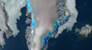
Shrinking Ice, Rising Seas
Sea level rise is an indicator that our planet is warming. When ice on land, such as mountain glaciers or the ice sheets of Greenland or Antarctica, melts, that water contributes to sea level rise.
Credit: NASA
› Play video › Download video -
Know Your Earth: Earth Observing Fleet Studies Climate
With the help of an animated astronaut, this video explains how climate change affects the ocean, land, atmosphere and ice sheets around the world. It also explains how NASA's Earth-observing satellite fleet enables scientists to gather accurate data and understand those changes.
Credit: NASA Scientific Visualization Studio
› Play video › Download video
Atmosphere
-
Piecing Together the Temperature Puzzle
The past decade has been the hottest ever recorded since global temperature records began 150 years ago. This video discusses the impacts of the sun's energy, Earth's reflectance and greenhouse gasses on global warming.
Credit: NASA
› Play video › Download video -
Taking Earth's Temperature
Earth's climate is changing at an unprecedented rate. This video explores climate modeling and other tools that NASA scientists use to take the Earth's temperature.
Credit: NASA Scientific Visualization Studio
› Play video › Download video -
27 Storms: Arlene to Zeta
27 named storms formed in the 2005 Atlantic hurricane season, which broke many records including the most hurricanes, the most category 5 hurricanes, and the most intense hurricane ever recorded in the Atlantic.
Credit: NASA Scientific Visualization Studio
› Play video › Download video -

Hello Crud
Aerosols are small particles suspended in the air. Glory's APS instrument will help researchers understand the properties, the global distribution, and the chemical composition of natural and anthropogenic aerosols and clouds.
Credit: NASA Scientific Visualization Studio
› Play video › Download video -
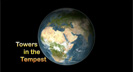
Towers in the Tempest
Hurricane intensification can be caused by phenomenon called 'hot towers', which form as air spirals inward towards the eye and is forced rapidly upwards, accelerating the movement of energy into high altitude clouds.
Credit: NASA Scientific Visualization Studio
› Play video › Download video -
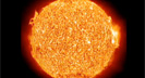
Striking a Solar Balance
Earth's climate depends on energy from the Sun. The Total Irradiance Monitor on NASA's Glory mission will continue measuring solar irradiance, which will contribute to the long-term climate record.
Credit: NASA Scientific Visualization Studio
› Play video › Download video -
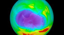
Exploring Ozone
Leading atmospheric NASA scientist, Dr. Paul Newman discusses the status of the stratospheric ozone hole, including what causes the ozone hole to form and the role climate change will play in future years.
Credit: NASA Scientific Visualization Studio
› Play video › Download video -
Supercomputing the Climate
Go behind-the-scenes of the NASA Center for Climate Simulation (NCCS), a state-of-the-art supercomputing facility capable of running complex models that give a picture of how Earth's climate is changing.
Credit: NASA Scientific Visualization Studio
› Play video › Download video -
Know Your Earth: Earth Observing Fleet Studies Climate
With the help of an animated astronaut, this video explains how climate change affects the ocean, land, atmosphere and ice sheets around the world. It also explains how NASA's Earth-observing satellite fleet enables scientists to gather accurate data and understand those changes.
Credit: NASA Scientific Visualization Studio
› Play video › Download video
Frozen Places
-
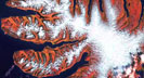
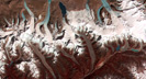
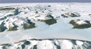
Frozen Earth
Ice covers 10 percent of Earth's surface and helps moderate the planet's temperature. Glaciers and ice sheets around the world are melting at an alarming rate. By keeping an eye on Earth's ice from space, NASA satellites help us understand the global effects of climate change.
Credit: NASA JPL
› Play video › Download video -

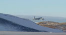
Earth's Climate Gets a Checkup: Operation IceBridge
The Operation IceBridge Mission is an unprecedented six-year mission to study the Earth's polar regions, not through the lens of a satellite, but from onboard an airplane. IceBridge is the largest airborne survey of Earth's polar ice ever flown.
Credit: NASA Scientific Visualization Studio
› Play video › Download video -
A Tour of the Cryosphere 2009
The cryosphere is Earth's solid water: snow, sea ice, glaciers, permafrost, ice sheets, and icebergs. Direct measurements can be difficult to obtain, so scientists use satellites to observe the cryosphere and to monitor changes.
Credit: NASA Scientific Visualization Studio
› Play video › Download video -
Arctic Sea Ice 101
A fast-paced interview with NASA climate scientist Tom Wagner, where he provides a look at the state of Arctic sea ice in 2009 and discusses NASA's role in monitoring the cryosphere.
Credit: NASA Scientific Visualization Studio
› Play video › Download video -
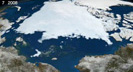
Sea Ice 2008
Arctic sea ice has shrunk dramatically in the last few decades. If recent trends in the melt rate continue, the Arctic Ocean could be ice free in the summer much sooner than previously thought.
Credit: NASA Scientific Visualization Studio
› Play video › Download video -
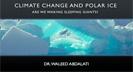
Climate Change and Polar Ice
Dr. Waleed Abdalait's lecture, entitled "Are We Waking Sleeping Giants?" discussing the vital importance played by the solid part of our planet's water inventory.
Credit: NASA Scientific Visualization Studio
› Play video › Download video -
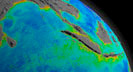
Guided Tour of Antarctica Flyover
This guided tour of the area surrounding McMurdo Station in Antarctica uses the Landsat Image Mosaic of Antarctica (LIMA). It's a great way to experience the frozen continent without any risk of frostbite.
Credit: NASA Scientific Visualization Studio
› Play video › Download video
Life
-
The Changing Face of Planet Earth
NASA satellites observe Earth's changes both natural as well as anthropogenic. These changes include growth in population, deforestation, floods, drought, and fires.
Credit: NASA JPL
› Play video › Download video -
Carbon and Climate Change in 90 Seconds
By burning coal and oil, people are adding old carbon to the atmosphere faster than plants and the oceans can take it out. The carbon in the atmosphere acts like a blanket trapping heat and making the planet warmer. NASA carbon expert Peter Griffiths explains.
Credit: NASA
› Play video › Download video -
The Home Frontier
NASA explores. From its earliest days of sounding rockets and balloon-borne instruments, to Apollo and Hubble and missions to Mars. This mission of exploration has also always focused on our own corner of the universe, Earth - The Home Frontier. It is still the only planet we've ever been to.
Credit: NASA
› Play video › Download video -
Feeling the Sting of Climate Change
By comparing bee data to satellite imagery, NASA research scientist Wayne Esaias uses honey bees as tiny data collectors to understand how climate change is affecting pollination and plants.
Credit: NASA Scientific Visualization Studio
› Play video › Download video -
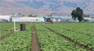
Science for a Hungry World: Agriculture and Climate Change
This video explores the need for accurate, continuous and accessible data and computer models to track and predict the challenges farmers face as they adjust to a changing climate.
Credit: NASA Scientific Visualization Studio
› Play video › Download video -

Plant Productivity in a Warming World
Warmer global temperatures and higher levels of precipitation are generally good for plant productivity, but as temperatures have continued to rise, the benefits to plants are now overwhelmed by longer and more frequent droughts.
Credit: NASA Scientific Visualization Studio
› Play video › Download video
Animations
Water
- Bloomin' phytoplankton
- The great ocean conveyor belt
- The water cycle
- Seafood!
- Sea surface temperature
- 2008 hurricane season
- Global temperature
- Carbon dioxide, a history
- Carbon dioxide, today
- The ozone hole
- The carbon cycle
- Smog and Arctic warming
- The ozone hole
- American carbon
- The living sun
- Greenhouse gases and global warming
- The water cycle
- Ozone and global warming
- Smog and Arctic warming
- Hurricane Katrina