
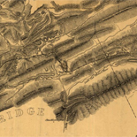
![[Rough sketch of the Rich Mountain battle area extending from Beverly, W. Va. to Clarksburg].](https://cybercemetery.unt.edu/archive/oilspill/20120916080013im_/http://www.loc.gov/collections/static/hotchkiss-maps/images/cwh00078.jpg)

![[Coast of Maine from Frenchmans Bay to Mosquito Harbor].](https://cybercemetery.unt.edu/archive/oilspill/20120916080013im_/http://www.loc.gov/collections/static/american-revolutionary-war-maps/images/np000011.jpg)


![[Map of Chancellorsville battlefield, May 3-4, 1863].](https://cybercemetery.unt.edu/archive/oilspill/20120916080013im_/http://www.loc.gov/collections/static/hotchkiss-maps/images/cwh00138.jpg)
![[December 16, 1944], HQ Twelfth Army Group situation map.](https://cybercemetery.unt.edu/archive/oilspill/20120916080013im_/http://www.loc.gov/collections/static/world-war-II-maps-military-situation-maps-from-1944-to-1945/images/ict21195.jpg)

Results
Refined by:
Original Format: Map-

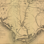
[Environs of Vicksburg, Mississippi, 1863] /
Relief shown by hachures. Depths shown by form lines.
Contributor: United States Coast Survey Site: American Memory-cultural - Main Catalog Original Format: Map Date: 1863 View catalog record -

Sketch map of United States of North-America. [1861-65]
Scale ca. 1:4,700,000.
Contributor: Rundall, Frank M. Site: American Memory-cultural - Main Catalog Original Format: Map Date: 1901 View catalog record -

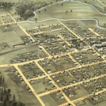
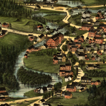
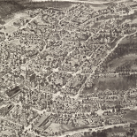
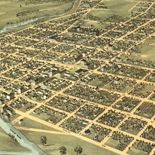
Perry, N.Y., Wyoming Co., 1892 /
Aerial view of village.
Contributor: Burleigh Litho Site: American Memory-cultural - Main Catalog Original Format: Map Date: 1892 View catalog record -

Portions of the military departments of Virginia, Washington, Middle & the Susquehanna,
Scale 1:200,000.
Contributor: United States. Army. Corps of Engineers Site: American Memory-cultural - Main Catalog Original Format: Map Date: 1863 View catalog record -

Map illustrating the operations of the army under com'd of Maj. Gen. W.T. Sherman, in Georgia, from May 5th to September 4th, 1864 /
Shows Union and Confederate works in southeastern Tennessee and northwestern Georgia.
Contributor: Brooks, Alfred F. Site: American Memory-cultural - Main Catalog Original Format: Map Date: 1864 View catalog record -

Plan of the siege of the Havana surrenderid [sic] Aug. 12, 1762 to the English commanded by the Earl of Albemarle General and Sir George ...
Relief shown by shading.
Contributor: Hawk, James Site: American Memory-cultural - Main Catalog Original Format: Map Date: 1762 View catalog record -

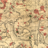
Yellowstone.
Scale ca. 1:250,000.
Contributor: United States. National Park Service Site: American Memory-cultural - Main Catalog Original Format: Map Date: 1972 View catalog record -

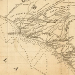
Colton's new topographical map of the eastern portion of the state of North Carolina with part of Virginia & South Carolina from the latest & ...
LC Civil War Maps (2nd ed.), S122,305
Contributor: Colton, J. H. Site: American Memory-cultural - Main Catalog Original Format: Map Date: 1864 View catalog record -

Map of Hays County, Texas /
Shows landownership.
Contributor: Texas. General Land Office Site: American Memory-cultural - Main Catalog Original Format: Map Date: 1880 View catalog record -


Springfield, 1827 : surveyed by direction of the town, 1826 / Catalog Record - Electronic Resource Available
General map showing names of landowners.
Contributor: Bowles, Samuel Site: Main Catalog Original Format: Map Date: 1827 -

French Guiana (France).
Also shows arrondissement boundaries.
Contributor: United States. Central Intelligence Agency Site: American Memory-cultural - Main Catalog Original Format: Map Date: 1992 View catalog record -

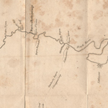
Geological section from S. Fork of Shenandoah R. to Lost R. (across Shenandoah Co.) /
Date and scale from Stephenson's Civil War maps, 1989.
Contributor: Lesley, Joseph Site: American Memory-cultural - Main Catalog Original Format: Map Date: 1860 View catalog record -

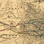
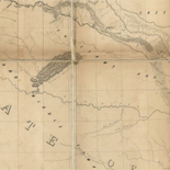
Map of the Iowa Central Air Line Rail Road and its connections.
Scale ca. 1:1,550,000.
Contributor: J.H. Colton & Co Site: American Memory-cultural - Main Catalog Original Format: Map Date: 1857 View catalog record -

North Korea.
"Base 504883 (546979) 3-82."
Contributor: United States. Central Intelligence Agency Site: American Memory-cultural - Main Catalog Original Format: Map Date: 1982 View catalog record -

Carte des isle situées au nord de St. Domingue, avec les passages pour le retour appellés débouquemens, 1763.
Scale ca. 1:80,000,000.
Contributor: Bellin, Jacques Nicolas Site: American Memory-cultural - Main Catalog Original Format: Map Date: 1764 View catalog record -

Map of Brown Co., state of Texas : showing the extent of all public surveys, land grants and all other official information compiled from the ...
Relief shown by hachures.
Contributor: Roessler, A. R. Site: American Memory-cultural - Main Catalog Original Format: Map Date: 1876 View catalog record -

Louisiana.
From Arrowsmith & Lewis New and Elegant General Atlas, 1804.
Contributor: Lewis, Samuel Site: American Memory-cultural - Main Catalog Original Format: Map Date: 1805 View catalog record -

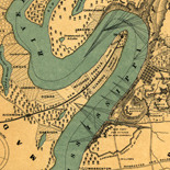
[St. Louis.
Perspective map not drawn to scale.
Site: American Memory-cultural - Main Catalog Original Format: Map Date: 1897 View catalog record -

National Wetlands Inventory, [Arizona].
Available also through the Library of Congress web site as a raster image.
Contributor: National Wetlands Inventory (U.S.) Site: American Memory-cultural - Main Catalog Original Format: Map Date: 1984 View catalog record -

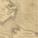
[Charts of the coast of Florida]
Scales vary.
Contributor: De Brahm, John Gerar William Site: American Memory-cultural - Main Catalog Original Format: Map Date: 1765 View catalog record