Image description:
From NASA’s Earth Observatory:
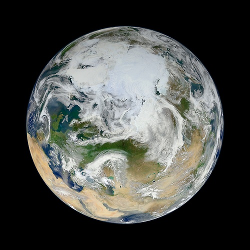
There have been many images of the full disc of Earth from space – a view often referred to as “the Blue Marble” – but few have looked quite like this. Using natural-color images from the Visible/Infrared Imaging Radiometer Suite (VIIRS) on the recently launched Suomi-NPP satellite, a NASA scientist has compiled a new view showing the Arctic and high latitudes.
We welcome your comments if you are 13 or older, and hope that our conversations here will be polite. You are responsible for the content of your comments.
We do not discriminate against any views, but may delete any of the following:
- violent, obscene, profane, hateful, or racist comments
- comments that threaten or harm the reputation of any person or organization
- advertisements or solicitations of any kind
- comments that suggest or encourage illegal activity
- multiple off-topic posts or repetitive posts that are copied and pasted
- personal information including, but not limited to, e-mail addresses, telephone numbers, mailing addresses, or identification numbers
In short: be nice and add to the discussion. If you continually violate this policy, we may limit your ability to comment in the future. If you have any questions or comments about this policy, please e-mail us.
