|
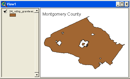
HUD has developed formula grantee boundary files, designed for use in a Geographic Information System (GIS) mapping system. These are not map images. While the Census Bureau provides GIS boundary files for many geographic components, the CPD formula grantee boundaries require special geography for which the boundary files are not available through the Census Bureau. HUD has developed two different sets of boundary files to supplement the Census Bureau boundary files:
When loaded into a GIS, these boundary files will show an outline of the geography selected.
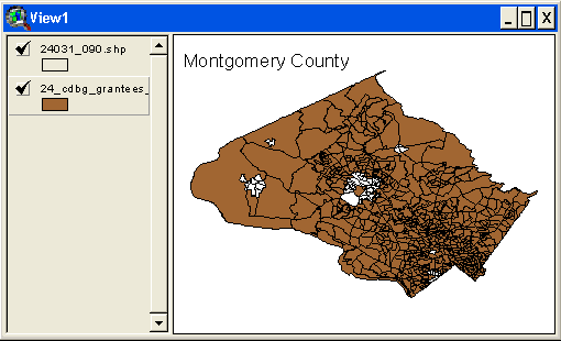
Once the boundary files are loaded into a GIS, they can be joined with other HUD data:
|