
Coin of the Month
Northern Mariana Islands Quarter
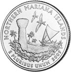
The last quarter to be released under the District of Columbia and U.S. Territories Quarters Program is the quarter that honors the Northern Mariana Islands. The 2009 Quarters page explains the images on the coin and gives you some of the history that brought these islands into their status as a territory of the United States.
As Coin of the Month, I'd like to take a look at what's happening "behind the scenes"…or should I say "UNDER the scenes"?
You see, according to the National Aeronautics and Space Administration (NASA), it was underwater volcanoes that formed the Mariana Islands. The islands lie along the edge of a huge patch of Earth's crust called the Philippine plate. East of the Marianas, the Pacific plate (under the Pacific Ocean) meets the Philippine plate. As the two plates collide, the Pacific plate gets pushed down under the Philippine plate, creating the Marianas Trench, the deepest ocean that we know of on the whole planet (more than 35,000 feet deep).
As the plates grind against each other, rock breaks up, causing heat and building pressure. Through cracks in the upper plate, lava rises and bursts through the crust. If this happens under water, the cooled lava creates undersea mountains called "seamounts." The mountains sometimes keep erupting and grow until they get higher than the water's surface. Then you have a volcanic island. All of the Marianas formed in this way.
The 14 islands of the Northern Marianas host nine active volcanoes. One volcano, on the island of Anatahan, was considered dormant (inactive) because there was no record of it erupting…until 2003. Anatahan's volcano has erupted several times since then, which just goes to show: you never know with volcanoes!

Anatahan ash, from the Image Science and Analysis Laboratory, NASA-Johnson Space Center. "The Gateway to Astronaut Photography of Earth."
|
Volcanoes can cause much destruction with their falling rock and flowing hot lava, but one force you might not think about is clouds of ash that rise into the air and drift for miles. This ash can damage airplanes that fly through it, causing engines to suddenly stop running and equipment to stop working properly. One of Anatahan's plumes rose 50,000 feet! The ash plume from Anatahan's 2003 eruption was so huge it was photographed from the International Space Station! |
Another problem with eruptions is that they're hard to predict. No people have been hurt during Anatahan's eruptions because no one lives on the island anymore, but weather scientists learned something from Anatahan: radar equipment, made to measure clouds, can also measure plumes of ash from volcanoes. Anatahan sent up plumes right before it erupted in 2003, which the radar detected. Because of this, pilots were warned to steer clear of the area, keeping their flights safe.
—Peter


Content Related Link