
![[Rough sketch of the Rich Mountain battle area extending from Beverly, W. Va. to Clarksburg].](https://cybercemetery.unt.edu/archive/oilspill/20120928092348im_/http://www.loc.gov/collections/static/hotchkiss-maps/images/cwh00078.jpg)
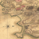
![Plano. I descripcion de la costa, desde el Cavo Cañaveral, hasta cerca de la boca de la Vir[g]inia, contando, costa de Florida, Georgia y Carolinas del S, y N, con todos sus puertos, este[ros ... ]letas, baxos, islas y rios; segun las vlti[mas not]icias, hata [sic] oy Octubre de 1756.](https://cybercemetery.unt.edu/archive/oilspill/20120928092348im_/http://www.loc.gov/collections/static/american-revolutionary-war-maps/images/ct000339.jpg)
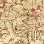
![[Map of Madison County, Va.].](https://cybercemetery.unt.edu/archive/oilspill/20120928092348im_/http://www.loc.gov/collections/static/hotchkiss-maps/images/cwh00046.jpg)

![[January 1, 1945], HQ Twelfth Army Group situation map.](https://cybercemetery.unt.edu/archive/oilspill/20120928092348im_/http://www.loc.gov/collections/static/world-war-II-maps-military-situation-maps-from-1944-to-1945/images/ict21211.jpg)
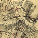
![[Sketch of the Manassas battlefield].](https://cybercemetery.unt.edu/archive/oilspill/20120928092348im_/http://www.loc.gov/collections/static/hotchkiss-maps/images/cwh00108.jpg)
![[Map of cavalry engagement near Bridgewater, Va. Oct. 4th and 5th, 1864]](https://cybercemetery.unt.edu/archive/oilspill/20120928092348im_/http://www.loc.gov/collections/static/hotchkiss-maps/images/cwh00193.jpg)
![[Map of parts of Caroline, Hanover, and Henrico counties, Va. west of the Mattaponi River and the Richmond, Fredericksburg, and Potomac Railroad].](https://cybercemetery.unt.edu/archive/oilspill/20120928092348im_/http://www.loc.gov/collections/static/hotchkiss-maps/images/cwh00025.jpg)
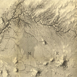
![[Base map of Alabama].](https://cybercemetery.unt.edu/archive/oilspill/20120928092348im_/http://www.loc.gov/collections/static/hotchkiss-maps/images/cwh00201.jpg)
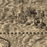
![Boston its environs and harbour, with the rebels works raised against that town in 1775... Sir Thomas Hyde Page, [1775?].](https://cybercemetery.unt.edu/archive/oilspill/20120928092348im_/http://www.loc.gov/collections/static/american-revolutionary-war-maps/images/ct000070.jpg)

Results
Refined by:
Original Format: Map-
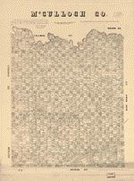
McCulloch Co., Texas.
Shows land ownership.
Contributor: Texas. General Land Office Site: American Memory-cultural - Main Catalog Original Format: Map Date: 1879 View catalog record -

Atlas of Logan County, Ohio /
Available also through the Library of Congress Web site as a raster image.
Contributor: D.J. Lake & Company Site: American Memory-cultural - Main Catalog Original Format: Map Date: 1890 View catalog record -

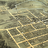
Bird's eye view of Jacksonville and the Rogue River Valley, Oregon 1883.
Perspective map not drawn to scale.
Contributor: Walpole, Fred A. Site: American Memory-cultural - Main Catalog Original Format: Map Date: 1883 View catalog record -

Plano que contiene desde el Río de Sta. Marta (en la América Setentrional) hasta la Punta de Granate.
Shows coast of Colombia in vicinity of Santa Marta.
Site: American Memory-cultural - Main Catalog Original Format: Map Date: 1725 View catalog record -

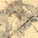
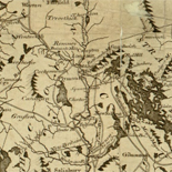
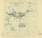
[Sketch of the Shenandoah Valley in the vicinity of Mt. Jackson].
Shows names of some residents.
Site: American Memory-cultural - Main Catalog Original Format: Map View catalog record -

Diagram showing the history of the exploration and navigation and survey of the Grand and other canons of the Colorado River of the West from ...
Available also through the Library of Congress web site as a raster image.
Contributor: Stanton, Robert Brewster Site: American Memory-cultural - Main Catalog Original Format: Map Date: 1908 View catalog record -

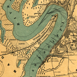
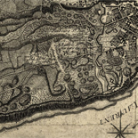
Sketch of McClelland's [sic] position, July 7th, 1862 /
Shows McClellan's army at Harrison's Landing in Charles City County and shows names of some residents.
Contributor: Blackford, W. W. Site: American Memory-cultural - Main Catalog Original Format: Map Date: 1862 View catalog record -

US Antarctic Inspection, 1983.
Shows the route of the U.S. Coast Guard cutter Polar Star and stations inspected.
Contributor: United States. Central Intelligence Agency Site: American Memory-cultural - Main Catalog Original Format: Map Date: 1984 View catalog record -
[July 9, 1944], HQ Twelfth Army Group situation map.
Available also through the Library of Congress web site as a raster image.
Contributor: Allied Forces. Army Group, 12th. Engineer Section Site: American Memory-cultural - Main Catalog Original Format: Map Date: 1944-07-09 View catalog record -

Map of Bedford County, Tenn. /
Relief shown by hachures.
Contributor: Beers, D. G. Site: American Memory-cultural - Main Catalog Original Format: Map Date: 1878 View catalog record -


Map of Pueblo County, Colorado / Catalog Record - Electronic Resource Available
Relief shown by hachures.
Contributor: Hills, V. G. Site: Main Catalog Original Format: Map Date: 1888 -
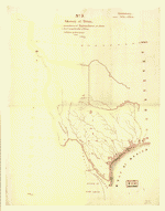
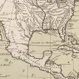
Sketch of Texas with the boundaries of Mexican States as shown on General Austin's map of Texas published by R. S. Tanner, 1839.
Manuscript.
Contributor: Gilman, E. Site: American Memory-cultural - Main Catalog Original Format: Map Date: 1839 View catalog record -

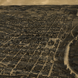
[St. Louis.
Perspective map not drawn to scale.
Site: American Memory-cultural - Main Catalog Original Format: Map Date: 1897 View catalog record -

Map of the battlefield of Gettysburg from original surveys by the engineers of the Commission
Scale ca. 1:8450.
Contributor: Gettysburg National Military Park Commission Site: American Memory-cultural - Main Catalog Original Format: Map Date: 1916 View catalog record -

Grand birds eye view of the Great East River Suspension Bridge. Connecting the cities of New York & Brooklyn showing also the splendid panorama of ...
Shows points of interest.
Contributor: Currier & Ives Site: American Memory-cultural - Main Catalog Original Format: Map Date: 1885 View catalog record -

Africa. 11-68.
Scale 1:11,300,000.
Contributor: [United States. Central Intelligence Agency] Site: American Memory-cultural - Main Catalog Original Format: Map Date: 1968 View catalog record -

[May 30, 1945], HQ Twelfth Army Group situation map.
Available also through the Library of Congress web site as a raster image.
Contributor: Allied Forces. Army Group, 12th. Engineer Section Site: American Memory-cultural - Main Catalog Original Format: Map Date: 1945-05-30 View catalog record -

Novvs atlas Sinensis.
Covers 16 provinces of China, Korea, and Japan.
Contributor: Martini, Martino Site: American Memory-cultural - Main Catalog Original Format: Map Date: 1655 View catalog record -

Ethiopia-Somalia boundary.
"502756 10-75."
Contributor: United States. Central Intelligence Agency Site: American Memory-cultural - Main Catalog Original Format: Map Date: 1975 View catalog record -
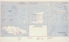
The West Indies. 11-58.
Scales vary.
Contributor: United States. Central Intelligence Agency Site: American Memory-cultural - Main Catalog Original Format: Map Date: 1958 View catalog record