Natural Hazards Support System

Natural Hazards Support System
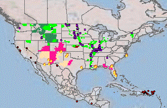
The Natural Hazards Support System (NHSS) is designed to provide a comprehensive overview of current natural hazards events for the public as well as USGS Federal, State and local partners. It enables users to monitor and analyze natural hazards events as they are occurring anywhere on the Earth. This information is presented in an integrated geospatial view that combines the dynamic natural hazards events with a rich set of reference data including shaded relief, transportation, and hydrography.
The United States Geological Survey (USGS) Rocky Mountain Geographic Science Center (RMGSC) developed NHSS to aid in monitoring, responding to, and analyzing current natural hazards events. This is achieved by NHSS' combination of information that allows users to easily monitor either a single natural hazard event or see the geospatial relationships of different natural hazards events.


