Skip Navigation
FREE: Federal Resources for Educational Excellence - Teaching and Learning Resources From Federal Agencies
RSS


Home
Subject Map
Go
Science
Applied Sciences
Computers/Tech (16)
Engineering (26)
Earth Sciences
Climate Change (42)
Environment (63)
Geology (37)
Oceans (42)
Other Earth Sciences (76)
Life Sciences
Animals/Zoology (34)
Botany (19)
Cells (25)
Diseases (34)
Genes, Evolution (43)
Human Body (30)
Interdependence (25)
Medicine (27)
Other Life Sciences (44)
Physical Sciences
Chemistry (36)
Energy (25)
Physics (46)
Other Physical Sciences (23)
Space Sciences
Aeronautics (27)
Astronomy (60)
Other Space Sciences (31)
Other Science (45)
 
What's New
Calendar

Science » Earth Sciences » Other Earth Sciences

Nationalatlas.gov

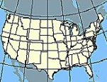
is a primary source of U.S. maps and geographic information. Zoom in on your state and make your own map by selecting features to display: cities and counties, roads and rivers, population and 109th congressional districts, crops and livestock, amphibians and butterflies, air and water quality, earthquakes and land cover, forest types, and more. Print a U.S. map (with or without names of states and capitals). Find an aerial photo of your neighborhood. (Department of the Interior)

   Go to this website

Interesting Fact:

Maps for Congressional districts show state and county boundaries, interstate and US highways, selected rivers and waterbodies, and major cities.
Image of the United States with longitude and latitude lines.

Map maker

 This website also appears in:
U.S. History Topics »  Other History & Soc Studies »  Geography

    About FREE      Privacy     Security     Disclaimer     WhiteHouse.gov     USA.gov   ED.gov