USGS - science for a changing world

U.S. Geological Survey

Maps, Imagery, and Publications Hazards Newsroom Education Jobs Partnerships Library About USGS Social Media

Real-Time

USGS Calendar

View our calendar of events or download the PDF version.

Science FeaturesRSS feed

Salt Marshes May Slow Climate Warming . . . For A WhileWest Nile Virus Imperils Humans and WildlifeSeptember is National Preparedness MonthDespite Isaac, Drought Persists in MidlandsStart with Science: Hurricane Isaac
Salt Marshes May Slow Climate Warming . . . For A While
Saltmarshes may slow the rate of climate change. Read more
West Nile Virus Imperils Humans and Wildlife
USGS vigilant for West Nile virus in wildlife through surveillance, research, and mapping.
September is National Preparedness Month
USGS science helps people understand and prepare for natural hazards. Read more
Despite Isaac, Drought Persists in Midlands
The majority of the nation is still experiencing abnormally dry conditions, even after soaking rains from Isaac. Read more
Start with Science: Hurricane Isaac
While Hurricane Isaac has passed, scientific work to understand the storm’s impact on Gulf Coast states continues. Read more
  • USGS Storm Surge Sensors

    USGS Storm Surge Sensors

    In response to Hurricane Isaac, USGS has deployed several hundred storm surge sensors to collect information about the effects of Isaac on the Gulf Coast.

  • A History of Rubble and Rumblings: Earthquakes in the Eastern U.S.

    A History of Rubble and Rumblings: Earthquakes in the Eastern U.S.

    Join us on September 5th in Reston, VA for a free public lecture on the 2011 Virginia earthquake!

  • Global Food Security in the 21st Century: Free USGS Public Lecture August 30

    Global Food Security in the 21st Century: Free USGS Public Lecture August 30

    7 p.m.—Public lecture (also live-streamed over the Internet)

  • View all Science Picks
  • News Releases RSS icon

    Quick look:
    The U.S. Geological Survey is making available two reports related to groundwater-quality, quality-control, and well yield data for two monitoring wells near Pavillion, Wyo. The first USGS report describes the sampling and analysis plan that was developed to collect groundwater data. A second report provides the raw data and information from the groundwater-quality samples. ...
    USGS Releases Reports on Groundwater-Quality Sampling Near Pavillion, Wyo.

    (Released: Wed, 26 Sep 2012 14:34:51 EDT)

    Quick look:
    MENLO PARK, Calif. — Large earthquakes can alter seismicity patterns across the globe in very different ways, according to two new studies by U.S. Geological Survey seismologists. Both studies shed light on more than a decade of debate on the origin and prevalence of remotely triggered earthquakes. Until now, distant but damaging “aftershocks” have not been included in hazard assessments, yet in each study, changes in seismicity were predictable enough to be included in future evaluations of earthquake hazards....
    Rare Great Earthquake in April Triggers Large Aftershocks All Over the Globe

    (Released: Wed, 26 Sep 2012 13:00:00 EDT)

    Quick look:
    Use ‘ProjectAlert’ to keep up with USGS scientists as they respond to floods, droughts, and chemical spills. These alerts are official, yet informal notices that describe flood, drought, or water quality conditions across the country, as well as how USGS field crews are responding to the event....
    Media Advisory: Sign Up for USGS Alerts for Flooding and Drought

    (Released: Mon, 24 Sep 2012 11:21:02 EDT)

    Latest PublicationsRSS feed

    Quick look:
    Topsoil from arid regions is the main source of dust clouds that move through the earth's atmosphere, and microbial communities within these soils can survive long-range dispersion. Microbial abundance and chemical composition were analyzed in topsoil from various desert regions. Statistical analyses showed that microbial direct counts were strongly positively correlated with calcium concentration
    Epifluorescent direct counts of bacteria and viruses from topsoil of various desert dust storm regions

    (Released: Wed, 26 Sep 2012 00:00 -0500)
    Quick look:
    The unprecedented nature of the Deepwater Horizon oil spill required the application of research methods to estimate the rate at which oil was escaping from the well in the deep sea, its disposition after it entered the ocean, and total reservoir depletion. Here, we review what advances were made in scientific understanding of quantification of flow rates during deep sea oil well blowouts. We asse
    Review of flow rate estimates of the Deepwater Horizon oil spill

    (Released: Wed, 26 Sep 2012 00:00 -0500)

    Quick look:
    Climate change will likely have profound effects on cold-water species of freshwater fishes. As temperatures rise, cold-water fish distributions may shift and contract in response. Predicting the effects of projected stream warming in stream networks is complicated by the generally poor correlation between water temperature and air temperature. Spatial dependencies in stream networks are complex b
    Projected climate-induced habitat loss for salmonids in the John Day River network, Oregon, U.S.A.

    (Released: Wed, 26 Sep 2012 00:00 -0500)

    CoreCast  Podcast feed  iTunes feed

    Multimedia Gallery

    Search USGS

    Download or Buy Maps

    Map Locator & Downloader
    Find, Order, or Download FREE Topographic Maps!


    Buy recreation passes.

    Science Topics

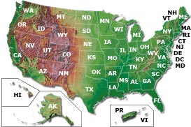
    Science In Your Backyard

    Image Map - U.S. Map

    See also:
    Coastal/Offshore | International

    Alabama Alaska Arizona Arkansas California Colorado Connecticut Delaware District of Columbia Florida Georgia Hawaii Idaho Illinois Indiana Iowa Kansas Kentucky Louisiana Maine Maryland Massachusetts Michigan Minnesota Mississippi Missouri Montana Nebraska Nevada New Hampshire New Jersey New Mexico New York North CarolinaNorth Dakota Ohio Oklahoma Oregon Pennsylvania Puerto Rico Rhode Island South Carolina South Dakota Tennessee Texas Utah Vermont U.S. Virgin Islands Virginia Washington West Virginia Wisconsin Wyoming

    Frequently Asked Questions RSS feed


    Accessibility FOIA Privacy Policies and Notices

    Take Pride in America logo USA.gov logo U.S. Department of the Interior | U.S. Geological Survey | DOI Inspector General
    URL: http://www.usgs.gov/default.asp
    Page Contact Information: Ask USGS
    Page Last Modified: Wednesday, May 02, 2012