Map
Rio Colorado of the West /

| Format |
Map |
|---|---|
| Contributors |
Ives, J. C. |
| Dates |
1858 |
| Location |
Colorado Colorado River Mexico United States |
| Language |
English |
| Subjects |
Colorado River (Colo.-Mexico) Maps United States |
- Title
- Rio Colorado of the West /
- Description
-
Relief shown by shading and hachures.
-
Also shows routes of exploration.
-
At head of title: Explorations and Surveys, War Department, map no. 2.
-
Available also through the Library of Congress Web site as a raster image.
-
1 map ; 38 x 89 cm.
- Creator
- Ives, J. C.
- Created Published
-
[Washington] : Office of Explorations and Surveys, 1858.
- Subject Headings
-
-
Colorado River (Colo.-Mexico)--Maps.
-
-
United States--Colorado River (Colo.-Mexico)
- Notes
-
-
Relief shown by shading and hachures.
-
-
Also shows routes of exploration.
-
-
At head of title: Explorations and Surveys, War Department, map no. 2.
-
-
Available also through the Library of Congress Web site as a raster image.
- Medium
-
1 map ; 38 x 89 cm.
- Call Number
-
G4302.C6 1858 .I9
- Repository
-
Library of Congress Geography and Map Division Washington, D.C. 20540-4650 USA dcu
- Digital Id
-
g4302c np000062 http://hdl.loc.gov/loc.gmd/g4302c.np000062
- Library of Congress Catalog Number
- 79692915
Rights & Access
The maps in the Map Collections materials were either published prior to 1922, produced by the United States government, or both (see catalogue records that accompany each map for information regarding date of publication and source). The Library of Congress is providing access to these materials for educational and research purposes and is not aware of any U.S. copyright protection (see Title 17 of the United States Code) or any other restrictions in the Map Collection materials.
Note that the written permission of the copyright owners and/or other rights holders (such as publicity and/or privacy rights) is required for distribution, reproduction, or other use of protected items beyond that allowed by fair use or other statutory exemptions. Responsibility for making an independent legal assessment of an item and securing any necessary permissions ultimately rests with persons desiring to use the item.
More about Copyright and other Restrictions
For guidance about compiling full citations consult Citing Primary Sources.
Part of...
-
Mapping The National Parks
[170]
-
Additional Conservation And Environment Cartographic Items
[232]
-
Geography And Maps Division
[60803]
-
American Memory
[1120703]
More maps like this
-
 Diagram showing the history of the exploration and navigation and survey of the Grand and other canons of the Colorado River of the West from ...
Contributor:
Stanton, Robert Brewster
Site:
American Memory-cultural, Main Catalog
Original Format:
Map
Date:
1908
View catalog record
Diagram showing the history of the exploration and navigation and survey of the Grand and other canons of the Colorado River of the West from ...
Contributor:
Stanton, Robert Brewster
Site:
American Memory-cultural, Main Catalog
Original Format:
Map
Date:
1908
View catalog record
-
 Boundaries between Brownsville, Texas and Matamoros, Tam. (Mexico)
Contributor:
International Boundary Commission, United States and Mexico
Site:
American Memory-cultural, Main Catalog
Original Format:
Map
Date:
1910
View catalog record
Boundaries between Brownsville, Texas and Matamoros, Tam. (Mexico)
Contributor:
International Boundary Commission, United States and Mexico
Site:
American Memory-cultural, Main Catalog
Original Format:
Map
Date:
1910
View catalog record
-
 Colorado /
Contributor:
Pezolt, F.
Site:
American Memory-cultural, Main Catalog
Original Format:
Map
Date:
1894
View catalog record
Colorado /
Contributor:
Pezolt, F.
Site:
American Memory-cultural, Main Catalog
Original Format:
Map
Date:
1894
View catalog record
-
 Map of Colorado Territory embracing the Central Gold Region /
Contributor:
Ebert, Frederick J.
Site:
American Memory-cultural, Main Catalog
Original Format:
Map
Date:
1862
View catalog record
Map of Colorado Territory embracing the Central Gold Region /
Contributor:
Ebert, Frederick J.
Site:
American Memory-cultural, Main Catalog
Original Format:
Map
Date:
1862
View catalog record
-
 Colton's new sectional map of the State of Colorado.
Contributor:
G.W. & C.B. Colton & Co
Site:
American Memory-cultural, Main Catalog
Original Format:
Map
Date:
1878
View catalog record
Colton's new sectional map of the State of Colorado.
Contributor:
G.W. & C.B. Colton & Co
Site:
American Memory-cultural, Main Catalog
Original Format:
Map
Date:
1878
View catalog record
-
 Indexed map of Colorado showing the railroads in the state, and the express company doing business over each, also counties and rivers.
Contributor:
Rand McNally and Company
Site:
American Memory-cultural, Main Catalog
Original Format:
Map
Date:
1879
View catalog record
Indexed map of Colorado showing the railroads in the state, and the express company doing business over each, also counties and rivers.
Contributor:
Rand McNally and Company
Site:
American Memory-cultural, Main Catalog
Original Format:
Map
Date:
1879
View catalog record
-
 Geological and geographical atlas of Colorado and portions of adjacent territory,
Contributor:
Geological and Geographical Survey of the Territories (U.S.)
Site:
American Memory-cultural, Main Catalog
Original Format:
Map
Date:
1877
View catalog record
Geological and geographical atlas of Colorado and portions of adjacent territory,
Contributor:
Geological and Geographical Survey of the Territories (U.S.)
Site:
American Memory-cultural, Main Catalog
Original Format:
Map
Date:
1877
View catalog record
-

 Topographic map of Mesa Verde National Park : Montezuma County, Colorado /
Contributor:
Geological Survey (U.S.)
Site:
Main Catalog
Original Format:
Map
Date:
1928
Topographic map of Mesa Verde National Park : Montezuma County, Colorado /
Contributor:
Geological Survey (U.S.)
Site:
Main Catalog
Original Format:
Map
Date:
1928
-
Topographic map of Mesa Verde National Park : Montezuma County, Colorado /
Contributor:
Geological Survey (U.S.)
Site:
Main Catalog
Original Format:
Map
Date:
1915
-
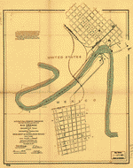
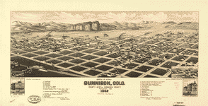 Bird's eye view of Gunnison, Colo. county seat of Gunnison County, 1882.
Contributor:
Stoner, J. J.
Site:
American Memory-cultural, Main Catalog
Original Format:
Map
Date:
1882
View catalog record
Bird's eye view of Gunnison, Colo. county seat of Gunnison County, 1882.
Contributor:
Stoner, J. J.
Site:
American Memory-cultural, Main Catalog
Original Format:
Map
Date:
1882
View catalog record
-
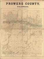 Prowers County, Colorado
Site:
American Memory-cultural, Main Catalog
Original Format:
Map
View catalog record
Prowers County, Colorado
Site:
American Memory-cultural, Main Catalog
Original Format:
Map
View catalog record
-
 Relief map, Rocky Mountain National Park : Colorado centennial, 1859-1959 /
Contributor:
Sprecher, J. M.
Site:
American Memory-cultural, Main Catalog
Original Format:
Map
Date:
1959
View catalog record
Relief map, Rocky Mountain National Park : Colorado centennial, 1859-1959 /
Contributor:
Sprecher, J. M.
Site:
American Memory-cultural, Main Catalog
Original Format:
Map
Date:
1959
View catalog record
-
 Map of great western Central City.
Contributor:
Kohfahl, John
Site:
American Memory-cultural, Main Catalog
Original Format:
Map
Date:
1887
View catalog record
Map of great western Central City.
Contributor:
Kohfahl, John
Site:
American Memory-cultural, Main Catalog
Original Format:
Map
Date:
1887
View catalog record
-
 A hysterical map of Rocky Mountain National Park scenery : chockfull of ohs & ahs /
Contributor:
Lindgren, Jolly
Site:
American Memory-cultural, Main Catalog
Original Format:
Map
Date:
1948
View catalog record
A hysterical map of Rocky Mountain National Park scenery : chockfull of ohs & ahs /
Contributor:
Lindgren, Jolly
Site:
American Memory-cultural, Main Catalog
Original Format:
Map
Date:
1948
View catalog record
-
 Bird's eye view of Denver, Colorado, 1908.
Contributor:
Birdseye View Publishing Co
Site:
American Memory-cultural, Main Catalog
Original Format:
Map
Date:
1908
View catalog record
Bird's eye view of Denver, Colorado, 1908.
Contributor:
Birdseye View Publishing Co
Site:
American Memory-cultural, Main Catalog
Original Format:
Map
Date:
1908
View catalog record
-
 Map of the United States of North America with parts of the adjacent countries /
Contributor:
Burr, David H.
Site:
American Memory-cultural, Main Catalog
Original Format:
Map
Date:
1839
View catalog record
Map of the United States of North America with parts of the adjacent countries /
Contributor:
Burr, David H.
Site:
American Memory-cultural, Main Catalog
Original Format:
Map
Date:
1839
View catalog record
You might also like
-
 Exploration of the Colorado River of the West and its tributaries. Explored in 1869, 1870, 1871, and 1872, under the direction of the secretary of ...
Contributor:
Smithsonian Institution
Site:
American Memory-cultural
Original Format:
Book
Date:
1875
Exploration of the Colorado River of the West and its tributaries. Explored in 1869, 1870, 1871, and 1872, under the direction of the secretary of ...
Contributor:
Smithsonian Institution
Site:
American Memory-cultural
Original Format:
Book
Date:
1875
-
Report of the explorations in 1873 of the Colorado of the West and its tributaries,
Contributor:
Smithsonian Institution
Site:
American Memory-cultural
Original Format:
Book
Date:
1874
-
 Canon of the Grand, Glenwood in distance
Contributor:
Dennis, A. W.
Site:
American Memory-cultural
Original Format:
Photo, Print, Drawing
Date:
1885
Canon of the Grand, Glenwood in distance
Contributor:
Dennis, A. W.
Site:
American Memory-cultural
Original Format:
Photo, Print, Drawing
Date:
1885
-
 Glenwood Springs
Contributor:
Dennis, A. W.
Site:
American Memory-cultural
Original Format:
Photo, Print, Drawing
Date:
1885
Glenwood Springs
Contributor:
Dennis, A. W.
Site:
American Memory-cultural
Original Format:
Photo, Print, Drawing
Date:
1885
-
 View above the Grand Falls
Contributor:
Dennis, A. W.
Site:
American Memory-cultural
Original Format:
Photo, Print, Drawing
Date:
1885
View above the Grand Falls
Contributor:
Dennis, A. W.
Site:
American Memory-cultural
Original Format:
Photo, Print, Drawing
Date:
1885
-
 View of the Canon the Grand
Contributor:
Dennis, A. W.
Site:
American Memory-cultural
Original Format:
Photo, Print, Drawing
Date:
1885
View of the Canon the Grand
Contributor:
Dennis, A. W.
Site:
American Memory-cultural
Original Format:
Photo, Print, Drawing
Date:
1885