![[Plan of Fort Henry and its outworks.]](https://cybercemetery.unt.edu/archive/oilspill/20120921145923im_/http://www.loc.gov/collections/static/civil-war-maps/images/cw0414000.jpg)
![[January 1, 1945], HQ Twelfth Army Group situation map.](https://cybercemetery.unt.edu/archive/oilspill/20120921145923im_/http://www.loc.gov/collections/static/world-war-II-maps-military-situation-maps-from-1944-to-1945/images/ict21211.jpg)
![[Map of Madison County, Va.].](https://cybercemetery.unt.edu/archive/oilspill/20120921145923im_/http://www.loc.gov/collections/static/hotchkiss-maps/images/cwh00046.jpg)
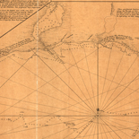
![[Coast of Maine from Frenchmans Bay to Mosquito Harbor].](https://cybercemetery.unt.edu/archive/oilspill/20120921145923im_/http://www.loc.gov/collections/static/american-revolutionary-war-maps/images/np000011.jpg)

![[Base map of Pennsylvania].](https://cybercemetery.unt.edu/archive/oilspill/20120921145923im_/http://www.loc.gov/collections/static/hotchkiss-maps/images/cwh00207.jpg)
![Boston its environs and harbour, with the rebels works raised against that town in 1775... Sir Thomas Hyde Page, [1775?].](https://cybercemetery.unt.edu/archive/oilspill/20120921145923im_/http://www.loc.gov/collections/static/american-revolutionary-war-maps/images/ct000070.jpg)
![[Detailed map of part of Virginia from Alexandria to the Potomac River above Washington, D.C. 1886].](https://cybercemetery.unt.edu/archive/oilspill/20120921145923im_/http://www.loc.gov/collections/static/civil-war-maps/images/cw0523000.jpg)
Results
-

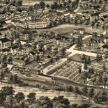
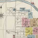
Greensburg, Pennsylvania 1901.
Perspective map not drawn to scale.
Contributor: Fowler, T. M. Site: American Memory-cultural - Main Catalog Original Format: Map Date: 1901 View catalog record -

Rochester, Pennsylvania 1900.
Perspective map not drawn to scale.
Contributor: Fowler, T. M. Site: American Memory-cultural - Main Catalog Original Format: Map Date: 1900 View catalog record -

Raineys farm line map of Greene County, Pennsylvania.
LC Land ownership maps, 754
Site: American Memory-cultural - Main Catalog Original Format: Map View catalog record -

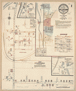
Sanborn Fire Insurance Map from Hollidaysburg, Blair County, Pennsylvania.
Includes Duncansville, Gaysport. 19 Sheet(s). Aug 1911.
Site: American Memory-cultural Original Format: Map Date: 1911 -

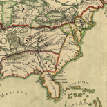
A new map of Virginia, Mary-Land, and the improved parts of Pennsylvania & New Jersey.
Relief shown pictorially.
Contributor: Senex, John Site: American Memory-cultural - Main Catalog Original Format: Map Date: 1719 View catalog record -
Sanborn Fire Insurance Map from Hellertown, Northampton County, Pennsylvania.
Includes Saucon Cross Roads, Didier. 5 Sheet(s). Jan 1915.
Site: American Memory-cultural Original Format: Map Date: 1915 -

Map of Allegheny Co., Pennsylvania : from actual surveys /
General-content county map showing relief, roads, railroads, place-names, buildings in rural areas, and householders' names in rural areas.
Contributor: Beers, S. N. Site: American Memory-cultural - Main Catalog Original Format: Map Date: 1862 View catalog record -

Sheffield, Warren County, Pennsylvania, 1895.
Perspective map not drawn to scale.
Contributor: Fowler, T. M. Site: American Memory-cultural - Main Catalog Original Format: Map Date: 1895 View catalog record -

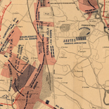
Map of the battlefield of Gettysburg
Scale ca. 1:12,000.
Contributor: Gettysburg Monuments Commissioners. New York Board Site: American Memory-cultural - Main Catalog Original Format: Map Date: 1894 View catalog record -

Gettysburg and vicinity, showing the lines of battle, July, 1863.
Scale 1:15,840.
Contributor: Burk & McFetridge Site: American Memory-cultural - Main Catalog Original Format: Map Date: 1863 View catalog record -

Philadelphia of to-day.
Perspective map not drawn to scale.
Contributor: Burk & McFetridge Site: American Memory-cultural - Main Catalog Original Format: Map Date: 1887 View catalog record -

A Sketch of the Battle of German. Tn., 4th October 1777, where the rebels were repulsed.
Scale ca. 1:16,200.
Site: American Memory-cultural - Main Catalog Original Format: Map Date: 1777 View catalog record -

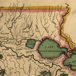
Industrial & political map of Pennsylvania : exhibiting the population, the principal resources of each county, and the valuation of property, the several congressional districts, ...
Printed to show extensive statistical data for each county.
Contributor: Biddle, Edward C. Site: American Memory-cultural - Main Catalog Original Format: Map Date: 1844 View catalog record -

Birds-eye view of the battlefield of Gettysburg.
"Copyright Jan. 18, 1901. C 476 H" in pencil in lower margin. DLC
Contributor: Gettysburg National Military Park Commission Site: American Memory-cultural - Main Catalog Original Format: Map Date: 1901 View catalog record -

Kittanning, Armstrong County, Pennsylvania 1896.
Perspective map not drawn to scale.
Contributor: Fowler, T. M. Site: American Memory-cultural - Main Catalog Original Format: Map Date: 1896 View catalog record -

Gettysburg Battlefield. Battle fought at Gettysburg, Pa. July 1st, 2d & 3d 1863 by the Federal and Confederate armies commanded respectively by Genl. G. G. ...
Perspective map not drawn to scale.
Contributor: Bachelder, John B. Site: American Memory-cultural - Main Catalog Original Format: Map Date: 1863 View catalog record -

Harmony, Butler County, Pennsylvania 1901.
Perspective map not drawn to scale.
Contributor: Fowler, T. M. Site: American Memory-cultural - Main Catalog Original Format: Map Date: 1901 View catalog record -

Map of Allegheny County, Pennsylvania, 1890 : with adjoining parts of Westmoreland, Washington & Beaver counties.
General-content county map showing roads, railroads, place-names, coal outcrops/mining areas, individual buildings in rural areas, and householders' names in rural areas. Does not show property lines or cadastral data.
Contributor: Krebs, Otto Site: American Memory-cultural - Main Catalog Original Format: Map Date: 1890 View catalog record -
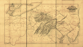
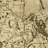
Map representing the route of the Philada. & Erie Rail Road its connections and the mineral lands in its vicinity.
Scale ca. 1:650,000.
Contributor: Sinclair, Thomas S. Site: American Memory-cultural - Main Catalog Original Format: Map Date: 1852 View catalog record -

Connellsville, Fayette County, Pennsylvania 1897 /
Perspective map not drawn to scale.
Contributor: Fowler, T. M. Site: American Memory-cultural - Main Catalog Original Format: Map Date: 1897 View catalog record
Refine your search
Original Format
- Map
- Web Page [8]