|
|
|
PRISM
Spatial climate products (digital maps) are available through
the links below. These products were developed through a
partnership between the NRCS National Water and Climate Center
(NWCC) and the
PRISM
Climate Group at
Oregon State University (OSU), developers of PRISM (the Parameter-elevation
Regressions on Independent Slopes Model).

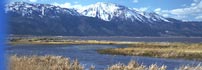
Click to view mapThis partnership has resulted in the production of the best and, in
many cases, the first high-spatial-resolution climate map products
for the United States. PRISM is an analytical tool that
uses point data, a digital elevation model, and other spatial data
sets to generate gridded estimates of monthly, yearly, and
event-based climatic parameters, such as precipitation, temperature,
snowfall, degree days, and dew point.
All products now available have been thoroughly scrutinized, having
passed a strenuous peer-review process in cooperation with state and
regional climatologists across the nation. The goal is to deliver
the highest quality and most accurate climate maps of the U.S. ever
produced. |
Go to these sites for more information, including full
documentation and metadata, regarding PRISM climate
map products developed by the NACSE at OSU, in conjunction with the
NRCS-NWCC:
Other, related links (now or soon using PRISM climate map
products):
Content Manager:
|
|
USDA-NRCS National Water and Climate Center
1201 NE Lloyd Blvd., Suite 802
Portland OR 97232-1274
(503)414-3017 Fax: (503)414-3101
email: jan.curtis@por.usda.gov
|
|