USGS - science for a changing world

Water Science for Maryland, Delaware and the District of Columbia


Welcome to our homepage! This site is your source for water-resources information collected and interpreted by the U.S. Geological Survey representing Maryland, Delaware, and the District of Columbia.

The water resources of Maryland, Delaware, and the District of Columbia consist of numerous streams, springs, lakes, and aquifer systems. Streamflow, groundwater levels, and water-quality data are collected at numerous locations, and water-use data are collected throughout the area. These hydrologic data and other data are used in research and hydrologic studies to describe the quantity, quality, and distribution of the area's water resources. The collection, analysis, and interpretation of these data are done in partnership with other federal, state and local agencies, universities, and research centers.

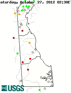
We also maintain and monitor a network of real-time data-collection sites throughout the region. Read our >>Science Strategy<< to learn more about our goals and operations.

*NEW and INTERESTING* Million Year Old Groundwater in Maryland Water Supply
June 18, 2012 USGS Press Release: Click Here


Team Based Projects

The USGS MD-DE-DC Water Science Center is organized into work teams to bring together projects that investigate similar water-resources issues, encourage sharing of individual expertise, data-collection methods, and personnel.

See what we're doing...

>> Fate & Bioremediation
>> Groundwater Qualilty Studies
>> National & Regional Assessments
>> Surface Water Monitoring & Sediment Studies
>> Water Quality Monitoring & Modeling
>> Water Supply & Groundwater Monitoring


Featured Project Website

Comprehensive Assessment of Water Supply in Maryland

All about water for Maryland's future. A collaborative effort with Maryland Geological Survey, Maryland Department of the Environment, Maryland Department of Natural Resources and USGS.

>> Access Website Here


New Publications Available Online

SIR 2012-5165 Cover Page

>> SIR 2012-5165
Potentiometric Surface and Water-Level Difference Maps of Selected Confined Aquifers in Southern Maryland and Maryland’s Eastern Shore, 1975–2011 by Stephen E. Curtin, David C. Andreasen, and Andrew W. Staley

SIR 2012-5160 Cover Page

>> SIR 2012-5160
A Science Plan for a Comprehensive Assessment of Water Supply in the Region Underlain by Fractured Rock in Maryland by By Brandon J. Fleming, Patrick A. Hammond, Scott A. Stranko, Mark T. Duigon, and Saeid Kasraei

SIR 2012-5079 Cover Page

>> SIR 2012-5079
Well Network Installation and Hydrogeologic Data Collection, Assateague Island National Seashore, Worcester County, Maryland by William S.L. Banks, John P. Masterson, and Carole D. Johnson

SIR 2012-5012 Cover Page

>> SIR 2012-5012
Geomorphic Responses to Stream Channel Restoration at Minebank Run, Baltimore County, Maryland by Edward J. Doheny, Jonathan J.A. Dillow, Paul M. Mayer, and Elise A. Striz


Image for Comprehensive
          Assessment of Water Supply in MD

NAWQA Chesapeake Bay
Maryland's water supply comes from streams and rivers, groundwater, and reservoirs. In the Baltimore region and other metropolitan areas, the primary source of water is surface water (streams or reservoirs). Water regulators, planners, and policy makers need to know how much water can be withdrawn from wells and streams without causing adverse impacts.
The National Water Quality Assessment (NAWQA) is a national program of the U.S. Geological Survey designed to provide consistent and reliable information on the quality of streams, groundwater, and aquatic ecology in the United States. Primary goals of the NAWQA program include determining the status of streams and groundwater, identifying changes over time, and understanding interacting natural and human influences on observed status and trends.
The Chesapeake Bay, the Nation's largest estuary, has been degraded due to the impact of human-population increase, which has doubled since 1950, resulting in degraded water quality, loss of habitat, and declines in populations of biological communities. Since the mid-1980s, the Chesapeake Bay Program (CBP), a multi-agency partnership which includes the Department of Interior (DOI), has worked to restore the Bay ecosystem.


Accessibility FOIA Privacy Policies and Notices

Take Pride in America logo USA.gov logo U.S. Department of the Interior | U.S. Geological Survey
URL: http://md.water.usgs.gov/index.html
Page Contact Information: webmaster@md.water.usgs.gov
Page Last Modified: Wednesday, October 24, 2012

DNR Spotlight