New Look!
New Trip Ideas!
Learn More...
[x]
Find Sites


For more information on passes click here

POINT REYES NATIONAL SEASHORE, CA

part ofPoint Reyes National Seashore, National Park Service
Status: Open year round.   Season Dates

Overview

From its thunderous ocean breakers crashing against rocky headlands and expansive sand beaches to its open grasslands, brushy hillsides and forested ridges, Point Reyes offers visitors over 1000 species of plants and animals to discover. Bordered by the San Andreas Fault, home to several cultures over thousands of years, the Seashore preserves a tapestry of stories and interactions of people. Point Reyes awaits your exploration.

Five campgrounds are available for reservations - four hike-in/bike-in campgrounds and one boat-in campground. For more information, please click here http://www.nps.gov/pore/index.htm .

Natural Features:

Point Reyes is a peninsula, one and half hours north of San Francisco providing a welcome respite for the surrounding urban area. Wooded hillsides give way to chaparral and grasslands with 140 miles of hiking trails and seven beaches.

Recreation:

Activities include hiking, limited bike riding along the borders of the Philip Burton Wilderness, bird watching, and beach walking. In the winter season whale watching and Northern Elephant seal populations may be viewed (though not in the backpacking or boat-in areas).

Facilities:

Four hike in/bike-in only areas in the southern area of the park and 20 boat-in only campsites on Tomales Bay. Amenities at the hike-in/bike-in sites included picnic tables charcoal only grills, food storage lockers with centrally located pit toilets and drinking water; no pets permitted. Boat-in sites have no amenities (except on Marshall and Tomales Beach where pit toilets are available.

The main Bear Valley Visitor Center is open seven days a week, year-round, except for Christmas.

Hike-in/Bike-in Campgrounds include:
COAST CAMP
Coast Camp is nestled within a small coastal grassy valley with easy access to the beach and tide pools. The beach is within 200 meters (200 yards) of the campground. The shortest approach to Coast Camp is via the 3 km (2 miles) slightly uphill hike on the Laguna and Firelane Trails, starting at the Laguna Trailhead just past the hostel. Following the Coast Trail from the Coast Trailhead before the hostel offers an easy, flat 4 km (3 miles) route and is open to bicycles. Twelve individual sites and two group sites. Sites 1 - 7 are in a small semi-protected canyon.

GLEN CAMP
Glen Camp is a quiet and secluded camp deep within a wooded valley protected from ocean breezes. The shortest hike to this camp is a moderate 7 km (5 miles) by foot along the Bear Valley Glen Trails. To access Glen Camp by bicycle, start at the Five Brooks Trailhead, follow the Stewart Trail to the Glen Trail, then north to the Glen Camp Loop, and finish by descending to Glen Camp. This is a strenuous 10 km (6 mile) bike ride. It is a 4 km (3 mile) strenuous one-way hike to the beach at Wildcat Camp. No groups, horses, or pack animals are allowed at Glen Camp. Twelve individual sites are available.

SKY CAMP
Sky Camp is located on the western side of Mt. Wittenberg at an elevation of 310 meters (1025 feet). In clear weather, it may have a sweeping view of Point Reyes, Drakes Bay, and the Pacific Ocean. The easiest and shortest approach is a 2 km (2 miles) moderate uphill hike or bicycle ride from the Sky Trailhead (elevation 250 meters (840 feet)) on Limantour Road. It is a steep 6 km (4 miles) one-way hike down to the beach. Eleven individual sites and one group site.

WILDCAT CAMP
Wildcat Camp is located in an open meadow on a bluff overlooking the ocean with a short walk to the beach and a 3 km (2.0 miles) round-trip walk to Alamere Falls. It is a 10 km (6 mile) hike from Bear Valley or an 9 km (6 miles) hike on the Coast Trail from Palomarin with access to Bass Lake. The only bicycling route is via a strenuous 11 km (7 miles) ride along the Stewart Trail from the Five Brooks Trailhead. Five individual sites and three group sites are available; three of the individual sites only hold up to four people.

Boat-in Campground:
TOMALES BAY
Tomales Bay boat-in camping is allowed on west-side National Park beaches north of Tomales Bay State Park's Indian Beach. These beaches are tidally influenced and generally are small sandy coves backed against steep cliffs. Campers on Tomales Bay beaches must arrive by boat and may not hike, bike, or ride horses to the beaches. Overnight parking for boat-in campers is prohibited within Point Reyes National Seashore (i.e., along the Pierce Point and L Ranch Roads and at the Marshall Beach Trailhead) and Tomales Bay State Park. All waste (including human) must be removed. Disposing of human waste in the bay or onto park beaches is prohibited, so campers must bring portable facilities or limit camping to Marshall Beach and Tomales Beach, where vault toilets and portable toilets, respectively, are available. There is no potable water available. There are seasonal closures on some beaches. Check with the Bear Valley Visitor Center for updates. Twenty permits are available each day - nine to parties of 1 to 6 people, eight to parties of 7 to 14 people, and three to parties of 15 to 25 people.

Nearby Attractions:

The Seashore shares the peninsula with Tomales Bay State Park, a day-use area popular for swimming and picnicking.

Activities and Amenities

Within Facility
  • Accessible Boat Ramp
  • Accessible Campsites
  • Accessible Drinking Water
  • Accessible Grills
  • Accessible Parking
  • Accessible Pit Toilets
  • Accessible Trails
  • Backpacking
  • Beach access
  • Birding
  • Boat-In Sites
  • Comfort Station
  • Drinking Water
  • Emergency Services
  • Fishing
  • Food Services
  • Food Storage Locker
  • Geological Attractions
  • Group Camping
  • Group Site (Reservable)
  • Hiking
  • Historic Sites
  • Hitching Racks
  • Kayak Rentals
  • Kayaking
  • Mountain Biking
  • Paved Roads
  • Pit Toilets
  • Ranger Station
  • Star Gazing
  • Swimming
  • Tables
  • Tent sites
  • Trailhead Parking
  • Trailheads
Know Before You Go
  • You must pick up a camping permit for your site assignment as well as a parking permit for each vehicle associated with your camping permit.
  • Individuals may not book multiple sites in any one campground on the same night. Groups of more than 6 may not purchase multiple sites in one campground for one night.
  • No pets, campfires, or weapons are allowed in the campgrounds.
  • Metal food storage lockers are provided at the hike-in/bike-in sites - skunks and raccoons are aggressive.
  • Weather is extremely changeable, be prepared to leave sunny, warm temperatures for foggy, cool weather with afternoon winds in the summer.

Getting There:

GPS Info. (Latitude, Longitude):
37.99667, -122.975
37°59'48"N, 122°58'30"W

Point Reyes is located approximately 50 miles north of San Francisco and can be approached either northbound or southbound via Highway 101 and Exit 450A/B Sir Francis Drake Highway. Visitors can also reach the park via the longer and winding scenic Highway 1 or the Point Reyes Petaluma Road.

Public transportation to the Bear Valley Visitor Center from San Rafael along Sir Francis Drake Boulevard is available through the West Marin Stagecoach.

Directions http://www.nps.gov/pore/planyourvisit/directions.htm for the quickest routes to Point Reyes National Seashore's Bear Valley Visitor Center.

Bear Valley Visitor Center GPS: Latitude: North 38 degrees, 2 minutes and 27 seconds. Longitude: West 122 degrees, 48 Minutes and 1 second.

Contact Information:

Mailing Address:

POINT REYES NATIONAL SEASHORE
76 Bear Valley Road
Point reyes Station CA 94956

Phone Number:

Information: (415)663-8054
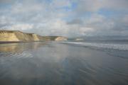
Photo: Point Reyes National Seashore -- Drakes Beach (no camping) Photo: Sky Photo: Wildcat Photo: Glen Photo: Coast Photo: Tomales Bay
Recreation.gov helps you discover and book trips to all of America's public places.
Learn more about us, or about any of our agency partners below:
Bureau of Land Management Federal Highway Administration National Oceanic Atmosphere Administration Smithsonian Institution USDA Forest Service US Army Corps of Engineers US Fish and Wildlife Service National Park Service Bureau of Engraving and Printing Tennessee Valley Authority Bureau of Reclamation National Archives Records Administration