The National Map

|
News you can use about USGS Mapping ProductsOctober 9, 2012 
URISA GIS Hall of Fame: Owing to 50 years of cutting-edge developments and significant contributions in advancing the field of Geographic Information Systems (GIS) and geospatial sciences, the USGS has been selected to enter the Urban and Regional Information System Association GIS Hall of Fame. The USGS was cited as a major contributor and driver to GIS progress across the government and the private sector. The formal nomination statement and other award details are available on the URISA Award website http://www.usgs.gov/ngpo/urisa/
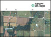
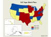
US Topo - Second time around! Production and release of the USGS new series of digital topographic maps, the US Topo , started in October 2009. This week, the project has met its very aggressive long term goal of replacing all quads in the lower 48 states in three years with the new GeoPDF maps. Thus, the second cycle of US Topo map production has started, beginning with Kansas. Also, all previous "Digital Map - Beta" products have been removed from distribution. Hawaii, Alaska, and US territories are presently being worked on.

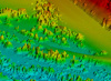
New lidar data: The National Elevation Dataset (NED) has posted the October 2012 Release Notes featuring new light detection and ranging (lidar) data for the epicenter area of the 2011 Virginia earthquake. The USGS has placed a high priority on understanding why earthquakes are occurring in this region and the lidar data will hopefully allow for new understanding of the earthquake hazard there. Also the release contains more than 3800 square miles of the San Luis Valley in Colorado, the largest alpine valley in the world. This area provides the setting for a wide range of scientific applications involving eight other Federal and state agencies. All NED data are available via The National Map Viewer: http://viewer.nationalmap.gov/viewer/
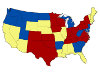
Florida and Illinois Make 48: People who want access to digital topographic maps for any of the lower 48 states can now count on the US Topo. The ongoing map project, as part of the USGS national map series, recently released new maps for Florida and Illinois – with Hawaii to soon follow. Adding more than 2,015 revised digital quadrangles has increased the collection to nearly 54,000 new US Topo maps, with plans for Alaska developing. The maps are available for free download from The National Map and the USGS Map Store website.

On the Radio; "Citizen Cartographer": Kari Craun, the Director of the USGS National Geospatial Technical Operations Center (NGTOC) was recently featured on Federal News Radio "Federal Drive Interview". The interview focused on pilot projects in the Denver area to harness the power of "crowdsourcing" in improving structures data for The National Map and other mapping applications. Volunteers are currently being accepted through The National Map Corps and if successful, the project may go nation-wide.

US Topo Video: US Topo is the next generation of topographic maps from the USGS. To support the ongoing transformation to digital mapping, The National Geospatial Program has released an informative and entertaining video to demonstrate the advantages, capabilities and opportunities provided by US Topo electronic maps. http://gallery.usgs.gov/videos/568 Also available on YouTube.

Uplifting Video: Elevation data has been an important component of USGS topographic maps since the 1880's. A topographic map without elevations in the form of contours is simply not a topographic map. The National Geospatial Program has launched a short video that emphasizes the relevance of elevation data not only to mapping, but to other areas of science and everyday life like flood insurance, climate change and environmental monitoring. http://gallery.usgs.gov/videos/567 . Also available on Youtube.

Passed 1,000! The National Map Twitter site recently surpassed 1,300 followers in just over a year. Let's make it to 2,000 @USGSTNM. Sign up today and join in the conversation!
US Topo Update: Production and release of the USGS's new series of digital topographic maps, the US Topo started in October 2009. In October 2012, the project met its very aggressive long term goal of replacing all quads in the lower 48 states in three years with the new GeoPDF maps. Thus, the second cycle of US Topo map production has started, beginning with Kansas. Also, all previous "Digital Map–Beta" products have been removed from distribution. The National Geospatial Technical Operations Center reports the following US Topo maps are loaded to the Map Locator of the USGS Store (as of 10-09-12):

Feds Embrace "Nerds of the Internet": Federal agencies are turning to the public to fill information gaps and promote their data, crowdsourcing experts said at a panel sponsored by NextGov in Washington DC, Sept 6, 2012. Kari Craun, Director of the USGS National Geospatial Technical Operations Center, provided insights into USGS efforts in engaging citizen volunteers for mapping information and a current crowdsouring pilot program in the Denver area. Short summary: shar.es/umCmT (Video of the presentation pending).

Distinguished Career Award: Dr. E. Lynn Usery, Director of the USGS Center of Excellence for Geospatial Information Science (CEGIS) received the Distinguished Career Award from the Cartographic and Geographic Information Society. The exclusive award was presented at the recent AutoCarto International Symposium. Dr. Usery was recognized for his research accomplishments, vision, and leadership in academia and government, as well as for his outstanding service to the Society and the international geospatial community. Due to the stringent nomination requirements, this is the first time since 2008 that the award has been conferred.

Sunshine state Maps: The full set of US Topo maps for Florida has been released and are available for free download from the USGS Store. The addition of 1,025 revised quadrangles from the land of the ’gaters rises the count of US digital topographic maps to more than 53, 650. http://1.usa.gov/82461k

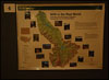
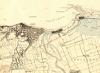
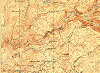
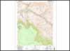
Wyoming Map Featured: The US Topo and Historical Topographic Map Collection websites have added an interactive map application to their home pages. The flash thumbnails of original scanned maps display all available versions of the featured state quadrangles in an animated format. The display allows the user to view the maps in chronological order, access larger versions and the map and go directly to the download services. The new series is six topographic maps of the Lewis Falls maps in Wyoming - ranging from 1886 to the present. http://1.usa.gov/82461k, http://1.usa.gov/oSPTDv

"Crowdsourcing": Looking at New Ways to Map Structures in Colorado In light of technical changes and increasing uses of social networking, the USGS is exploring a new approach to the volunteer program —the National Map Corps - and is launching a project to test options for volunteer participation in providing data to The National Map. The project uses internet mapping applications to add or corrected information to man-made structures and facilities, such as schools and fire stations, in the state of Colorado. News Release. Video Link.
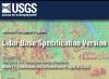
LiDAR Publication Released: A new USGS publication from the National Geospatial Program titled, "LiDAR Base Specification Version 1.0" is now available for free download. This officially replaces what is widely known as "the v13 Spec", a draft LiDAR base specification that has been largely adopted by many US Federal agencies and private industry. That formative document has been completely reformatted and re-edited, and now includes a glossary, a metadata template, and a metadata example file. LiDAR continues to be a rapidly evolving technology, and the NGP anticipates periodic future revisions to this document as changes in the technology, data, applications, and program requirements dictate. Report link.
Northern Plains Data Improved – plus PLSS: New US Topo maps for Wyoming and South Dakota are available (News Release), with more than 3,230 revised digital quadrangles added to the collection. Wyoming is the first state to have Public Land Survey System (PLSS) data added to US Topo maps. The PLSS is a way of subdividing and describing land in the United States. All lands in the public domain are subject to subdivision by this rectangular system of surveys, which is regulated by the U.S. Department of the Interior. The maps are available for free download from the USGS Map Store website.
PR Historical Maps: The complete series of USGS Historical Topographic Maps for Puerto Rico has been loaded for free download from the USGS Store Map Locator. The addition of these 611 quadrangles brings the total number of historical, legacy topographic maps to nearly 164,000, covering the lower 48 states and Hawaii. The historical maps are available in a GeoPDF format and can be searched by state name, scale or map name. The goal of the Historical Topographic Map Collection is to scan all scales and all editions of the more than 200,000 topographic maps published by the USGS since the inception of the topographic mapping program in 1884. http://1.usa.gov/oSPTDv
MI and SD State Maps: The full sets of US Topo maps for Michigan and South Dakota have been released and are available for free download from the USGS Store. The 1,319 revised quadrangles from the Great Lakes State and the1,445 topo maps from the Mount Rushmore have been added to the more than 51,600 US digital topographic maps. 
Find 1, Get 1, Use 1: The National Atlas has released new sets of digital cartographic frameworks at the one million-scale, which is twice the detail of previous versions. Users can now easily find "one" using popular search engines; get it as documented data or Web map services; and use "one" in their geospatial analyses, maps, or map mashups. 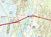
New Maps for New England: Nearly 690 revised digital maps covering Connecticut, Rhode Island, Massachusetts, New Hampshire and Vermont have been added to approximately 51,000 maps currently covering the lower 48 states and are available for free download from the website.

Legacy Maps in the News: The Historical Topographic Map Collection, with more than 167,335 scanned and referenced USGS topo quadrangles available for free download, has recently been featured in several publications, including the Smithsonian "Constant Traveler", PC World, the Verge and the IMTA update. 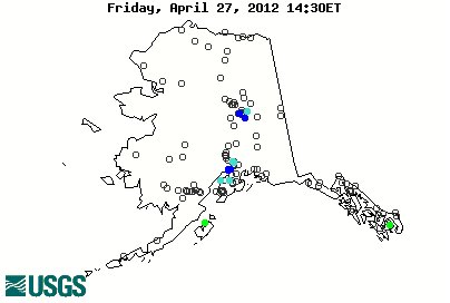
USGS Mapping Alaska: In conjunction with nearly 20 Federal Agencies and representatives from the state of Alaska, the USGS sponsored an Alaska Mapping Roundtable to discuss collaborative funding strategies for Alaska's Statewide Digital Mapping Initiative. The meeting, convened by Lt. Gov Mead Treadwell and DOI Assistant Secretary for Water and Science, Anne Castle, was also featured in the July 5 edition of The Seward Phoenix Log.
New NHD Publication: The analysis of surface-water systems optimized by using the National Hydrography Dataset (NHD) as the common national framework has provided improved data maintenance, better tools and reduced costs. To portray the complex water data, often from many agencies, the NHD has developed and refined a linear referencing system. Fact Sheet: http://pubs.usgs.gov/fs/2012/3068/
Passed 50,000: The US Topo map project has produced more than 50,000 revised digital topographic maps since late-2009, keeping pace with the complete coverage goal of the continental US by the end 2012. Users from almost every state can now access and download new US Topo maps for free from the USGS Store map locator. To see if your desired map is available, go to: http://on.doi.gov/ctQcJG
Connecticut Quads Featured: The US Topo and Historical Topographic Map Collection websites have added an interactive map application to their home pages. The flash thumbnails of original scanned maps display all available versions of the featured state quadrangles in an animated format. The display allows the user to view the maps in chronological order, access larger versions and the map and go directly to the download services. The new series is six topographic maps of the Old Lyme maps in Connecticut - ranging from 1893 to the present. http://1.usa.gov/82461k, http://1.usa.gov/oSPTDv
US Topo Update: New maps for Wyoming and South Dakota are nearly half way complete. More than 36 states containing more than 40,700 quadrangles are now partially or almost totally covered by the new USGS digital electronic topographic map, the US Topo. Free download from the USGS Store. Complete listing. Is your state covered? http://1.usa.gov/82461k

Bay State Maps: The full set of US Topo maps for Massachusetts has been released. The 196 revised quadrangles have been added to the more 49,800 US digital topographic maps available for free download from the USGS Store. http://1.usa.gov/82461k
TopoBathy added to the NED: The first set of topobathymetric data has been added to the National Elevation Dataset (NED). Topobathymetric data are created by merging topography (land elevation) and bathymetry (water depth) into a seamless elevation product useful for applications such as modeling sea level rise and storm surge. The initial dataset is centered over Mobile Bay, Alabama and was constructed using a combination of 71 disparate topographic and bathymetric datasets from the USGS, the National Oceanic and Atmospheric Administration, and the U.S. Army Corps of Engineers; ranging in temporal variation from 1917 to 2011. It was developed in collaboration between the USGS Coastal and Marine Geology Program (CMGP) and the USGS National Geospatial Program. In the next five years, the CMGP has plans to expand its research and modeling along the northern Gulf of Mexico coastline, and San Francisco and Chesapeake Bays. Release notes: http://bit.ly/K5RCEE
Ocean State Maps: The full set of US Topo maps for Rhode Island has been released. The 27 revised quadrangles have been added to the more 48,900 US digital topographic maps available for free download from the USGS Store. http://1.usa.gov/82461k
Hawaii Historical Maps Available: The complete series of USGS Historical Topographic Maps for Hawaii has been loaded for free download from the USGS Store Map Locator. The addition of these quadrangles brings the total number of historical, legacy topographic maps to nearly 167,000, with only one more state left to completing coverage for the entire US and territories. The historical maps are available in a GeoPDF format and can be searched by state name, scale or map name. The goal of the Historical Topographic Map Collection is to scan all scales and all editions of the more than 200,000 topographic maps published by the USGS since the inception of the topographic mapping program in 1884. http://1.usa.gov/oSPTDv
Constitution State Maps: The full set of US Topo maps for Connecticut has been released. The 94 revised quadrangles have been added to the more 48,900 US digital topographic maps available for free download from the USGS Store. http://1.usa.gov/82461k
California Quads Featured: The US Topo and Historical Topographic Map Collection websites have added an interactive map application to their home pages. The flash thumbnails of original scanned maps display all available versions of the featured state quadrangles in an animated format. The display allows the user to view the maps in chronological order, access larger versions and the map and go directly to the download services. The new series is six topographic maps of the Yosemite/Half Dome maps in California - ranging from 1897 to the present. http://1.usa.gov/82461k, http://1.usa.gov/oSPTDv
New Maps for CA, LA and MS Rolled Out: Complete sets of US Topo maps for California, Louisiana and Mississippi have been released. They join the growing list of other states. The 4,300 new maps have been added to the more than 48,580 digital topographic quadrangles now available for free download from the USGS Store. News Release with quotes from the USGS Director: http://on.doi.gov/LmdbjB
Arizona quads complete: After a short delay, the finished set of US Topo maps numbering more than 1,880 updated digital topographic quadrangles for Arizona have been loaded to the USGS Store for free download. http://1.usa.gov/lvbSol
More New England States Started: US Topo maps for the states of Connecticut, Rhode Island, Vermont, Massachusetts and New Hampshire are starting to be posted to the US Topo quadrangle collection. Currently, more than 275 digital topographic maps from those New England states are available for free download from the USGS Store. http://1.usa.gov/lvbSol
Elevation Study Results: The USGS completed a National Enhanced Elevation Assessment (NEEA) in December 2011. The assessment was the most comprehensive investigation of options for improving the availability and quality of national elevation data. Research participants included 34 federal agencies, 50 states, and selected local governments and tribes, as well as private and not-for-profit organizations. The study and other resources will be available through a NEEA website (coming soon!). In the interim, the full report from Dewberry can be found at: http://bit.ly/JNlGcj
Golden State Coverage: The state of California is now completely covered
with new US Topo maps. More than 2,800 California digital topographic
quadrangles are now available for free download from the USGS Store. The
improved maps feature contours, updated hydrography, woodland tint,
additional critical structures, enhanced boundaries, commercial roads and
new Forest Service data. Also, the US Topo allows for the addition of a
high resolution aerial photography map layer, which is not available on
older paper-based topographic maps. Download instructions:
http://nationalmap.gov/ustopo/
Release of CA, LA and MS US Topo’s Soon: The release of US Topo maps for both California and Louisiana is currently at 98% complete, and Mississippi is close behind at 97%. All three should be finished soon! More than 40 states containing more than 47,754 quadrangles are now partially or almost totally covered by the new USGS digital electronic topographic map, the US Topo. The program is now replacing the former "Digital Map-Beta" maps with revised US Topo maps. Free download from the USGS Store. Complete listing. Is your state covered? http://1.usa.gov/lvbSol
Tweet us! The National Map Twitter site has steadily increased to more than 970 followers in just over a year. Let’s make it to 1,000 @USGSTNM. Sign up today and join in the conversation!

Records Set: USGS legacy topographic maps from the Historical Topographic Map Collection have set a record of more than 427,700 downloads during the month of April. This follows the completion of historical map coverage for the lower 48 states in a few weeks ago. The newest USGS topographic map, the US Topo, also set a personal best of nearly 174,000 downloads for the same period. Check out the mapping websites and see why they are becoming so popular. http://1.usa.gov/82461k, http://1.usa.gov/oSPTDv

Geospatial Technology Workshop: The USGS will be offering a workshop titled "Introduction to Geospatial Semantics and Technology" preceding the University Consortium for Geographic Information Science Symposium on May 29, 2012 in Washington D.C. The Workshop is an introductory tutorial on geospatial semantics with hands-on exercises using standard Web browsers. The workshop is divided into two major sections: general semantics on the Web, and specific examples of geospatial semantics using data from The National Map of the USGS. The general section will include information and access to publicly available semantic archives. The specific session will include information on geospatial semantics with access to semantically enhanced data for hydrography, transportation, boundaries, names, and land cover. Details: http://www.ucgis.org/Events/moreinfo.asp?ID=304
Alaska Mapping Interview: Mark DeMulder, Director of the USGS National Geospatial Program (NGP) was interviewed by KNTA Radio out of Talkeetna, Alaska about the new and ambitious USGS initiative to update and upgrade the topographic maps of the Alaskan region. The interactive discussion covers the history of mapping Alaska, the new US Topo digital map project, new cartographic technologies and proposed plans for the Alaskan Mapping Initiative. Interview and sound bites: http://bit.ly/HVcy4R
Border Elevation Improved: Updated elevation data along the U.S. and Canadian border have been added to the National Elevation Dataset (NED) layer as result of collaboration between U.S. Geological Survey (USGS) and Natural Resources Canada (NRCAN). Scientist from NRCAN Centre for Topographic Information and the USGS Earth Resources Observation and Science (EROS) Center improved the topographic information along the international border by making the U.S. and Canada elevation data seamless in the 1-arc-second NED. These data will complete the watersheds originating in the U.S. and fill a small void that existed between the two elevation datasets. The new Canada elevation data, as well as the latest elevation data for the contiguous U.S. added to the NED can be viewed at NED Release Notes for April. The next release of the NED, due in June, 2012, will include Canada elevation along the border of Alaska
CONUS Complete: The USGS Historical Topographic Map Collection is celebrating a major milestone, as the lower 48 states, spanning in excess of 130 years, are now available for free download from the Collection website. This Collection features well over 161,000 USGS legacy topographic maps in a digital format. Since September, more than 1.2 million maps have been downloaded from the Map Locator – an average of more than 5,700 maps per day! News Release

USGS Scientist Receives "High" Water Award: USGS cartographer Jeff Simley, the product lead for the National Hydrography Dataset (NHD) received the Maidment Award at this year’s American Water Resources Association (AWRA) GIS specialty conference for water resources in New Orleans. The prestigious award acknowledges his contributions to the water resources field as a key player in establishing a Stewardship program that partners many federal, state, and local agencies all with a common goal to improve and maintain a hydrography GIS layer for the nation. http://nhd.usgs.gov/
The Last Piece of the Puzzle - USGS Historical Maps: A summary of the USGS Historical Topographic Map Collection, its status and relevance to many diverse audiences has been published as a "Top Story" on the USGS main website. The article outlines the goals of the Historical Collection program and a short history of The National Program for Topographic Mapping, which was established in 1884. Also, it reviews map changes over time, including scales and symbology. Article link.
Florida Historical Maps added, one state left: The complete series of USGS Historical Topographic Maps for Florida has been loaded for free download from the USGS Store Map Locator. The addition of these quadrangles brings the total number of historical, legacy topographic maps to nearly 164,000, with only one more state left to completing coverage for the lower 48 states. The historical maps are available in a GeoPDF format and can be searched by state name, scale or map name. The goal of the Historical Topographic Map Collection is to scan all scales and all editions of the more than 200,000 topographic maps published by the USGS since the inception of the topographic mapping program in 1884. http://1.usa.gov/oSPTDv

NHD/WBD in the Big Easy: The USGS will be hosting the 4th bi-annual National Hydrography Dataset (NHD)/ Watershed Boundary Dataset (WBD) Stewardship Conference in New Orleans, March 29-30, 2012. The conference is in conjunction with the American Water Resources Association's 2012 Spring Specialty Conference on Geographic Information Systems and Water Resources. The NHD is the surface water component of The National Map to be used in general mapping and in the analysis of surface-water systems by geographic information systems (GIS). Conference agenda: http://bit.ly/zNXixX
Wyoming Historical Maps added: The complete series of USGS Historical Topographic Maps for Wyoming has been loaded for free download from the USGS Store Map Locator. The addition of these quadrangles brings the total number of historical, legacy topographic maps to more than 154,000, covering 48 states. The historical maps are available in a GeoPDF format and can be searched by state name, scale or map name. The goal of the Historical Topographic Map Collection is to scan all scales and all editions of the more than 200,000 topographic maps published by the USGS since the inception of the topographic mapping program in 1884. http://1.usa.gov/oSPTDv
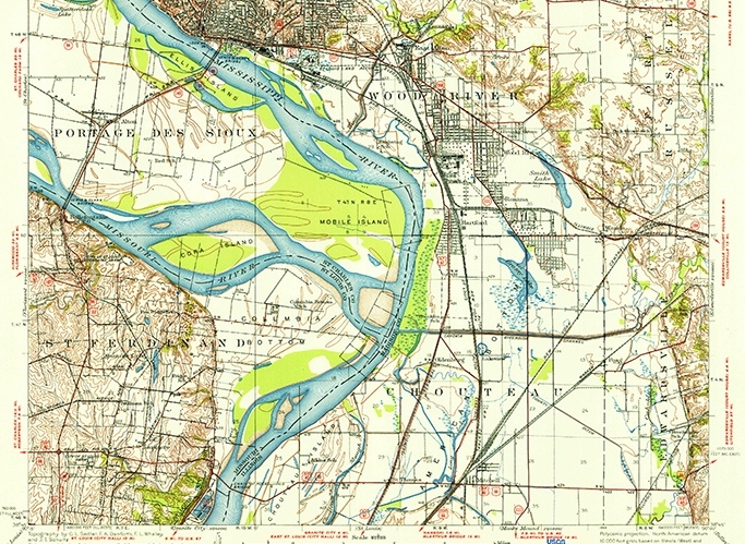
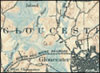
Missouri/Illinois Quads Featured: The US Topo and Historical Topographic Map Collection websites have added an interactive map application to their home pages. The flash thumbnails of original maps display all available versions of the featured state quadrangles in an animated format. The display allows the user to view the maps in chronological order, access larger versions and the map and go directly to the download services. The third showcased series is six topographic maps of the Columbia Bottoms area, straddling Missouri and Illinois - ranging from 1927 to the present. http://1.usa.gov/82461k, http://1.usa.gov/oSPTDv
Rhode Island and South Dakota Historical Maps added: The complete series of USGS Historical Topographic Maps for Rhode Island and South Dakota have been loaded for free download from the USGS Store Map Locator. The addition of these quadrangles brings the total number of historical, legacy topographic maps to more than 149,800, covering 47 states. The historical maps are available in a GeoPDF format and can be searched by state name, scale or map name. The goal of the Historical Topographic Map Collection is to scan all scales and all editions of the more than 200,000 topographic maps published by the USGS since the inception of the topographic mapping program in 1884. http://1.usa.gov/oSPTDv

ASPRS Fellow Award: Kari Craun, Director of the USGS National Geospatial Technical Operations Center (NGTOC) has been named as one of two 2012 American Society for Photogrammetry and Remote Sensing (ASPRS) Fellow Award winners. The ASPRS hilghly selective designation of Fellow is awarded to active Society members who have performed exceptional service in advancing geospatial science and use of the mapping sciences. News release: http://bit.ly/zW7xXg

USGS at Esri FedUC: The USGS played a prominent role at the 2012 Esri Federal Users Conference in Washington, DC this past week. The USGS sponsored two exhibits featuring new and improved geospatial products and services from the National Geospatial Program and the National Atlas ®. Also, the USGS was involved in several presentations and technical sessions throughout the Conference. http://bit.ly/qgNZJs
Arizona Quad Featured: The US Topo and Historical Topographic Map Collection websites are now displaying the Phantom Ranch topographic quadrangle on their flash application. The maps cover the a series to quadrangles from 1967 to the present. ? http://1.usa.gov/lvbSol, http://1.usa.gov/oSPTDv

CEGIS Researcher Honored: Kristina Yamamoto, a student geographer with the USGS Center of Excellence for Geospatial Information Science (CEGIS) is featured this month in the "Students at USGS" on the USGS main website. As part of her experience with the National Geospatial Program (NGP), she is conducting remote sensing research, including soil moisture and LiDAR projects. She is also PhD candidate at the University of Denver in the geography department, with her dissertation topic covering sea turtle nesting beach characteristics in southern Florida.
Vermont Historical Maps added: The complete series of USGS Historical Topographic Maps for Vermont has been loaded for free download from the USGS Store Map Locator. That brings the total number of historical, legacy topographic maps to more than 147,300, covering 45 states. The historical maps are available in a GeoPDF format and can be searched by state name, scale or map name. The goal of the Historical Topographic Map Collection is to scan all scales and all editions of the more than 200,000 topographic maps published by the USGS since the inception of the topographic mapping program in 1884. http://1.usa.gov/oSPTDv
Mississippi Historical Maps added: The complete series of USGS Historical Topographic Maps for Mississippi has been loaded for free download from the USGS Store Map Locator. That brings the total number of historical, legacy topographic maps to more than 147,300, covering 45 states. The historical maps are available in a GeoPDF format and can be searched by state name, scale or map name. The goal of the Historical Topographic Map Collection is to scan all scales and all editions of the more than 200,000 topographic maps published by the USGS since the inception of the topographic mapping program in 1884. http://1.usa.gov/oSPTDv
Louisiana Historical Maps added: The complete series of USGS Historical Topographic Maps for Louisiana has been loaded for free download from the USGS Store Map Locator. That brings the total number of historical, legacy topographic maps to more than 147,300, covering 40 states. The historical maps are available in a GeoPDF format and can be searched by state name, scale or map name. The goal of the Historical Topographic Map Collection is to scan all scales and all editions of the more than 200,000 topographic maps published by the USGS since the inception of the topographic mapping program in 1884. http://1.usa.gov/oSPTDv
Geospatial Websites Upgraded: The US Topo and Historical Topographic Map Collection websites have added an interactive map application to their home pages. The flash thumbnails of original maps display all available versions of the featured series in an animated format. The display allows the user to view the maps in chronological order, access larger versions of the map and go directly to the download services. The second showcased series is six topographic maps of the Phantom Range, Arizona quadrangle (part of the Grand Canyon) - ranging from 1962 to the present. http://1.usa.gov/82461k, http://1.usa.gov/oSPTDv

New NHD Tools: The National Hydrography Dataset (NHD) contains detailed geospatial information about the Nation's surface water. Ensuring the accuracy of these data is an ongoing task as the landscape changes and users demand greater accuracy. To better support and grow the NHD stewardship program, the USGS has reinvented both the process and tools involved in maintaining the NHD. More information: http://bit.ly/dZZZ33
Missouri and New Hampshire Historical Maps added: The complete series of USGS Historical Topographic Maps for Missouri and New Hampshire have been loaded for free download from the USGS Store Map Locator. The addition of these quadrangles brings the total number of historical, legacy topographic maps to more than 141,000 , covering 41 states. The historical maps are available in a GeoPDF format and can be searched by state name, scale or map name. The goal of the Historical Topographic Map Collection is to scan all scales and all editions of the more than 200,000 topographic maps published by the USGS since the inception of the topographic mapping program in 1884. http://1.usa.gov/oSPTDv
Connecticut Historical Maps added: The complete series of USGS Historical Topographic Maps for Connecticut has been loaded for free download from the USGS Store Map Locator. That brings the total number of historical, legacy topographic maps to more than 149,190, covering 39 states. The historical maps are available in a GeoPDF format and can be searched by state name, scale or map name. The goal of the Historical Topographic Map Collection is to scan all scales and all editions of the more than 200,000 topographic maps published by the USGS since the inception of the topographic mapping program in 1884. http://1.usa.gov/oSPTDv

Trail Running, Kiwi-Style: NGTOC employee Paul Jurasin recently celebrated his 50th birthday in a rather unique fashion. His story can be found at: http://www.runningtimes.com/Article.aspx?ArticleID=24699
Nebraska Historical Maps added: The complete series of USGS Historical Topographic Maps for Nebraska has been loaded for free download from the USGS Store Map Locator. That brings the total number of historical, legacy topographic maps to more than 132,200, covering 38 states. The historical maps are available in a GeoPDF format and can be searched by state name, scale or map name. The goal of the Historical Topographic Map Collection is to scan all scales and all editions of the more than 200,000 topographic maps published by the USGS since the inception of the topographic mapping program in 1884. http://1.usa.gov/oSPTDv

Geospatial Websites Upgraded: The US Topo and Historical Topographic Map Collection websites have added an interactive map application to their home pages. Thumbnail images of actual maps display all available versions of the featured series in an animated format. The display allows the user to view the maps in chronological order, view larger versions of each map, and an option to download the full-resolution version directly. This first showcase features six topographic maps from the Boothbay, Maine area - ranging from 1893 to the present.

Historical Map Video: The USGS has released the "Historical Topographic Map Collection-Distribution of USGS Maps- Old and New" video presentation. It features team lead Greg Allord at the recent International Map Trade Association (IMTA) Conference. The video covers the project history, goals, updates and examples.
US Topo Moving Forward: Nevada has started and Missouri is continuing! More than 36 states containing more than 41,000 quadrangles are now partially or almost totally covered by the new USGS digital electronic topographic map, the US Topo. The program is now replacing the former "Digital Map-Beta" maps with US Topo maps. Free download from the USGS Store. Complete listing. Is your state covered? http://1.usa.gov/lvbSol

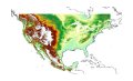
New Heights of Accuracy for World Topography: The U.S. Geological Survey (USGS) and the National Geospatial-Intelligence Agency (NGA) have collaborated in the development of a much improved global elevation model, the Global Multi-resolution Terrain Elevation Data 2010 (GMTED2010). GMTED2010 replaces the widely used, 15-year-old GTOPO30 terrain model as the best available global digital elevation model. All of the GMTED2010 data products are publicly available online with no redistribution restrictions. http://on.doi.gov/v0sreR
Arizona Historical Maps added: The complete series of USGS Historical Topographic Maps for Arizona has been loaded for free download from the USGS Store Map Locator. That brings the total number of historical, legacy topographic maps to nearly 130,000, covering 37 states. The historical maps are available in a GeoPDF format and can be searched by state name, scale or map name. The goal of the Historical Topographic Map Collection is to scan all scales and all editions of the more than 200,000 topographic maps published by the USGS since the inception of the topographic mapping program in 1884. http://1.usa.gov/oSPTDv

USGS Geospatial Data Contract Website: The National Geospatial Technical Operations Center (NGTOC) has linked a new Geospatial Data Contract website to The National Map website. The Geospatial Product and Service Contracts (GPSC) is a suite of contracts, broad in scope, that can accommodate activities related to standard, nonstandard, graphic, and digital cartographic products. Services provided may include: photogrammetric mapping and aerotriangulation; orthophotography; thematic mapping (for example, land characterization); digital imagery applications; IFSAR and LiDAR; geographic information systems development; surveying and control acquisition, including ground-based and airborne GPS; and much more.
Historical Maps Now Covering 36 States: The release of more than 13,688 historical topographic maps covering California highlights the rapid pace of the USGS Historical Topographic Map Collection. Nearly 124,000 high resolution scans of historical USGS maps, some dating as far back as 1884, are now available online for free from the USGS Store. The electronic maps are georeferenced and can be used in conjunction with the new USGS digital topographic map, the US Topo.

FGDC Launches New Geospatial Website: The Federal Geographic Data Committee (FGDC), in conjunction with several geospatial partners has released a prototype Geospatial Platform website providing an initial view of the future of user-friendly, integrated, federal data collections on common geographic maps. Through the website, users can create their own maps by combining their data with public domain data and can collaborate in public and private groups with others who share their interests. Maps assembled through the Geospatial Platform can be shared with others through web browsers and mobile technologies. All of this is possible without requiring users to install software on their own computers. News Release.

Volunteer Geographic Information: Since 1994, citizen volunteers have helped the USGS improve its topographic maps. A new fact sheet has been released to explain the current status of volunteer map data collection, pilot projects and the possible future of The National Map Corps.
Historical Topographic Map Collection Update – over half way: More than 102,300high resolution scans of the more than 200,000 historical USGS topographic maps, some dating as far back as 1884, are now available online. The Historical Topographic Map Collection includes published U.S. maps of all scales and editions, and are offered as a georeferenced digital download or as a scanned print from the USGS Store.

There's A (M)app For That: Topographic maps from the USGS are now available as an app for Apple iOS devices including the iPhone, iPad and iPod Touch. The new app, called PDF Maps, has been released though the iTunes App Store and allows free download of any available US Topo or USGS Historical maps from the USGS Store or Map Locator tool.

US Topo – Exceeding Goals: The US Topo crested an important milestone as the staff exceeded the ambitions goal of producing 18,500 digital quadrangles in one year. This brings the total of US Topos available for no-cost download to more than 36,200 maps covering 33 states. Recently, the program has started to replace the former "Digital Map Beta" prototypes with US Topo maps and have included a land cover layer. Also, the US Topo website has been updated to reflect significant product additions.

Geospatial Summit and Radio Interview: Mark DeMulder, the Director of the National Geospatial Program gave a keynote presentation on "Mapping the Future" at the inaugural Geospatial Summit, September13 in Herndon, VA. Prior to the Summit, he was featured in a radio interview on Federal News Radio. NGP Standards: Standards and specifications are essential to facilitate the development and sharing of geospatial data and products. The USGS standards and specifications that define the requirements to ensure that all products and data prepared by the USGS under the National Geospatial Program are consistent in accuracy, structure, format, style, and content can now be found on The National Map website.

Bridging the Gap – The National Map Now Serving Complete Data for the US-Canadian Border: Since 2007 the USGS has partnered with the International Joint Commission of Canada and the U.S. (IJC) to extend National Hydrography Dataset (NHD) and WBD interpretations into Canada. This effort involves complex negotiations between State, Provincial and Federal agencies, resulting in the ability for users of the National Map to view, download and use Hydrologic Units and Hydrographic layers that were previously limited to the International Boundary. Identical interpretations are currently available on Natural Resources Canada's data portal GeoBase.
The National Map Corps Update: The USGS National Geospatial Program (NGP) sponsored volunteer map data collection projects for 20+ years. Citizen mappers revised many maps, but the program was suspended in 2008 due to funding.
New technologies and social media have made volunteered geographic information (VGI) a possibility.
As a result, the USGS has launched a pilot project to explore the future citizen participation. http://1.usa.gov/pkNgfi

Emergency Response Fact Sheet: The USGS National Geospatial Program (NGP) has released a new fact sheet listing the most popular web based resources for emergency responders and others to get timely and relevant information concerning earthquakes, floods, hurricanes, landslides, tsunamis, volcanoes, wildfires, terrorist attacks and accidental oil spills. http://on.doi.gov/iEmVfo

New Website Face: An updated version of The National Map website (nationalmap.gov) was rolled out in conjunction with The National Map Users Conference. The new home page includes an user-specified map selection menu, easier to read navigation tabs, a search box, refined news section and a real-time Twitter feed. Check it out – comments welcome!
|
|

![]() U.S. Department of the Interior |
U.S. Geological Survey
U.S. Department of the Interior |
U.S. Geological Survey
URL: http://nationalmap.gov/index.html
Page Contact Information: The National Map
Page Last Modified: Wednesday, 10-Oct-2012 09:20:04 EDT