to the National Atlas Home page
About | Fact Sheets | Contact Us | Partners | Products | Site Map | FAQ | Help | Follow us on Twitter 
AgricultureBiologyBoundariesClimateEnvironmentGeologyGovernmentHistoryMappingPeopleTransportationWater
to the Interactive Map MakerMap LayersPrintable MapsWall MapsDynamic MapsArticlesMapping Professionals


Map Layer Info


Cancer Mortality in the United States: 1970-1994

What this map layer shows:

The death rates, number of deaths, confidence levels, and expected number of deaths for white males and white females for 20 types of cancer.
opens the National Cancer Institute home page
Background Information
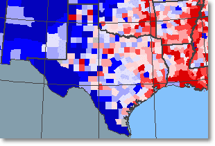
Sample map Sample Map
The National Cancer Institute (NCI), Division of Cancer Epidemiology and Genetics, collects information on geographic patterns of cancer deaths because this information may provide important clues to the causes of cancer. The Atlas of Cancer Mortality in the U.S., 1950-94, prepared and published by the NCI, is a book of maps, text, tables, and figures showing the geographic patterns of cancer deaths throughout the United States. The atlas presents statistics for more than 40 cancers and includes data for two time periods: 1950-69 and 1970-94. The U.S. Geological Survey prepared this map layer from the 1970-94 data, with the assistance of the NCI.

The Cancer Mortality in the United States: 1970-1994 map layer shows the death rates, number of deaths, confidence levels, and expected number of deaths for white males and white females for 20 cancers. For most of the country information is presented by county; in a few States, the information is presented by reporting unit. Alaska and Hawaii are each a single reporting unit; in Montana, New York, and Wisconsin some counties have been combined into larger units; and in Virginia independent cities have been included with the surrounding counties.