Map Layer Info
| 2004 Presidential General Election, County Results | |
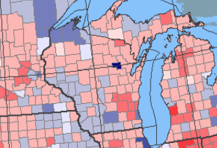
What this map layer shows: The popular vote of the 2004 Presidential election, by county. |
|
| Background Information | |
 Sample Map
The 2004 Presidential General Election, County Results map layer portrays the popular vote by county for the 2004 Presidential general election. Included are the number of popular votes for the Democratic, Republican, and independent candidates; the total votes received by other political parties; and the percentage of votes cast for each party. |
|
| History |
| Map Maker Sample |
| Popular Vote - 2004 Presidential Election Results |
| Printable Maps |
| Presidential Elections 1789-2008 |
| Wall Maps |
| Presidential Elections 1789-2008 |
| Articles |
| How the Electoral College Works |
