USGS - science for a changing world
Logo and link to The National Map

The National Map: Historical Topographic Map Collection


Skip Links


This is a formatting graphic.
Lewis Falls, Wyoming Powerslider for Historical Topographic Map Collection home page
  • 2012 LEWIS FALLS, WYOMING
    7.5 MINUTE SERIES QUADRANGLE (1:24,000–SCALE)
    US TOPO (ORTHOIMAGE OFF)
    click on map to view larger image
    download map (GeoPDF 23.3 MB)
    Thumbnail image of the 2012 Lewis Falls, Wyoming 7.5 minute series quadrangle (1:24,000-scale), US Topo (orthoimage and public land survey system layers off)
  • 2012 LEWIS FALLS, WYOMING
    7.5 MINUTE SERIES QUADRANGLE (1:24,000–SCALE)
    US TOPO (ORTHOIMAGE ON)
    click on map to view larger image
    download map (GeoPDF 23.3 MB)
    Thumbnail image of the 2012 Lewis Falls, Wyoming 7.5 minute series quadrangle (1:24,000-scale), US Topo (orthoimage layer on; contour, hydrography features, woodland, and public land survey system layers off)
  • 1986 LEWIS FALLS, WYOMING
    7.5 MINUTE SERIES QUADRANGLE (1:24,000–SCALE)
    HISTORICAL TOPOGRAPHIC MAP COLLECTION
    click on map to view larger image
    download map (GeoPDF 11.3 MB)
    Thumbnail image of the 1986 Lewis Falls, Wyoming  7.5 minute series quadrangle (1:24,000-scale), Historical Topographic Map Collection.
  • 1956 WEST THUMB, WYOMING
    15 MINUTE SERIES QUADRANGLE (1:62,500–SCALE)
    HISTORICAL TOPOGRAPHIC MAP COLLECTION
    click on map to view larger image
    download map (GeoPDF 7.89 MB)
    Thumbnail image of the 1956 West Thumb, Wyoming 15 minute series quadrangle (1:62,500-scale), Historical Topographic Map Collection.
  • click on map to view larger image
    download map (GeoPDF 7.51 MB)
    Thumbnail image of the 1911 Shoshone, Wyoming (1951 reprint) 30 minute series quadrangle (1:125,000-scale), Historical Topographic Map Collection.
    1911 SHOSHONE, WYOMING (1951 REPRINT)
    30 MINUTE SERIES QUADRANGLE (1:125,000–SCALE)
    HISTORICAL TOPOGRAPHIC MAP COLLECTION
  • 1886 SHOSHONE, WYOMING
    30 MINUTE SERIES QUADRANGLE (1:125,000–SCALE)
    HISTORICAL TOPOGRAPHIC MAP COLLECTION
    click on map to view larger image
    download map (GeoPDF 7.07 MB)
    Thumbnail image of the 1886 Shoshone, Wyoming 30 minute series quadrangle (1:125,000-scale), Historical Topographic Map Collection.

Historical Topographic Maps - Preserving the Past

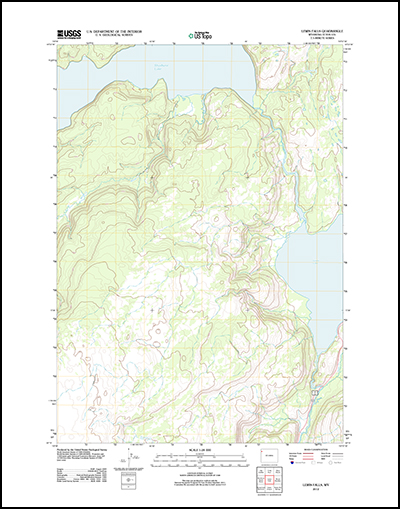
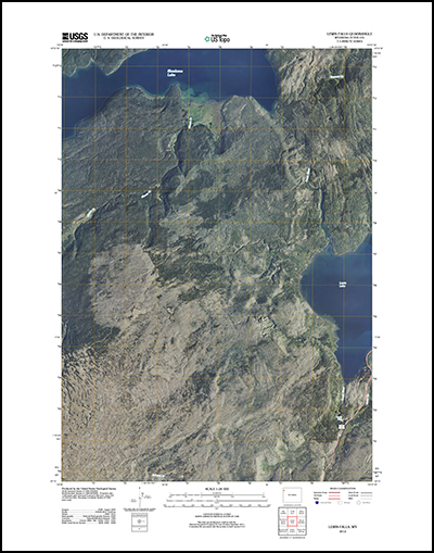
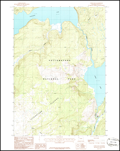
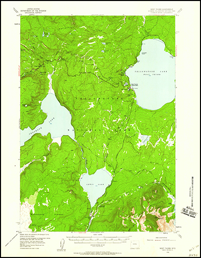
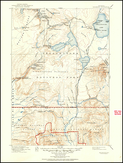
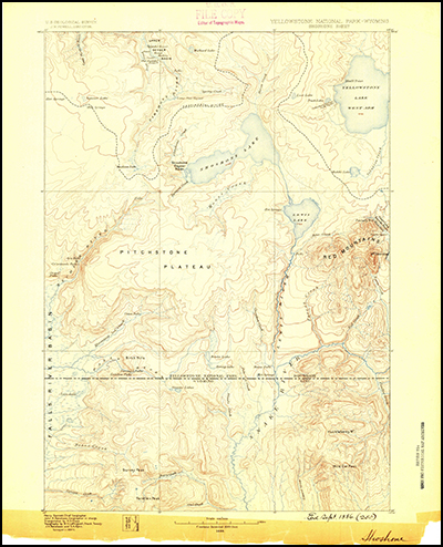
For more than 125 years, the U.S. Geological Survey (USGS) topographic maps have accurately portrayed the complex geography of the Nation. The USGS is the largest producer of printed topographic maps, and, prior to 2009, USGS topographic maps were created using traditional cartographic methods and printed using the lithographic printing process.

Because historical maps are stored in a limited number of collections and are not readily available, the USGS National Geospatial Program (NGP) is converting these historical printed topographic quadrangles to an electronic format (GeoPDF). This scanning and processing effort serves the dual purpose of creating a master catalog and digital archive copies of the irreplaceable collection of topographic maps in the USGS Reston Map Library, as well as making the maps available for viewing and download from the USGS Store.

The processing of this invaluable collection is well underway, with more than 141,000 GeoPDF maps of the approximate total 180,000 currently available for download. Over the next months the number of files available, in a variety of published scales, will continue to expand until all of the topographic maps created throughout the Survey's history are once again available to the public.

*     Find My Map !!

*     Availability:

  Completed

(Click graphic for larger version)

  Scheduled

*     Download Instructions

*     Historical Maps Users Guide

*     Frequently Asked Questions
     Link to HTMC status graphic


For more information contact us.


 Free document viewers: Adobe Reader | Microsoft Word | Microsoft Excel | Microsoft Powerpoint
 

Accessibility FOIA Privacy Policies and Notices

Take Pride in America logo USA.gov logo U.S. Department of the Interior | U.S. Geological Survey
URL: http://nationalmap.gov/historical/index.html
Page Contact Information: Historical Topographic Map Collection
Page Last Modified: Friday, 24-Aug-2012 09:05:36 EDT