USGS - science for a changing world
Logo and link to The National Map

The National Map

Skip Links

The National Map Home >> US Topo


This is a formatting graphic.

US Topo Quadrangles — Maps for America


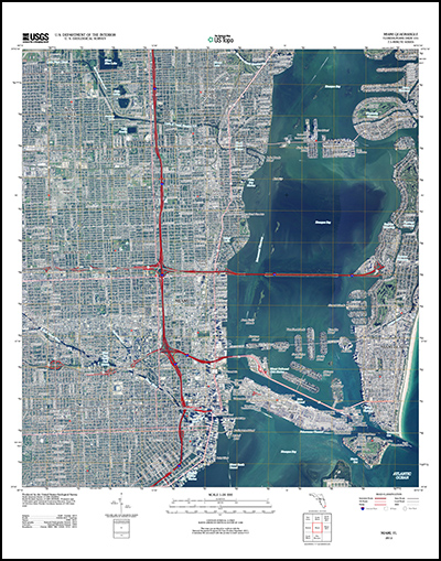
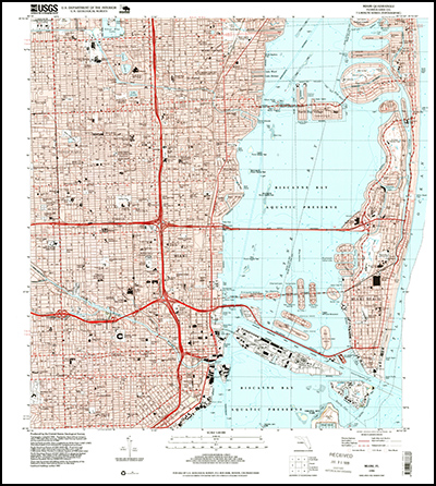
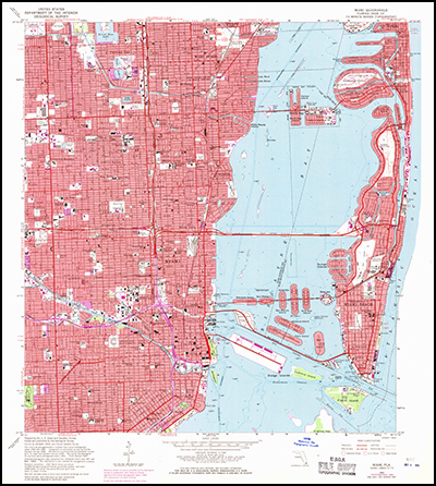
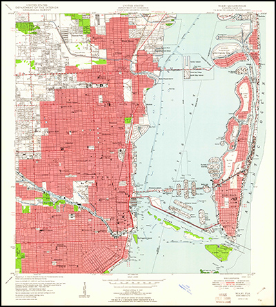
US Topo quadrangles are digital topographic maps produced by the National Geospatial Program of the U.S. Geological Survey (USGS). Created in the familiar 7.5-minute quadrangle format like the legacy paper maps, US Topo maps support frequent updating, wide and fast public distribution, and basic, on-screen geographic analysis.

US Topo maps are available for free Web download from the USGS Store. Each map is delivered in PDF format with geospatial extensions (GeoPDF®) and is made from key layers of geographic data - orthoimagery, transportation, geographic names, topographic contours, boundaries, hydrography, structures, and woodlands - found in The National Map. The National Map is a nationwide repository of integrated data from local, State, Federal, and other sources. Recent US Topo maps also include the Public Land Survey System (PLSS) and the United States National Grid (USNG).

Users can turn US Topo data layers on and off as needed, zoom in and out to examine specific features or see a broader area, and print the maps in their entirety or in customized sections on a broad array of printing devices. Viewing and analytical tools are available for free download from Adobe and TerraGo Technologies. File size for each US Topo is about 15-20 megabytes.

US Topo maps are produced by the USGS National Geospatial Technical Operations Center. The first US Topo prototypes, "Digital Maps - Beta," were made in June 2009. A limited number of these maps were made spanning 18 states. As of October 2012, the prototype maps were replaced by US Topo maps and the "Digital Maps - Beta" prototype maps are no longer available. More information about US Topo maps can be found here.

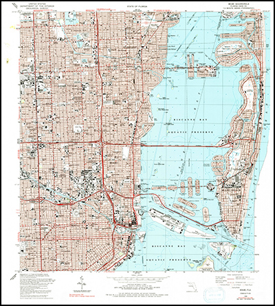
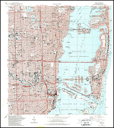
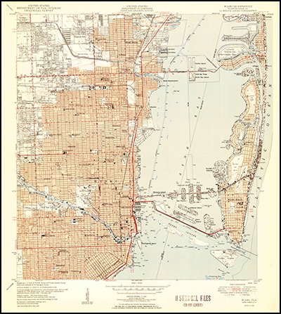
The USGS also distributes digital versions of earlier US Topo and paper topographic quadrangle maps through the Historical Topographic Map Collection. These maps also are available for download through the USGS Store.

US Topo Video Introduction to US Topo -- a video The National Geospatial Program has released an informative and entertaining video to demonstrate the advantages, capabilities and opportunities provided by US Topo electronic maps. http://gallery.usgs.gov/videos/568


Coverage

Thumbnail of and link to USTopo coverage from the USGS Store   
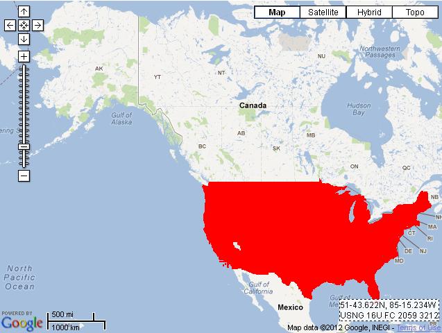
Current US Topo map coverage (click image for status)

Thumbnail and link to USTopo three-year plan status graphic   
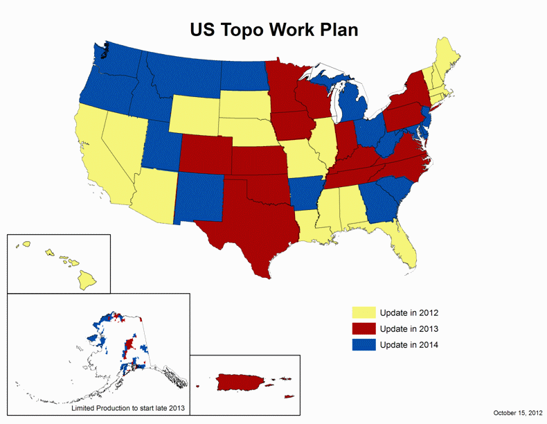
US Topo three-year Work Plan (click image for larger version)


How US Topos Differ from Traditional USGS Topographic Maps

  • Made from nationally consistent data that are quality assured to high standards
  • Downloadable free from the USGS Store
  • Free downloadable user tools
  • Selectable reference systems:
    • Latitude-Longitude
    • UTM (Universal Transverse Mercator)
    • MGRS (Military Grid Reference System)
  • Interactive capabilities with Google Maps®
  • A planned 3-year revision cycle, facilitating incorporation of additional data layers

User Feedback

The USGS values your comments and suggestions about US Topo Maps.


  Miami, Florida Powerslider for US Topo home page
  • MIAMI, FLORIDA 2012 (ORTHOIMAGE OFF)(ORTHOIMAGE OFF)
    7.5 MINUTE SERIES QUADRANGLE (1:24,000–SCALE)
    US TOPO
    click on map to view larger image
    download map (GeoPDF 26.2 MB)
    Thumbnail image of the 2012 Miami, Florida 7.5 minute series quadrangle (1:24,000-scale), US Topo (orthoimage layer off)
  • MIAMI, FLORIDA 2012 (ORTHOIMAGE ON)
    7.5 MINUTE SERIES QUADRANGLE (1:24,000–SCALE)
    US TOPO
    click on map to view larger image
    download map (GeoPDF 26.2 MB)
    Thumbnail image of the 2012 Miami, Florida 7.5 minute series quadrangle (1:24,000-scale), US Topo (orthoimage layer on; contour, hydrography features, and woodland layers off)
  • MIAMI, FLORIDA 1994
    7.5 MINUTE SERIES QUADRANGLE (1:24,000–SCALE)
    HISTORICAL TOPOGRAPHIC MAP COLLECTION
    click on map to view larger image
    download map (GeoPDF 13.2 MB)
    Thumbnail image of the 1994 Miami, Florida 7.5 minute series quadrangle (1:24,000-scale), Historical Topographic Map Collection.
  • MIAMI, FLORIDA 1988 (PHOTOINSPECTED 1990)
    7.5 MINUTE SERIES QUADRANGLE (1:24,000–SCALE)
    HISTORICAL TOPOGRAPHIC MAP COLLECTION
    click on map to view larger image
    download map (GeoPDF 20.2 MB)
    Thumbnail image of the 1988 (Photoinspected 1990) Miami, Florida 7.5 minute series quadrangle (1:24,000-scale), Historical Topographic Map Collection.
  • click on map to view larger image
    download map (GeoPDF 19.6 MB)
    Thumbnail image of the 1988 Miami, Florida 7.5 minute series quadrangle (1:24,000-scale), Historical Topographic Map Collection.
    MIAMI, FLORIDA 1988
    7.5 MINUTE SERIES QUADRANGLE (1:24,000–SCALE)
    HISTORICAL TOPOGRAPHIC MAP COLLECTION
  • MIAMI, FLORIDA 1962 (PHOTOREVISED 1969)
    7.5 MINUTE SERIES QUADRANGLE (1:24,000–SCALE)
    HISTORICAL TOPOGRAPHIC MAP COLLECTION
    click on map to view larger image
    download map (GeoPDF 20.7 MB)
    Thumbnail image of the 1962 (Photorevised 1969) Miami, Florida 7.5 minute series quadrangle (1:24,000-scale), Historical Topographic Map Collection.
  • MIAMI, FLORIDA 1962
    7.5 MINUTE SERIES QUADRANGLE (1:24,000–SCALE)
    HISTORICAL TOPOGRAPHIC MAP COLLECTION
    click on map to view larger image
    download map (GeoPDF 11.4 MB)
    Thumbnail image of the 1962 Miami, Florida 7.5 minute series quadrangle (1:24,000-scale), Historical Topographic Map Collection.
  • MIAMI, FLORIDA 1950 (WITH WOODLAND)
    7.5 MINUTE SERIES QUADRANGLE (1:24,000–SCALE)
    HISTORICAL TOPOGRAPHIC MAP COLLECTION
    click on map to view larger image
    download map (GeoPDF 12.0 MB)
    Thumbnail image of the 1950 Miami, Florida (with woodland) 7.5 minute series quadrangle (1:24,000-scale), Historical Topographic Map Collection.
  • MIAMI, FLORIDA 1950 (WITHOUT WOODLAND)
    7.5 MINUTE SERIES QUADRANGLE (1:24,000–SCALE)
    HISTORICAL TOPOGRAPHIC MAP COLLECTION
    click on map to view larger image
    download map (GeoPDF 11.5 MB)
    Thumbnail image of the 1950 Miami, Florida (without woodland) 7.5 minute series quadrangle (1:24,000-scale), Historical Topographic Map Collection.
 Free document viewers: Adobe Reader | Microsoft Word | Microsoft Excel | Microsoft Powerpoint
 

Accessibility FOIA Privacy Policies and Notices

Take Pride in America logo USA.gov logo U.S. Department of the Interior | U.S. Geological Survey
URL: http://nationalmap.gov/ustopo/index.html
Page Contact Information: US Topo
Page Last Modified: Monday, 14-Jan-2013 17:53:43 EST