 | | |
National Scenic and Historic Trails
The Bureau of Land Management is one of several agencies responsible for management of National Historic or Scenic Trails. In 1968, Congress established the National Trails System and designated the first national trails. National Historic Trails are extended trails that closely follow a historic trail or route of travel of national significance. Designation identifies and protects historic routes, historic remnants, and artifacts for public use and enjoyment. The Bureau of Land Management is responsible for over 5,343 miles of 11 National Historic Trails. National Scenic Trails are extended trails that provide maximum outdoor recreation potential and for the conservation and enjoyment of the various qualities – scenic, historical, natural, and cultural – of the areas they pass through. The Bureau of Land Management is responsible for over 668 miles of the Continental Divide, Pacific Crest, Potomac Heritage, Arizona, and Pacific Northwest National Scenic Trails. On March 30, 2009, the Omnibus Public Lands Management Act of March 30, 2009 (P.L.111-11) added three new trails and 40 miles to the NLCS. The new trails include the Arizona National Scenic Trail, Pacific Northwest National Scenic Trail, and the Washington Rochambeau Revolutionary Route National Historic Trail. The BLM administers three trails and supports five national trail-related visitor centers to foster visitor enjoyment, appreciation, and learning, including California Trail Historic Interpretive Center; National Historic Oregon Trail Interpretive Center; National Historic Trails Interpretive Center; Pompeys Pillar National Monument Visitor Contact Station; and Upper Missouri River Breaks National Monument Interpretive Center. Additonal details about the national trails managed by the BLM are listed below, and see our Frequently Asked Questions page for more information on our National Scenic and Historic Trails.
|
| |
|
Arizona NST | Continental Divide NST | Pacific Crest NST |
Pacific Northwest NST | Potomac Heritage NST | California NHT | El Camino Real NHT | Iditarod NHT | Juan Batista NHT | Lewis and Clark NHT|
Mormon Pioneer NHT | Nez Perce NHT |
Old Spanish NHT | Oregon NHT | Pony Express NHT
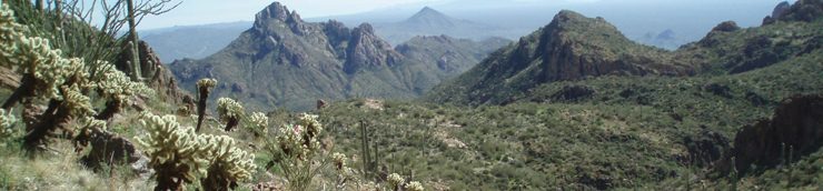
National Scenic Trails | | 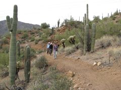 | Arizona National Scenic Trail Arizona The Arizona Trail is a 820 mile non-motorized trail that traverses the State from Mexico to Utah. The Arizona Trail is intended to be a primitive, long distance trail that highlights the state's topographic, biologic, historic and cultural diversity. The trail's primary users are hikers, equestrians and mountain bicyclists (outside of wilderness or other specially managed areas). Opportunities will also exist for cross-country skiers, snowshoers, joggers and pack stock users. More than 780 miles of Arizona National Scenic Trail have been "officially" designated and signed. BLM manages 31 miles: Buckskin Mountain, White Canyon and Tortilla Mountain passages. | | | | 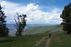 | Continental Divide National Scenic Trail Colorado Idaho Montana New Mexico Wyoming The Continental Divide National Scenic Trail was designated for its scenic significance. It is also considered the ‘King of Trails’, more difficult than its sister long distance trails, the Appalachian and Pacific Crest. It navigates dramatically diverse ecosystems through mountain meadows, granite peaks, and high-desert surroundings. Upon designation in 1978, Congress identified a corridor for this trail, straddling along the backbone of the North American continent --the Divide-- for the future placement of the trail. When complete, the trail will climb and descend the peaks and cross the high-deserts of the Rocky Mountains from Canada to Mexico for 3,100 miles. | | | | 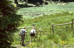 | Pacific Crest National Scenic Trail California Oregon Washington Designated for its scenic significance, Pacific Crest National Scenic Trail spans California desert valleys to Northwestern rain forests, offering hikers and equestrians a wide variety of climate and terrain. It crosses California, Oregon, and Washington, with starting points in Canada and Mexico. The Pacific Crest has the greatest elevation change of any of the National Scenic Trails, from near sea level to the crest of the Sierra and Cascade mountain ranges. | | | |  | Pacific Northwest National Scenic Trail Idaho Montana Washington From the Rocky Mountains to the Pacific Ocean, the Pacific Northwest Trail (PNT) is a unique hiking experience, offering a variety of back-country scenery and outdoor adventure. The 1200-mile Pacific Northwest Trail, running from the Continental Divide to the Pacific Ocean, ranks among the most scenic trails in the world. The PNT crosses 3 National Parks and 7 National Forests, and ends at the Pacific Ocean, on Washington's Olympic Peninsula. On Bureau of Land Management (BLM) lands, this trail meanders through areas rich in Native American and Pioneer history, along a historic railroad grade deep in the canyon of the Similkameen River, and high above the shores of Lake Chopaka, in the heart of the Okanogan highlands of northern Washington. | | | |  | Potomac Heritage National Scenic Trail Maryland The Potomac Heritage National Scenic Trail is a network of locally-managed trails in a corridor between the mouth of the Potomac River and the Allegheny Highlands. As of mid-2009, 830 miles of existing and planned trails have been recognized as segments of the National Scenic Trail. BLM manages two miles of the trail at Douglas Point (Chile Site) in St. Charles, Maryland. The area hosts diverse plant and animal populations as well as a historic homesite occupied as early as the 18th century and throughout the 19th century. | | | | National Historic Trails | | 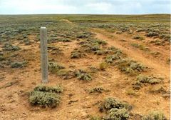 | California National Historic TrailThe California National Historic Trail was a mid-19th century highway for human movement to lures of gold and farmland in California. Numerous routes emerged in attempts to create the best available course. These fostered commerce and encouraged the development of transportation and communication networks. There were many changes in cultures of Native Americans along the way as hundreds of thousands of people and animals used the trail. Designated in 1992, this trail commemorates that which brought the country closer together and today offers auto touring, educational programs and visitor centers to present-day gold seekers and explorers. | 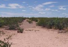 | El Camino Real de Tierra Adentro National Historic TrailDesignated in October 2000, El Camino Real de Tierra Adentro National Historic Trail recognizes the primary route between the colonial Spanish capital of Mexico City and the Spanish provincial capitals in what are now Mexico and New Mexico between the 16th and 19th centuries. The “Royal Road of the Interior” introduced Europeans, their institutions, and their goods, into the heart of the indigenous world of long-lived Pueblo communities and their nomadic neighbors. Today, the cultural corridor created along the Camino Real reflects the heritage and riches of Native America, the Old World, and the modern societies of the United States and Mexico. BLM jointly administers the trail with the National Park Service. |  | Iditarod National Historic TrailAlaska Designated in 1978, this 2,200 mile winter trail system first connected prehistoric Native Alaskan villages, became a major settlement route for Gold Rush-era Alaska, and continues to play a vital role in modern-day Alaska. The main trail from Seward to Nome was first mapped and marked by the U.S. Army in 1908. Alaskan freight and mail haulers relied primarily on dogsleds, while travelers also used snowshoes, skis, and the occasional bicycle. Today, BLM administers this trail, used by thousands of winter recreation enthusiasts, subsistence hunters, inter-village travelers, and three internationally recognized long-distance winter races. | | 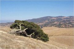
| Juan Bautista de Anza National Historic Trail Arizona California Juan Bautista de Anza National Historic Trail commemorates Spanish Commander Anza’s route taken on the expedition to bring colonists to the San Francisco bay area in 1775-1776. In exploring the trail today, one can experience diverse deserts, mountains, and coastal areas, and learn the historical roles of American Indian and Spanish cultures in the settlement of Arizona and California. | | | | 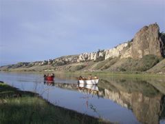 | Lewis and Clark National Historic TrailIdaho Montana North Dakota Oregon South Dakota Washington In 1804, Meriwether Lewis and William Clark began their journey along what is now the Lewis and Clark National Historic Trail. With significant assistance from American Indian tribes along the route, the expedition was able to map and explore extensive western lands acquired only one year earlier from France by the United States in the Louisiana Purchase. Today, BLM manages stretches of the trail which look essentially the same as when Lewis and Clark first saw them. The only remnant of the expedition is Captain Clark's signature at Pompey’s Pillar National Monument in Montana. The trail was designated in to recognize the route’s role in shaping the Nation’s identity. Today, thousands of visitors follow this 3,700-mile, 11-State route that extends from Camp Wood, Illinois, to the Oregon coast. | 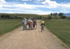 | Mormon Pioneer National Historic Trail Utah Wyoming The Mormon Pioneer National Historic Trail once carried tens of thousands of Mormon emigrants to the Great Basin. In 1847, Mormon Church leader Brigham Young led pioneers west toward the Great Salt Lake Valley, across about 1,200 miles of extreme climate and terrain. Today, the historic route and sites along the way offer a glimpse into the Mormon settlement history. | | | | 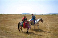 | Nez Perce (Nee Me Poo) National Historic Trail Idaho Montana Oregon Wyoming Added to the National Trails System in 1986, the Nez Perce National Historic Trail commemorates the flight of the Nez Perce Indians from their homeland in the Pacific Northwest to Canada to escape capture by the U.S. military. Using an indirect escape route as dictated by terrain and strategy, the Nez Perce passed through four states and traveled over 1,170 miles, from Wallowa Lake, Oregon, to the Bear Paw Battlefield near Chinook, Montana. | | | | 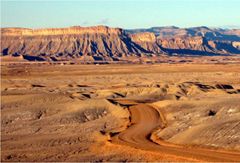 | The Old Spanish National Historic Trail Arizona California Colorado Nevada New Mexico Utah The Old Spanish National Historic Trail opened a land route across 19th century Mexico between the Tierra Adentro, the fabled, yet isolated place that would become New Mexico, and California’s missions and burgeoning settlements. When he left Abiquiu, New Mexico for California in 1829 with 40 men and 200 pack mules, Antonio Armijo blazed a trail between the two colonies that had frustrated explorers for over a century. The Abiquiu party’s woolen blankets and tanned hides were welcomed in textile-starved California. In return, the horses and mules Armijo and his followers on the trail brought east would become the working stock for miners, American and Mexican military, and farmers from northern Mexico to the east coast of the United States. | | | |  | Oregon National Historic Trail Idaho Oregon Wyoming For over 80 years in the nineteenth century, an estimated 300,000 emigrants used the Oregon National Historic Trail as a pathway to the Pacific. Fur traders, gold seekers, missionaries and others traveled west on the approximately 2,000 miles of trail, from Missouri towards the Rocky Mountains to Oregon’s Willamette Valley. The once 5-month journey can now be traveled via auto touring, and portions can be travel via foot, mountain bike, and horseback. | | | | 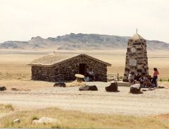 | Pony Express National Historic Trail California Colorado Nevada Utah Wyoming The Pony Express National Historic Trail is the route where young men on horseback once carried the nation’s mail across the country between 1860 and 1861. The horse-and-rider system became the United States’ most direct and practical means of east-west communications before the telegraph, delivering mail in the unprecedented time of ten days. Today, one can auto-tour the route visiting interpretive sites and museums, or hike, bike, or horseback ride various trail segments. The History Mystery! Mystery of the Pony Express is now available online! |
|
 |
|
|


