USGS - science for a changing world

New England Water Science Center, Maine Office

Home iconHome Info iconInformation/Data Publications iconPublications Drought iconDrought Flood iconFlood Education iconEducation Contact iconContact us
Latest Kennebec River web camera image.

DATA CENTER

INFORMATION CENTER

ABOUT THE MAINE WSC

USGS IN YOUR STATE

USGS Water Science Centers are located in each state.

There is a USGS Water Science Center office in each State. Washington Oregon California Idaho Nevada Montana Wyoming Utah Colorado Arizona New Mexico North Dakota South Dakota Nebraska Kansas Oklahoma Texas Minnesota Iowa Missouri Arkansas Louisiana Wisconsin Illinois Mississippi Michigan Indiana Ohio Kentucky Tennessee Alabama Pennsylvania West Virginia Georgia Florida Caribbean Alaska Hawaii New York Vermont New Hampshire Maine Massachusetts South Carolina North Carolina Rhode Island Virginia Connecticut New Jersey Maryland-Delaware-D.C.

Water Resources of Maine

Real-Time Streamflow Sites

Current streamflow conditions in Maine; click to go to a live map.
Map legend showing percentile class groups.

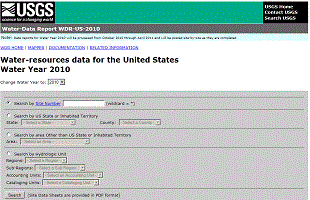
Welcome to the U.S. Geological Survey (USGS) Web page for the water resources of Maine; this is your direct link to all kinds of water-resource information. Here you'll find information on Maine's rivers and streams. You'll also find information about groundwater, water quality, and many other topics. The USGS operates the most extensive satellite network of stream-gaging stations in the state, many of which form the backbone of flood-warning systems.

The USGS provides current ("real-time") stream stage and streamflow, water-quality, and groundwater levels for over 130 sites in Maine.


Quick Link to Real-Time Data


View site list: SW | GW | WQ

Monthly Hydrologic Conditions Report

Maine Data Highlights

2010 Water Data Report Now Available

Annual Water Data for Maine home page.The 2010 USGS Water Data Report is now available to provide a snapshot of water conditions for a given year. The report includes text and map interfaces that can be used to identify and access an area of interest, locate sites where water data were collected for various Water Years

Instantaneous Data Archive (IDA)

Instantaneous Data Archive for Maine.The Instantaneous Data Archive makes available as much intra-day streamflow data and historical instantaneous data continuous (measurements from every 5 to every 60 minutes), as possible, often several years' worth of data.


Featured Project

Flood innundation map interface.

Flood inundation map interface.

Ft. Kent, Maine Flood Inundation Mapping - This Google Map interface to flood inundation maps developed for Fort Kent, Maine depicts estimates of the areal extent and depth of flooding corresponding to selected water levels (gage heights) at the USGS streamgage, St. John River below Fish River at Fort Kent, Maine (station 01014000) and the USGS streamgage, Fish River near Fort Kent, Maine (station 01013500). Current gage heights at these USGS streamgages may be obtained on the Internet at http://waterdata.usgs.gov/me/nwis/current/?type=flow. Forecasted peak-gage-height information, available from the National Weather Service, may be used in conjunction with these maps to show predicted areas of flood inundation.
(References to non-U.S. Department of the Interior (DOI) products do not constitute an endorsement by the DOI. By viewing the Google Maps API on this web site the user agrees to these TERMS of Service set forth by Google.)

Recent Publications

The New England Water Science Center, Maine Office produces publications about water resources.

OF2011-1252 Open-File Report 2011-1252
Huntington, T.G., Culbertson, C.W., and Duff, J.H., 2011, Denitrification rates in marsh soils and hydrologic and water quality data for Northeast Creek and Bass Harbor Marsh watersheds, Mount Desert Island, Maine: U.S. Geological Survey Open-File Report 2011-1252, 30 p.


SIM3157 Scientific Investigations Map 2011-3157
Lombard, P.J., 2011, Flood-inundation maps for the St. John and Fish Rivers in Fort Kent, Maine: U.S. Geological Survey Scientific Investigations Map 2011-3157, 8 p. pamphlet, 29 sheets, scale 1:17,500.


SIR2010-5221 Scientific Investigations Report 2010-5221
Dudley, R.W., and Nielsen, M.G., 2011, Simulation of streamflow in the Pleasant, Narraguagus, Sheepscot, and Royal Rivers, Maine, using watershed models: U.S. Geological Survey Scientific Investigations Report 2010-5221, 31 p.


SIR2010-5255 Scientific Investigations Report 2010-5255
Dudley, R.W., Schalk, C.W., Stasulis, N.W., and Trial, J.G., 2011, A digital terrain model of bathymetry and shallow-zone bottom-substrate classification for Spednic Lake and estimates of lake-level-dependent habitat to support smallmouth bass persistence modeling: U.S. Geological Survey Scientific Investigations Report 2010-5255, 18 p.


FS2011-3015 Fact Sheet 2011-3015
Dudley, R.W., and Nielsen, M.G., 2011, Inventory and protection of salt marshes from risks of sea-level rise at Acadia National Park, Maine: U.S. Geological Survey Fact Sheet 2011-3015, 4 p.

Search our publications

Real-Time Air Temperatures via Google Maps

New Maps Deliver Current Air Temperatures

Example of Google Map showing temperaturesWe recently added a Google-Map based Web page to deliver map-based current surface-water-resources conditions in Maine.
(References to non-U.S. Department of the Interior (DOI) products do not constitute an endorsement by the DOI. By viewing the Google Maps API on this web site the user agrees to these TERMS of Service set forth by Google.)

The maps utilize zoom and pan to allow you to focus in on the sites that interest you. The maps show current air temperatures. By hovering your mouse over a site, a popup box shows the most recent stage and streamflow.

USGS Home Water Climate Change Core Science Ecosystems Energy&Env. Health Hazards

Accessibility FOIA Privacy Policies and Notices

Take Pride in America logo USA.gov logo U.S. Department of the Interior | U.S. Geological Survey
URL: http://me.water.usgs.gov/index.html
Page Contact Information: webmaster@me.water.usgs.gov
Page Last Modified: Thursday, 25-Oct-2012 13:24:39 EDT

01069500: Flow=235cfs,Stage=1.53ft,2012-10-28 15:45,>90,Mousam River near West Kennebunk, Maine 01066000: Flow=3000cfs,Stage=4.69ft,2012-10-28 15:45,76-90,Saco River at Cornish, Maine 01049000: Flow=1140cfs,Stage=3.86ft,Floodstage=9ft,2012-10-28 15:45,76-90,Sebasticook River near Pittsfield, Maine 01034500: Flow=13700cfs,Stage=5.53ft,Floodstage=18ft,2012-10-28 15:30,76-90,Penobscot River at West Enfield, Maine 01064500: Flow=690cfs,Stage=3.43ft,Floodstage=9ft,2012-10-28 15:45,25-75,Saco River near Conway, NH 01057000: Flow=85cfs,Stage=2.98ft,2012-10-28 15:15,25-75,Little Androscoggin River near South Paris, Maine 01055500: Flow=126cfs,2012-10-28 15:45,Stage=1.72ft,2012-10-28 14:45:00,25-75,Nezinscot River at Turner Center, Maine 01055000: Flow=120cfs,Stage=1.88ft,Floodstage=7ft,2012-10-28 15:30,25-75,Swift River near Roxbury, Maine 01054300: Flow=158cfs,Stage=5.91ft,2012-10-28 15:30,25-75,Ellis River at South Andover, Maine 01054200: Flow=103cfs,Stage=2.76ft,2012-10-28 15:45,25-75,Wild River at Gilead, Maine 01052500: Flow=130cfs,Stage=2.54ft,2012-10-28 15:15,25-75,Diamond River near Wentworth Location, NH 01048000: Flow=652cfs,2012-10-28 16:00,Stage=4.06ft,2012-10-28 15:00:00,Floodstage=12ft,25-75,Sandy River near Mercer, Maine 01047000: Flow=646cfs,2012-10-28 16:00,Stage=4.34ft,2012-10-28 15:00:00,Floodstage=15ft,25-75,Carrabassett River near North Anson, Maine 01046000: Flow=106cfs,Stage=4.81ft,2012-10-28 15:30,25-75,Austin Stream at Bingham, Maine 01038000: Flow=132cfs,Stage=2.60ft,2012-10-28 15:45,25-75,Sheepscot River at North Whitefield, Maine 01034000: Flow=2520cfs,Stage=3.94ft,Floodstage=13ft,2012-10-28 15:15,25-75,Piscataquis River at Medford, Maine 01031500: Flow=372cfs,Stage=2.97ft,Floodstage=11ft,2012-10-28 15:30,25-75,Piscataquis River near Dover-Foxcroft, Maine 01030500: Flow=3160cfs,Stage=7.85ft,Floodstage=13.5ft,2012-10-28 15:15,25-75,Mattawamkeag River near Mattawamkeag, Maine 01022500: Flow=454cfs,2012-10-28 16:00,Stage=9.06ft,2012-10-28 15:00:00,25-75,Narraguagus River at Cherryfield, Maine 01021200: Flow=127cfs,Stage=1.45ft,2012-10-28 15:15,25-75,Dennys River at Dennysville, Maine 01018000: Flow=349cfs,Stage=3.49ft,2012-10-28 15:30,25-75,Meduxnekeag River near Houlton, Maine 01017000: Flow=1360cfs,2012-10-28 16:00,Stage=2.50ft,2012-10-28 15:00:00,Floodstage=14ft,25-75,Aroostook River at Washburn, Maine 01015800: Flow=759cfs,2012-10-28 16:00,Stage=4.17ft,2012-10-28 15:00:00,Floodstage=17ft,25-75,Aroostook River near Masardis, Maine 01014000: Flow=5650cfs,Stage=5.41ft,Floodstage=22.5ft,2012-10-28 15:30,25-75,St. John River below Fish R, nr Fort Kent, Maine 01013500: Flow=891cfs,Stage=4.10ft,Floodstage=11ft,2012-10-28 15:45,25-75,Fish River near Fort Kent, Maine 01011000: Flow=1010cfs,Stage=2.88ft,Floodstage=15ft,2012-10-28 15:00,25-75,Allagash River near Allagash, Maine 01010500: Flow=2880cfs,2012-10-28 16:00,Stage=5.18ft,2012-10-28 15:00:00,Floodstage=25ft,25-75,St. John River at Dickey, Maine 01010000: Flow=1320cfs,Stage=2.34ft,Floodstage=15ft,2012-10-28 15:00,25-75,St. John River at Ninemile Bridge, Maine 01073785: Flow=4.9cfs,Stage=4.13ft,2012-10-28 15:30,Not ranked,WINNICUT RIVER AT GREENLAND, NR PORTSMOUTH, NH 01072870: Flow=122cfs,Stage=4.54ft,2012-10-28 15:15,Not ranked,ISINGLASS R AT ROCHESTER NECK RD, NR DOVER, NH 01072800: Flow=70cfs,Stage=3.40ft,2012-10-28 15:00,Not ranked,COCHECO RIVER NEAR ROCHESTER, NH. 01069700: Flow=10cfs,Stage=1.73ft,2012-10-28 15:45,Not ranked,Branch Brook near Kennebunk, Maine 01068910: Flow=87cfs,Stage=2.11ft,2012-10-28 15:45,Not ranked,Mousam River at Route 4 near Sanford, Maine 01067950: Flow=10cfs,Stage=2.57ft,2012-10-28 15:45,Not ranked,Kennebunk River near Kennebunk, Maine 01064118: Stage=8.59ft,Floodstage=15ft,2012-10-28 15:15,Not ranked,Presumpscot River at Westbrook, Maine 01063995: Stage=264.64ft,2012-10-28 15:15,Not ranked,Sebago Lake near North Windham, Maine 01063310: Flow=0.70cfs,Stage=3.828ft,2012-10-28 15:45,Not ranked,Stony Brook at East Sebago, Maine 01059000: Flow=7420cfs,Stage=4.93ft,Floodstage=13ft,2012-10-28 15:45,Not ranked,Androscoggin River near Auburn, Maine 01055220: Stage=4.85ft,2012-10-28 15:15,Not ranked,Dead River at Leeds, Maine 01054500: Flow=3890cfs,Stage=4.67ft,Floodstage=15ft,2012-10-28 15:15,Not ranked,Androscoggin River at Rumford, Maine 01053500: Flow=3780cfs,Stage=3.82ft,2012-10-28 15:15,Not ranked,Androscoggin River at Errol, NH 01049505: Stage=5.24ft,2012-10-28 15:00,Not ranked,Kennebec River at Gardiner, Maine 01049500: Flow=530cfs,Stage=4.77ft,2012-10-28 15:45,Not ranked,Cobbosseecontee Stream at Gardiner, Maine 01049320: Stage=4.80ft,Floodstage=12ft,2012-10-28 15:00,Not ranked,Kennebec River at Calumet Bridge at Augusta, Maine 01049265: Flow=7340cfs,Stage=7.49ft,Floodstage=17ft,2012-10-28 15:30,Not ranked,Kennebec River at North Sidney, Maine 01048220: Flow=28cfs,2012-10-28 16:00,Stage=3.03ft,2012-10-28 15:00:00,Not ranked,East Branch Wesserunsett Stream near Athens, Maine 01047200: Flow=41cfs,2012-10-28 16:00,Stage=4.66ft,2012-10-28 15:00:00,Not ranked,Sandy River near Madrid, Maine 01047150: Flow=6630cfs,Stage=5.32ft,2012-10-28 15:45,Not ranked,Kennebec River near Madison, Maine 01046500: Flow=5480cfs,Stage=8.40ft,2012-10-28 15:15,Not ranked,Kennebec River at Bingham, Maine 01044550: Flow=178cfs,2012-10-28 16:00,Stage=2.91ft,2012-10-28 15:00:00,Not ranked,Spencer Stream near Grand Falls, Maine 01042500: Flow=2830cfs,Stage=3.76ft,2012-10-28 15:15,Not ranked,Kennebec River at The Forks, Maine 01037380: Flow=22cfs,Stage=2.37ft,2012-10-28 15:15,Not ranked,Ducktrap River near Lincolnville, Maine 01037050: Stage=-3.02ft,2012-10-28 15:45,Not ranked,Penobscot River at Bangor, Maine 01037000: Flow=150cfs,Stage=3.85ft,2012-10-28 15:15,Not ranked,Kenduskeag Stream near Bangor, Maine 01036390: Stage=5.36ft,Floodstage=18ft,2012-10-28 15:30,Not ranked,Penobscot River at Eddington, Maine 01031510: Flow=32cfs,Stage=3.14ft,2012-10-28 15:30,Not ranked,Black Stream near Dover-Foxcroft, Maine 01031450: Flow=122cfs,Stage=6.90ft,2012-10-28 15:30,Not ranked,Kingsbury Stream at Abbot Village, Maine 01031300: Flow=159cfs,Stage=4.70ft,Floodstage=11ft,2012-10-28 15:30,Not ranked,Piscataquis River at Blanchard, Maine 01030350: Flow=103cfs,Stage=3.34ft,2012-10-28 15:15,Not ranked,Wytopitlock Stream near Wytopitlock Maine 01029500: Flow=1580cfs,Stage=5.77ft,Floodstage=13ft,2012-10-28 15:30,Not ranked,East Branch Penobscot River at Grindstone, Maine 01029200: Flow=126cfs,2012-10-28 16:00,Stage=5.17ft,2012-10-28 15:00:00,Not ranked,Seboeis River near Shin Pond, Maine 01027200: Flow=243cfs,Stage=4.63ft,2012-10-28 15:45,Not ranked,North Branch Penobscot River nr Pittston Farm, ME 01022840: Flow=1.5cfs,Stage=1.796ft,2012-10-28 15:25,Not ranked,Otter Creek near Bar Harbor, Maine 01022295: Flow=0.089cfs,2012-10-28 16:00,Stage=5.208ft,2012-10-28 15:00:00,Not ranked,West Br Bear Brook near Beddington, Maine 01022294: Flow=0.080cfs,2012-10-28 16:00,Stage=5.202ft,2012-10-28 15:00:00,Not ranked,East Br Bear Brook near Beddington, Maine 01021480: Flow=47cfs,Stage=4.27ft,2012-10-28 15:30,Not ranked,Old Stream near Wesley, Maine 01021470: Flow=10cfs,Stage=1.83ft,2012-10-28 15:30,Not ranked,Libby Brook near Northfield, Maine 01021000: Flow=3140cfs,Stage=6.70ft,2012-10-28 15:15,Not ranked,St. Croix River at Baring, Maine 01019000: Flow=232cfs,2012-10-28 16:00,Stage=2.20ft,2012-10-28 15:00:00,Not ranked,Grand Lake Stream at Grand Lake Stream, Maine 01018900: Stage=298.23ft,2012-10-28 15:00,Not ranked,West Grand Lake at Grand Lake Stream, Maine 01018500: Flow=950cfs,Stage=5.54ft,2012-10-28 15:15,Not ranked,St. Croix River at Vanceboro, Maine 01018035: Flow=452cfs,Stage=3.10ft,2012-10-28 15:45,Not ranked,Meduxnekeag River at Lowery Rd. nr Houlton, Maine 01018009: Flow=10cfs,Stage=2.247ft,2012-10-28 15:30,Not ranked,Pearce Brook at Route 1 at Houlton, Maine 01017960: Flow=180cfs,Stage=3.65ft,2012-10-28 15:45,Not ranked,Meduxnekeag R above S Br Medux. R nr Houlton, ME 01017550: Flow=2.4cfs,Stage=1.422ft,2012-10-28 15:15,Not ranked,Williams Brook at Phair, Maine 01017290: Flow=168cfs,Stage=3.72ft,2012-10-28 15:30,Not ranked,Little Madawaska River at Caribou, Maine 01017060: Flow=4.6cfs,Stage=1.999ft,2012-10-28 15:20,Not ranked,Hardwood Brook below Glidden Brk nr Caribou, Maine 01010070: Flow=133cfs,Stage=3.93ft,Floodstage=12ft,2012-10-28 15:00,Not ranked,Big Black River near Depot Mtn, Maine Go to WaterWatch (offsite) for a larger map with additional options