Mississippi Water Science Center
Search this site:DATA CENTER
USGS IN YOUR STATEUSGS Water Science Centers are located in each state. 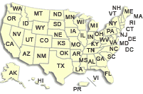
ABOUT THE MS WSC |
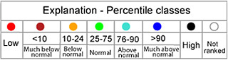
Water Resources of MississippiState and National Streamflow Conditions 
Welcome to the U.S. Geological Survey (USGS) Web page for the water resources of Mississippi. The USGS provides maps, reports and information to help others meet their needs to manage, develop, and protect America's water, energy, mineral, and land resources. We help find natural resources needed to build tomorrow, and supply scientific understanding needed to help minimize or mitigate the effects of natural hazards and environmental damage caused by human activities. The results of our efforts touch the daily lives of almost every American.
Steele Bayou Monitoring Update
USGS Mississippi Data Highlights2010 Mississippi Water Data Report Now Available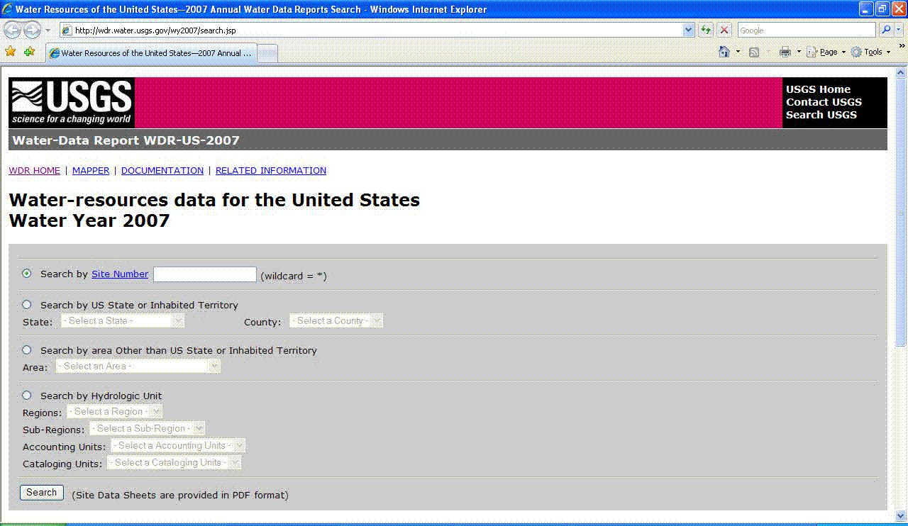
The 2010 USGS Water Data Report is now available online and improves on the previous online reports with a new interactive feature designed to make site data retrieval easier and more convenient. The new report includes a national map interface that can be used to identify an area of interest, locate sites where
water data were collected for Water Year 2010, and access most of that data. The annual Water Data Report provides a
snapshot of water conditions for a given year. Access the Water Data Report using a
text
(
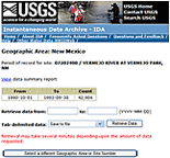
National Water Information System: MapperThe new NWIS Mapper provides an interactive map interface to all USGS water data (historical and current). (Note: To access data, zoom in on the map to level 11 or greater to make the individual sites clickable.) Instantaneous Data Archive (IDA)
Informative Tools & LinksUSGS StreaMail USGS StreaMail is a system for accessing real-time river stage and streamflow from hand-held wireless devices, such as cell phones
and Blackberries. All you have to do is send an email or text message to "streamail@usgs.gov" and use a USGS station number in the
"Subject" line. In a few minutes you'll get back an email/text message with the most recent stage and streamflow.
USGS WaterAlert Now you can receive instant, customized updates about water conditions by subscribing to WaterAlert, a new service from
the U.S. Geological Survey. WaterAlert allows users to receive updates about river flows, groundwater levels, water temperatures,
rainfall, and water quality at more than 9,500 sites where USGS collects real-time water information. The Mississippi Water Science
Center collects real-time water information at more than 130 sites throughout Mississippi and makes that data available to the public
through WaterAlert.
USGS News & Social Media
USGS Newsroom The USGS has several social media presences. Find others that may interest you at: http://www.usgs.gov/socialmedia/ Highlighted Publications
Journal Article -- Sources and Delivery of Nutrients to the Northwestern Gulf of Mexico from Streams in the South-Central United States. By Richard A. Rebich, Natalie A. Houston, Scott V. Mize, Daniel K. Pearson, Patricia B. Ging, C. Evan Hornig
OFR 2010-1229 -- Unintended Consequences of Biofuels Production: The Effects of Large-Scale Crop Conversion on Water Quality and Quantity. By Heather L. Welch, Christopher T. Green, Richard A. Rebich, Jeannie R.B. Barlow, and Matthew B. Hicks
SIR 2011-5019 -- Prepared in cooperation with the Yazoo Mississippi Delta Joint Water Management District Simulation of Water-Use Conservation Scenarios for the Mississippi Delta Using an Existing Regional Groundwater Flow Model. By Jeannie R.B. Barlow and Brian R. Clark
Journal Article -- Groundwater and Surface-Water Exchange and Resulting Nitrate Dynamics in the Bogue Phalia Basin in Northwestern Mississippi. By Jeannie R. B. Barlow and Richard H. Coupe
Journal Article -- Changes in Shallow Groundwater Quality Beneath Recently Urbanized Areas in the Memphis, Tennessee Area. By Jeannie R. B. Barlow, James A. Kingsbury, and Richard H. Coupe
Journal Article -- Field Tracer Investigation of Unsaturated Zone Flow Paths and Mechanisms in Agricultural Soils of Northwestern Mississippi, USA. By Kim S. Perkins, John R. Nimmo, Claire E. Rose, and Richard H. Coupe
Journal Article -- Fate and Transport of Glyphosate and Aminomethylphosphonic Acid in Surface Waters of Agricultural Basins. By Richard H. Coupe, Stephen J. Kalkhoff, Paul D. Capel, and Caroline Gregoire
DS 546 -- Water-Quality, Water-Level, and Discharge Data Associated with the Mississippi Embayment Agricultural chemical Transport Study, 2006-2008. By melinda S. Dalton, Claire E. Rose, and Richard H. Coupe
SIR 2012-5021 -- National Water Quality Assessment (NAWQA) Program's Agriculural Chemical Team (ACT): Environmental Settings of the South Fork Iowa River Basin, Iowa, and the Bogue Phalia Basin, Mississippi, 2006-10. By Kathleen A. McCarthy, Claire E. Rose, and Stephen J. Kalkhoff
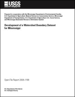
OFR-2008-1198 -- Prepared in cooperation with the Mississippi Department of Environmental Quality, U.S. Department of Agriculture-Natural Resources Conservation Service, Mississippi Department of Transportation, U.S. Department of Agriculture-U.S. Forest Service, and Mississippi Automated Resource Information System: Development of a Watershed Boundary Dataset for Mississippi. By K. Van Wilson, Jr., Michael G. Clair II, D. Phil Turnipseed, and Richard A. Rebich
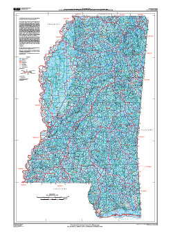
SIM 3020 -- Prepared in cooperation with the Mississippi Department of Environmental Quality, U.S. Department of Agriculture-Natural Resources Conservation Service, Mississippi Department of Transportation, U.S. Department of Agriculture-U.S. Forest Service, and Mississippi Automated Resource Information System: Watershed Boundary Dataset for Mississippi. By By K. Van Wilson, Jr., Michael G. Clair II, D. Phil Turnipseed, and Richard A. Rebich |

![]() U.S. Department of the Interior |
U.S. Geological Survey
U.S. Department of the Interior |
U.S. Geological Survey
URL: http://ms.water.usgs.gov/index.html
Page Last Modified: Friday, 04-May-2012 16:18:37 EDT