06344600: Flow=0.00cfs,Stage=5.28ft,2007-10-19 12:30,Low,GREEN RIVER NR NEW HRADEC, ND 06331000, LITTLE MUDDY RIVER BL COW CREEK NR WILLISTON, ND 06345500, HEART RIVER NR RICHARDTON, ND 06339100, KNIFE RIVER AT MANNING, ND 06332515, BEAR DEN CREEK NR MANDAREE, ND 05090000, PARK RIVER AT GRAFTON, ND 05085000, FOREST RIVER AT MINTO, ND 05084000, FOREST RIVER NR FORDVILLE, ND 05060500, RUSH RIVER AT AMENIA, ND 05059000, SHEYENNE RIVER NEAR KINDRED, ND 05058700, SHEYENNE RIVER AT LISBON, ND 05058000, SHEYENNE RIVER BELOW BALDHILL DAM, ND 06349000, HEART RIVER NR MANDAN, ND 06471200, MAPLE R AT ND-SD STATE LINE 06470800, BEAR CREEK NR OAKES, ND 06470500, JAMES RIVER AT LAMOURE, ND 06470000, JAMES RIVER AT JAMESTOWN, ND 05100000, PEMBINA RIVER AT NECHE, ND 05099400, LITTLE SOUTH PEMBINA RIVER NR WALHALLA, ND 05059700, MAPLE RIVER NR ENDERLIN, ND 05057200, BALDHILL CREEK NR DAZEY, ND 05050000, BOIS DE SIOUX RIVER NEAR WHITE ROCK, SD 06342500, MISSOURI RIVER AT BISMARCK, ND 06340500, KNIFE RIVER AT HAZEN, ND 06337000, LITTLE MISSOURI RIVER NR WATFORD CITY, ND 06329500, Yellowstone River near Sidney MT 05120000, SOURIS RIVER NR VERENDRYE, ND 05117500, SOURIS RIVER ABOVE MINOT, ND 05116000, SOURIS RIVER NR FOXHOLM, ND 05054500, SHEYENNE RIVER ABOVE HARVEY, ND 06468170, JAMES RIVER NR GRACE CITY, ND 06354000, CANNONBALL RIVER AT BREIEN, ND 06352000, CEDAR CREEK NR HAYNES, ND 06342260, SQUARE BUTTE CREEK BELOW CENTER, ND 06336000, LITTLE MISSOURI RIVER AT MEDORA, ND 05124000, SOURIS RIVER NR WESTHOPE, ND 05116500, DES LACS RIVER AT FOXHOLM, ND 05114000, SOURIS RIVER NR SHERWOOD, ND 05113600, LONG CREEK NR NOONAN, ND 05099600, PEMBINA RIVER AT WALHALLA, ND 05092000, RED RIVER OF THE NORTH AT DRAYTON, ND 05082500, RED RIVER OF THE NORTH AT GRAND FORKS, ND 05069000, SAND HILL RIVER AT CLIMAX, MN 05064500, RED RIVER OF THE NORTH AT HALSTAD, MN 05064000, WILD RICE RIVER AT HENDRUM, MN 05062000, BUFFALO RIVER NEAR DILWORTH, MN 05057000, SHEYENNE RIVER NR COOPERSTOWN, ND 05056000, SHEYENNE RIVER NR WARWICK, ND 05054000, RED RIVER OF THE NORTH AT FARGO, ND 05051500, RED RIVER OF THE NORTH AT WAHPETON, ND 06470878, JAMES RIVER AT ND-SD STATE LINE 06470875, DAKOTA LAKE NR LUDDEN, ND 06469400, PIPESTEM CREEK NR PINGREE, ND 06468250, JAMES RIVER ABOVE ARROWWOOD LAKE NR KENSAL, ND 06354580, BEAVER CREEK BL LINTON, ND 06353000, CEDAR CREEK NR RALEIGH, ND 06351200, CANNONBALL RIVER NR RALEIGH, ND 06350000, CANNONBALL RIVER AT REGENT, ND 06349700, MISSOURI RIVER NR SCHMIDT, ND 06349600, HAY CREEK AT MAIN AVENUE IN BISMARCK, ND 06349500, APPLE CREEK NR MENOKEN, ND 06348500, SWEETBRIAR CREEK NR JUDSON, ND 06348300, HEART RIVER AT STARK BRIDGE NR JUDSON, ND 06347500, BIG MUDDY CREEK NEAR ALMONT, ND 06347000, ANTELOPE CREEK NR CARSON, ND 06345780, HEART R AB LAKE TSCHIDA NR GLEN ULLIN, ND 06342450, BURNT CREEK NR BISMARCK, ND 06342020, MISSOURI RIVER AT PRICE, ND 06341000, MISSOURI RIVER AT WASHBURN, ND 06340700, MISSOURI RIVER NEAR STANTON, ND 06340000, SPRING CREEK AT ZAP, ND 06339500, KNIFE RIVER NR GOLDEN VALLEY, ND 06336600, BEAVER CREEK NR TROTTERS, ND 06335500, LITTLE MISSOURI RIVER AT MARMARTH, ND 06332770, DEEPWATER CREEK AT MOUTH NR RAUB, ND 06332523, E. FORK SHELL CREEK NR PARSHALL, ND 06330000, MISSOURI RIVER NR WILLISTON, ND 06329610, YELLOWSTONE R NO. 2 NR CARTWRIGHT, ND 06329597, CHARBONNEAU CREEK NR CHARBONNEAU, ND 05123510: 2007-10-19 07:15,Not ranked,Seasonal site,DEEP RIVER NR UPHAM, ND 05123400, WILLOW CREEK NR WILLOW CITY, ND 05122000, SOURIS RIVER NR BANTRY, ND 05121001, SOURIS RIVER EAST OUTFALL AT EATON DAM NR TOWNER 05121000, SOURIS RIVER WEST OUTFALL AT EATON DAM NR TOWNER 05120500, WINTERING RIVER NR KARLSRUHE, ND 05113750, EAST BRANCH SHORT CREEK RES NR COLUMBUS, ND 05102490, RED RIVER OF THE NORTH AT PEMBINA, ND 05101000, TONGUE RIVER AT AKRA, ND 05083500, RED RIVER OF THE NORTH AT OSLO, MN 05082625, TURTLE RIVER AT TURTLE R STATE PARK NR ARVILLA, ND 05070000, RED RIVER OF THE NORTH NEAR THOMPSON, ND 05067500, MARSH RIVER NEAR SHELLY, MN 05066500, GOOSE RIVER AT HILLSBORO, ND 05060400, SHEYENNE RIVER AT HARWOOD, ND 05060100, MAPLE RIVER BL MAPLETON, ND 05060000, MAPLE RIVER NR MAPLETON, ND 05059715, MAPLE RIVER ABOVE MAPLE RIVER DAM NR SHELDON, ND 05059600, MAPLE RIVER NR HOPE, ND 05059500, SHEYENNE RIVER AT WEST FARGO, ND 05059480, SHEYENNE RIVER DIVERSION AT WEST FARGO, ND 05059310, SHEYENNE RIVER DIVERSION NR HORACE, ND 05059300, SHEYENNE R AB SHEYENNE R DIVERSION NR HORACE, ND 05058500, SHEYENNE RIVER AT VALLEY CITY, ND 05056665, EASTERN STUMP LAKE NR LAKOTA, ND 05056636, DEVILS LAKE OUTLET TO STUMP LAKE NR LAKOTA, ND 05056500, DEVILS LAKE NR DEVILS LAKE, ND 05056340, LITTLE COULEE NR LEEDS, ND 05056255, LAKE ALICE-IRVINE CHANNEL NR CHURCHS FERRY, ND 05056241, DRY LAKE NEAR PENN, ND 05056239, STARKWEATHER COULEE NR WEBSTER, ND 05056222M ORRISON LAKE NEAR WEBSTER, ND 05056215, EDMORE COULEE TRIB NR WEBSTER, ND 05056200, EDMORE COULEE NR EDMORE, ND 05056100, MAUVAIS COULEE NR CANDO, ND 05056060, MAUVAIS COULEE TRIB NO. 3 NR CANDO, ND 05055400, SHEYENNE R BL DEVILS LK STATE OUTLET NR BREMEN, ND 05055300, SHEYENNE R AB DEVILS LK STATE OUTLET NR FLORA, ND 05053000, WILD RICE RIVER NR ABERCROMBIE, ND 05052500, ANTELOPE CREEK AT DWIGHT, ND 05051600, WILD RICE RIVER NR RUTLAND, ND 05051522, RED RIVER OF THE NORTH AT HICKSON, ND 05051300, BOIS DE SIOUX RIVER NEAR DORAN, MN 05049995, MUD LAKE ABOVE WHITE ROCK DAM NEAR WHITE ROCK, SD 05046475, OTTERTAIL RIVER DIVERSION AT BRECKENRIDGE, MN
USGS - science for a changing world

North Dakota Water Science Center

home home information/data information/data publications publications FAQs FAQs links links about us about us contact contact internal internal

USGS North Dakota Water Science Center


 What's New

 USGS WaterAlert

 Data Center

 Information Center

 USGS in Your State


USGS Water Science Centers are located in each state.

There is a USGS Water Science Center office in each State. Washington Oregon California Idaho Nevada Montana Wyoming Utah Colorado Arizona New Mexico North Dakota South Dakota Nebraska Kansas Oklahoma Texas Minnesota Iowa Missouri Arkansas Louisiana Wisconsin Illinois Mississippi Michigan Indiana Ohio Kentucky Tennessee Alabama Pennsylvania West Virginia Georgia Florida Caribbean Alaska Hawaii New York Vermont New Hampshire Maine Massachusetts South Carolina North Carolina Rhode Island Virginia Connecticut New Jersey Maryland-Delaware-D.C.


 Connect with USGS

USGSND - Follow USGSND on Twitter
USGSND - YouTube - USGSND

RSSPublications
RSSUSGS News Releases
RSSFAQs
What is RSS?


Water Resources of North Dakota  Bookmark and Share

Here you'll find information on North Dakota's rivers, streams, and lakes. You'll also find information about ground water, water quality, and many other topics.


 In the Spotlight

Webcams in North Dakota Webcams in North Dakota
All USGS webcams can now be viewed on our new Webcams in North Dakota web page at http://nd.water.usgs.gov/webcams/. Available webcams include photos of the Red River of the North at Fargo, N. Dak., the Red River of the North at Grand Forks, N. Dak., Tolna Coulee, and the Missouri River at Bismarck, N. Dak.

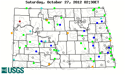
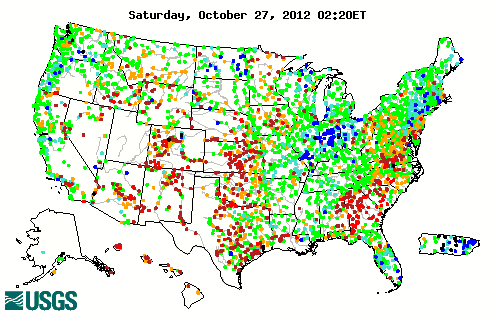
 Current Conditions in North Dakota

Choose a site on the map for real-time streamgage information.

Stream gage levels in North Dakota, relative to 30 year average.

Colors based on percentile classes - Click for further information

 Resources

U.S. Coast Guard Boating Safety Resource Center

North Dakota flood and high flow conditions

Soil Moisture/Snow Water Equivalent Information

Water Temperatures

Ice Formations in North Dakota

Streamgages in the Souris River Basin in U.S. and Canada

Streamgages in the Red River of the North Basin in U.S. and Canada

Streamgages in the Missouri River Basin 

 Highlighted Publications

The North Dakota Water Science Center produces publications about water resources.

image

SIR 2012 5111
Sediment Loads in the Red River of the North and Selected Tributaries near Fargo, North Dakota, 2010—2011


image

SIR 2012 5112
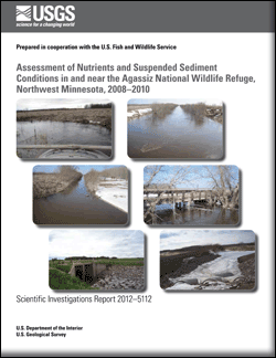
Assessment of Nutrients and Suspended Sediment Conditions in and near the Agassiz National Wildlife Refuge, Northwest Minnesota, 2008–2010


image

OFR 2012 1042
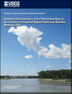
Sediment Characteristics of the Yellowstone River in the Vicinity of a Proposed Bypass Chute near Glendive, Montana, 2011


image

SIR 2011 5178
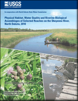
Physical Habitat, Water Quality, and Riverine Biological Assemblages of Selected Reaches of the Sheyenne River, North Dakota, 2010


More recent publications

 Photos

 USGS National News

Daily Streamflow Conditions


Current streamflow conditions for the nation.
Map color code explanation

Selected USGS News Releases


Mississippi River Flows Backwards Due to Isaac
 
Scientists Explore Changing Arctic Ocean
 
Climate and Drought Lessons from Ancient Egypt
 

Accessibility FOIA Privacy Policies and Notices

Take Pride in America logo USA.gov logo U.S. Department of the Interior | U.S. Geological Survey
URL: http://nd.water.usgs.gov/index.html
Page Contact Information: Webmaster
Page Last Modified: Friday, 31-Aug-2012 15:21:04 EDT
Sioux Falls, SD [sdww55]