New Jersey Water Science Center
|
QUICK LINKS WATER DATA
PUBLICATIONSABOUT USUSGS IN YOUR STATEUSGS Water Science Centers are located in each state. 
|
Water Resources of New Jersey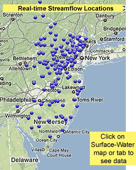
Welcome to the USGS New Jersey Water Science Center Web page. This is your direct link to water-resource information on New Jersey's rivers and streams, groundwater, water quality, and biology. Data collection and interpretive studies are done by the Center to support statewide water-resource infrastructure and management needs and are part of the USGS science strategy to address the water-resource priorities of the Nation and global trends in:
View NJ Monthly Hydrologic Conditions View NJ Annual Data Report, Water Year 2010 View Water-Resources Data for the US: Water Year 2010 View Hydrologic conditions: 2010 GW | 2009-10 QW Quick Link to Real-Time Data (Quick look: For more information about this topic, click here. Mobile Information CenterUSGS WaterAlert
sends email or text messages when certain parameters measured by a USGS data-collection station exceed user-definable thresholds. NJ Water SciencesThe USGS New Jersey Water Science Center monitors and analyzes surface-water, groundwater, water-quality, and biological parameters throughout the State. Data collection and interpretive studies are done in cooperation with various local, State, or Federal agencies. Surface WaterThe USGS New Jersey Water Science Center provides real-time water-stage and streamflow data for more than 140 sites across the State. Flood prediction, stream low-flow characteristics, and surface-water-quality are currently being investigated as part of 28 studies. GroundwaterThe USGS New Jersey Water Science Center maintains a long-term water-level-monitoring network. Real-time water-level data are available for 22 of these wells. More than 30 groundwater investigations are underway to evaluate groundwater-supply and groundwater-quality issues. Water QualityThe USGS New Jersey Water Science Center continuously monitors Water-quality conditions at 42 real-time sites across the State of New Jersey. Groundwater and Surface-water-quality issues are addressed in more than 30 current interpretive studies. BiologyInterpretive studies based on periodic monitoring address aquatic-life impairments resulting from the impact of hydrologic stresses. Recent Events**USGS WEBSITE FOR CURRENT INFORMATION ON HURRICANE SANDY** Featured ProjectTrace Elements National Synthesis Project
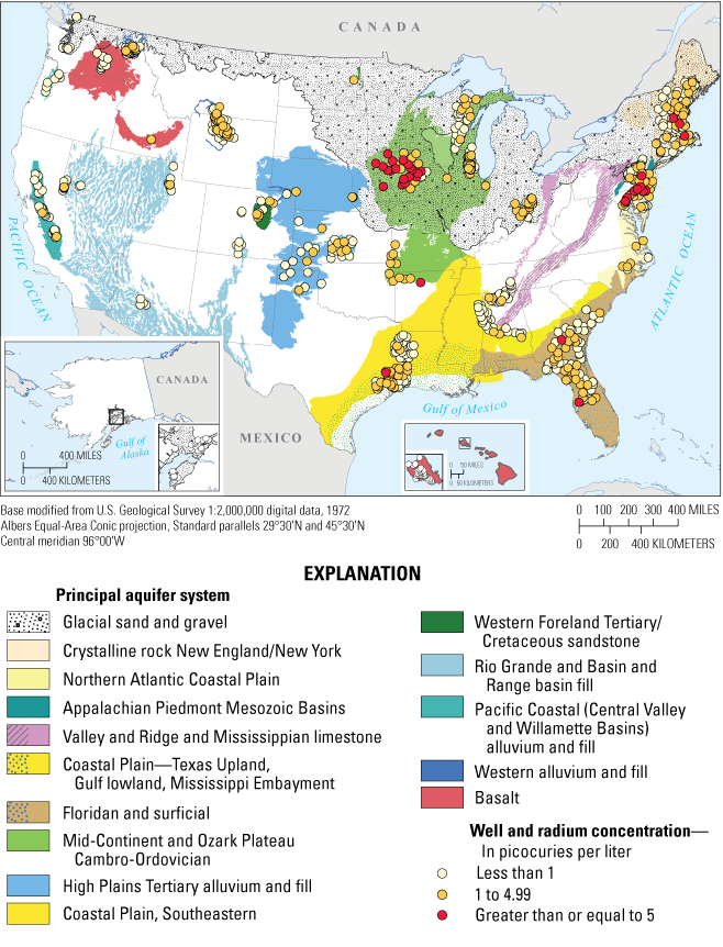
A recently completed National study on radium occurrence indicated that the North Atlantic Coastal Plain, which underlies southern New Jersey, is one of two principal aquifers in the United States where more than 20 percent of the raw water samples from wells exceed the drinking water standard. The Appalachian Piedmont Mesozoic Basins bedrock principal aquifer, which underlies a substantial part of northern New Jersey, had a small likelihood that the raw water samples from the wells exceed the drinking water standard, a likelihood of about 3 percent, which is equivalent to the overall National frequency. The study found that geochemical conditions, such as low levels of dissolved oxygen (<1mg/L) and low pH (<6), were indicators of where radium was likely to be detected or exceed a standard. Low levels of dissolved oxygen occur on occasion in the bedrock aquifers of northern New Jersey and low pH is widespread in southern New Jersey coastal plain aquifers.
Highlighted PublicationsThe USGS New Jersey Water Science Center produces publications about water resources.
|

![]() U.S. Department of the Interior |
U.S. Geological Survey
U.S. Department of the Interior |
U.S. Geological Survey
URL: http://nj.usgs.gov/index.html
Page Contact Information: New Jersey WSC Webmaster
Page Last Modified: Tuesday, 15-Jan-2013 08:45:41 EST