USGS - science for a changing world

New England Water Science Center - Rhode Island Office
  home   water data   watersheds   projects   publications   hazards   water education   about us   contact   MA WSC
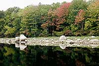
Scituate Reservoir, Rhode Island

DATA CENTER

USGS IN YOUR STATE

USGS Water Science Centers are located in each state.

There is a USGS Water Science Center office in each State. Washington Oregon California Idaho Nevada Montana Wyoming Utah Colorado Arizona New Mexico North Dakota South Dakota Nebraska Kansas Oklahoma Texas Minnesota Iowa Missouri Arkansas Louisiana Wisconsin Illinois Mississippi Michigan Indiana Ohio Kentucky Tennessee Alabama Pennsylvania West Virginia Georgia Florida Caribbean Alaska Hawaii New York Vermont New Hampshire Maine Massachusetts South Carolina North Carolina Rhode Island Virginia Connecticut New Jersey Maryland-Delaware-D.C.

Water Resources of Rhode Island

Welcome to the New England Water Science Center - Rhode Island Office web page. This is your direct link to water-resource information on Rhode Island's rivers and streams, groundwater, water quality, and biology. Data collection and interpretive studies are done by the Center to support state-wide water-resource infrastructure and management needs and are part of the USGS science strategy to address the water-resource priorities of the nation and global trends in:

    • Ecosystem status and change
    • Climate variability and change
    • Energy and mineral management
    • National hazard risk and assessment
    • Environmental risk to human health
    • Water use and availability


Monthly Water-Conditions Statements:

Previous month               Recent months historical maps


RI Annual Data Report, Water Year 2010

USGS WaterAlert:

The U.S. Geological Survey WaterAlert service sends e-mail or text messages when certain parameters measured by a USGS data-collection station exceed user-definable thresholds.

USGS StreaMail:

 Use the USGS system to request real-time stream stage and flow data by email from your computer, cell phone or Blackberry. Send an email to streammail@usgs.gov and in the "Subject" line, put in a USGS station (site) number. In a few minutes, you'll get back an email with the most recent stream stage and flow.

RI Water Sciences

The USGS Rhode Island Office monitors and analyzes surface water, groundwater, water-quality and biological parameters throughout the state. Data collection and interpretive studies are done in cooperation with various local, State, or Federal agencies.

Find out about the N.J. surface-water monitoring network

Surface Water

Rhode Island provides real-time water-stage and streamflow data at over 140 sites across the state. Flood prediction, stream low-flow characteristics and surface-quality are currently under investigation in 28 studies.

Groundwater

Twenty-two groundwater wells are monitored hourly by the USGS in Rhode Island. Over 30 current groundwater investigations evaluate groundwater-supply and groundwater-quality issues.

Water Quality

Water-quality conditions are continuously monitored by the USGS at 42 sites across the state of Rhode Island. Water-quality issues in groundwater and surface water are addressed in over 30 current interpretive studies.

Biology

Interpretive studies based on periodic monitoring address aquatic life impairments resulting from the impact of hydrologic stresses.

Featured Project

Field Characterization and Numerical Simulation of Groundwater and Surface Water Interactions in Rhode Island Wetlands: Big River Watershed Case Study

Wetland sediment coring

Big River Watershed - wetland sediment coring

Water demand in Rhode Island is increasing, and the Rhode Island Water Resources Board (RIWRB), which is responsible developing and protecting the State's major water resources, is concerned that this increasing demand may exceed the current capacity. Nearly all of the potable groundwater supplies identified in Rhode Island are found in shallow, river-dominated valley-fill aquifer systems, such as the Big River Watershed in central Rhode Island. There are concerns about potential effects of groundwater withdrawals on the hydrology of streams and wetlands. These concerns have created the need for a better understanding of the interaction between groundwater and surface water in wetlands in order to better assess potential effects of pumping on wetlands.

Find out more

Highlighted Publications

The Rhode Island Office produces publications about water resources.

Scientific Investigations Report 2012-5114
Evaluating prediction uncertainty of areas contributing recharge to well fields of multiple water suppliers in the Hunt–Annaquatucket–Pettaquamscutt River Basins, Rhode Island

Scientific Investigations Report 2012-5110
Estimating basin lagtime and hydrograph-timing indexes used to characterize stormflows for runoff-quality analysis
 

Open-File Report 2011-1284
Time of travel and dispersion of a dye plume in the Blackstone River, Massachusetts and Rhode Island, 2009
 

Open-File Report 2011-1076
Streamflow, water quality, and constituent loads and yields, Scituate Reservoir drainage area, Rhode Island, water year 2010
 

Open-File Report 2011-1029
Elevation of the March–April 2010 flood high water in selected river reaches in Rhode Island


Search our publications

USGS Home Water Climate Change Core Science Ecosystems Energy&Env. Health Hazards

Accessibility FOIA Privacy Policies and Notices

Take Pride in America logo USA.gov logo U.S. Department of the Interior | U.S. Geological Survey
URL: http://ri.water.usgs.gov/index.html
Page Contact Information:
Page Last Modified: Tuesday, 16-Oct-2012 16:06:33 EDT