USGS - science for a changing world

West Virginia Water Science Center

orange iconhome ornage iconpublications orange iconcontact   orange iconinternal
ELK RIVER NEAR FRAMETOWN, WV

DATA CENTER

  • Real-time data (Opens real-time data page in new window. )


INFORMATION CENTER

ABOUT THE WV WSC

OFFICE

Charleston - 304-347-5130


USGS IN YOUR STATE

USGS Water Science Centers are located in each state.

There is a USGS Water Science Center office in each State. Washington Oregon California Idaho Nevada Montana Wyoming Utah Colorado Arizona New Mexico North Dakota South Dakota Nebraska Kansas Oklahoma Texas Minnesota Iowa Missouri Arkansas Louisiana Wisconsin Illinois Mississippi Michigan Indiana Ohio Kentucky Tennessee Alabama Pennsylvania West Virginia Georgia Florida Caribbean Alaska Hawaii New York Vermont New Hampshire Maine Massachusettes South Carolina North Carolina Rhode Island Virginia Connecticut New Jersey Maryland-Delaware-D.C.


Water Resources of West Virginia

Current streamflow conditions in West Virginia; click to go to a live map.
Map legend.

Welcome to the U.S. Geological Survey (USGS) Web page for the water resources of West Virginia; this is your direct link to all kinds of water-resource information. Here you'll find information on West Virginia's rivers and streams. You'll also find information about ground water, water quality, and many other topics. The USGS operates the most extensive satellite network of stream-gaging stations in the state, many of which form the backbone of flood-warning systems.

The USGS provides current ("real-time") stream stage and streamflow, water-quality, and ground-water levels for over 200 sites in West Virginia.

03110000: Flow=221cfs,Stage=2.54ft,2007-08-10 06:00,High,Yellow Creek near Hammondsville OH 03072000: Flow=1020cfs,Stage=5.17ft,Floodstage=12ft,2007-08-10 07:00,High,Dunkard Creek at Shannopin, PA 03066000: Flow=909cfs,Stage=4.87ft,Floodstage=20ft,2007-08-10 06:00,High,BLACKWATER R AT DAVIS, WV 01595000: Flow=459cfs,Stage=3.52ft,2007-08-10 06:15,High,NORTH BRANCH POTOMAC RIVER AT STEYER, MD 03111500: Flow=144cfs,Stage=1.93ft,Floodstage=9ft,2007-08-10 04:00,>90,Short Creek near Dillonvale OH 03109500: Flow=2020cfs,Stage=6.12ft,2007-08-10 04:00,>90,Little Beaver Creek near East Liverpool OH 03076600: Flow=68cfs,Stage=2.07ft,2007-08-10 03:00,>90,BEAR CREEK AT FRIENDSVILLE, MD 03070500: Flow=571cfs,Stage=5.77ft,Floodstage=17.5ft,2007-08-10 04:00,>90,BIG SANDY CREEK AT ROCKVILLE, WV 03069500: Flow=2790cfs,Stage=5.06ft,Floodstage=16ft,2007-08-10 07:00,>90,CHEAT RIVER NEAR PARSONS, WV 03193000: Flow=2190cfs,Stage=2.36ft,Floodstage=27ft,2007-08-10 07:00,<10,KANAWHA RIVER AT KANAWHA FALLS, WV 03175500: Flow=36cfs,Stage=2.57ft,2007-08-10 07:00,<10,WOLF CREEK NEAR NARROWS, VA 03176500: Flow=1030cfs,Stage=2.64ft,Floodstage=15ft,2007-08-10 07:00,<10,NEW RIVER AT GLEN LYN, VA 03198000: Flow=9970cfs,Stage=18.28ft,2007-08-10 07:00,76-90,KANAWHA RIVER AT CHARLESTON, WV 03065000: Flow=670cfs,Stage=2.91ft,Floodstage=14ft,2007-08-10 07:00,76-90,DRY FORK AT HENDRICKS, WV 03061500: Flow=73cfs,Stage=2.58ft,2007-08-10 06:00,76-90,BUFFALO CREEK AT BARRACKVILLE, WV 03052500: Flow=14cfs,Stage=1.88ft,2007-08-10 07:30,76-90,SAND RUN NEAR BUCKHANNON, WV 01595200: Flow=51cfs,Stage=2.40ft,2007-08-10 07:00,76-90,STONY RIVER NEAR MOUNT STORM,WV 03213500: Flow=1.7cfs,Stage=2.41ft,2007-08-10 06:30,10-24,PANTHER CREEK NEAR PANTHER, WV 03206600: Flow=1.5cfs,Stage=4.45ft,2007-08-10 07:00,10-24,EAST FORK TWELVEPOLE CREEK NEAR DUNLOW, WV 03203600: Flow=152cfs,Stage=4.68ft,Floodstage=23ft,2007-08-10 07:00,10-24,GUYANDOTTE RIVER AT LOGAN, WV 03202750: Flow=14cfs,Stage=1.74ft,2007-08-10 07:00,10-24,CLEAR FORK AT CLEAR FORK, WV 03202400: Flow=69cfs,Stage=2.90ft,2007-08-10 07:30,10-24,GUYANDOTTE RIVER NEAR BAILEYSVILLE, WV 03200500: Flow=134cfs,Stage=10.05ft,Floodstage=25ft,2007-08-10 06:00,10-24,COAL RIVER AT TORNADO, WV 03197000: Flow=142cfs,Stage=3.75ft,Floodstage=19ft,2007-08-10 07:00,10-24,ELK RIVER AT QUEEN SHOALS, WV 03191500: Flow=3.6cfs,Stage=4.79ft,2007-08-10 07:30,10-24,PETERS CREEK NEAR LOCKWOOD, WV 03190400: Flow=41cfs,Stage=2.88ft,2007-08-10 03:30,10-24,MEADOW RIVER NEAR MT. LOOKOUT, WV 03189100: Flow=130cfs,Stage=10.04ft,2007-08-10 07:00,10-24,GAULEY RIVER NEAR CRAIGSVILLE, WV 03159540: Flow=1.4cfs,Stage=4.65ft,2007-08-10 05:00,10-24,Shade River near Chester OH 03155000: Flow=95cfs,Stage=13.76ft,2007-08-10 07:00,10-24,LITTLE KANAWHA RIVER AT PALESTINE, WV 03151400: Flow=6.4cfs,Stage=4.01ft,2007-08-10 07:00,10-24,L KANAWHA RIVER NR WILDCAT, WV 01636500: Flow=681cfs,Stage=1.54ft,Floodstage=13.5ft,2007-08-10 05:00,10-24,SHENANDOAH RIVER AT MILLVILLE, WV 01616500: Flow=73cfs,Stage=1.79ft,Floodstage=10ft,2007-08-10 05:30,10-24,OPEQUON CREEK NEAR MARTINSBURG, WV 01605500: Flow=31cfs,Stage=1.91ft,2007-08-10 06:30,10-24,SOUTH BRANCH POTOMAC RIVER AT FRANKLIN, WV 03214500: Flow=259cfs,Stage=2.34ft,Floodstage=38ft,2007-08-10 07:00,25-75,TUG FORK AT KERMIT, WV 03213700: Flow=263cfs,Stage=2.99ft,Floodstage=27ft,2007-08-10 07:00,25-75,TUG FORK AT WILLIAMSON, WV 03198500: Flow=51cfs,Stage=1.36ft,2007-08-10 06:30,25-75,BIG COAL RIVER AT ASHFORD, WV 03192000: Flow=285cfs,Stage=1.48ft,Floodstage=20ft,2007-08-10 07:00,25-75,GAULEY RIVER ABOVE BELVA, WV 03186500: Flow=46cfs,Stage=1.22ft,2007-08-10 06:30,25-75,WILLIAMS RIVER AT DYER, WV 03185000: Flow=8.4cfs,Stage=1.72ft,2007-08-10 07:30,25-75,PINEY CREEK AT RALEIGH, WV 03184000: Flow=233cfs,Stage=0.99ft,2007-08-10 07:00,25-75,GREENBRIER RIVER AT HILLDALE, WV 03183500: Flow=294cfs,Stage=2.53ft,Floodstage=14ft,2007-08-10 07:00,25-75,GREENBRIER RIVER AT ALDERSON, WV 03182500: Flow=120cfs,Stage=2.21ft,Floodstage=15ft,2007-08-10 07:00,25-75,GREENBRIER RIVER AT BUCKEYE, WV 03179000: Flow=49cfs,Stage=2.18ft,2007-08-10 03:00,25-75,BLUESTONE RIVER NEAR PIPESTEM, WV 03112000: Flow=24cfs,Stage=1.40ft,Floodstage=7ft,2007-08-10 07:00,25-75,WHEELING CREEK AT ELM GROVE, WV 03061000: Flow=233cfs,Stage=1.95ft,2007-08-10 06:00,25-75,WEST FORK RIVER AT ENTERPRISE, WV 03054500: Flow=274cfs,Stage=4.24ft,Floodstage=19ft,2007-08-10 07:00,25-75,TYGART VALLEY RIVER AT PHILIPPI, WV 03053500: Flow=74cfs,Stage=4.25ft,2007-08-10 03:30,25-75,BUCKHANNON RIVER AT HALL, WV 03052000: Flow=63cfs,Stage=2.07ft,2007-08-10 06:00,25-75,MIDDLE FORK RIVER AT AUDRA, WV 03051000: Flow=165cfs,Stage=2.93ft,Floodstage=14ft,2007-08-10 07:00,25-75,TYGART VALLEY RIVER AT BELINGTON, WV 03050000: Flow=52cfs,Stage=1.12ft,Floodstage=14ft,2007-08-10 07:00,25-75,TYGART VALLEY RIVER NEAR DAILEY, WV 02011800: Flow=292cfs,Stage=9.22ft,2007-08-10 07:30,25-75,JACKSON RIVER BL GATHRIGHT DAM NR HOT SPGS, VA 02011500: Flow=26cfs,Stage=2.15ft,Floodstage=7.0ft,2007-08-10 07:30,25-75,BACK CREEK NEAR MOUNTAIN GROVE, VA 02011460: Flow=8.0cfs,Stage=0.35ft,2007-08-10 06:45,25-75,BACK CREEK NEAR SUNRISE, VA 02011400: Flow=33cfs,Stage=3.00ft,2007-08-10 07:30,25-75,JACKSON RIVER NEAR BACOVA, VA 01617800: Flow=6.1cfs,Stage=1.04ft,2007-08-10 06:15,25-75,MARSH RUN AT GRIMES, MD 01614000: Flow=30cfs,Stage=1.79ft,2007-08-10 06:30,25-75,BACK CREEK NEAR JONES SPRINGS, WV 01613000: Flow=821cfs,Stage=3.06ft,Floodstage=30ft,2007-08-10 06:15,25-75,POTOMAC RIVER AT HANCOCK, MD 01611500: Flow=102cfs,Stage=1.39ft,2007-08-10 07:00,25-75,CACAPON RIVER NEAR GREAT CACAPON, WV 01610000: Flow=816cfs,Stage=4.22ft,Floodstage=25ft,2007-08-10 06:15,25-75,POTOMAC RIVER AT PAW PAW, WV 01608500: Flow=281cfs,Stage=1.79ft,Floodstage=15ft,2007-08-10 07:30,25-75,SOUTH BRANCH POTOMAC RIVER NEAR SPRINGFIELD, WV 01608000: Flow=27cfs,Stage=1.95ft,Floodstage=10ft,2007-08-10 07:00,25-75,SO FK SOUTH BRANCH POTOMAC R NR MOOREFIELD, WV 01607500: Flow=9.4cfs,Stage=0.93ft,2007-08-10 07:00,25-75,SO FK SO BR POTOMAC R AT BRANDYWINE, WV 01606500: Flow=108cfs,Stage=3.20ft,Floodstage=13ft,2007-08-10 06:30,25-75,SO. BRANCH POTOMAC RIVER NR PETERSBURG, WV 01606000: Flow=47cfs,Stage=4.06ft,2007-08-10 07:00,25-75,N F SOUTH BR POTOMAC R AT CABINS, WV 01604500: Flow=21cfs,Stage=2.77ft,2007-08-10 07:00,25-75,PATTERSON CREEK NEAR HEADSVILLE, WV 01603000: Flow=354cfs,Stage=2.53ft,Floodstage=17ft,2007-08-10 06:15,25-75,NORTH BRANCH POTOMAC RIVER NEAR CUMBERLAND, MD 01601500: Flow=53cfs,Stage=1.99ft,Floodstage=10ft,2007-08-10 06:00,25-75,WILLS CREEK NEAR CUMBERLAND, MD 01597500: Flow=56cfs,Stage=0.70ft,2007-08-10 06:15,25-75,SAVAGE RIV BL SAVAGE RIV DAM NEAR BLOOMINGTON, MD 380649081083301: Stage=3.73ft,2007-08-10 06:30:00,Not ranked,NEW RIVER BELOW HAWKS NEST DAM, WV 03216000: Stage=34.61ft,2007-08-10 07:00:00,Floodstage=52ft,Not ranked,OHIO RIVER AT ASHLAND, KY 03215000: Stage=3.42ft,2007-08-10 04:00:00,Floodstage=49ft,Not ranked,BIG SANDY R AT LOUISA, KY 03212980: Flow=39cfs,Stage=2.54ft,2007-08-10 05:00,Not ranked,DRY FORK AT BEARTOWN, W. VA. 03212750: Flow=70cfs,Stage=3.08ft,Floodstage=17ft,2007-08-10 06:00,Not ranked,TUG FORK AT WELCH, W. VA. 03207020: Stage=3.81ft,2007-08-10 07:00:00,Not ranked,TWELVEPOLE CREEK BELOW WAYNE, WV 03206790: Stage=1.48ft,2007-08-10 07:00:00,Not ranked,EAST FORK TWELVEPOLE CREEK BELOW EAST LYNN DAM 03206000: Stage=26.29ft,2007-08-10 07:00:00,Floodstage=50ft,Not ranked,OHIO RIVER AT HUNTINGTON, WV 03204250: Stage=21.63ft,2007-08-10 06:00:00,Not ranked,MUD RIVER AT PALERMO, WV 03204000: Stage=3.27ft,2007-08-10 03:30:00,Floodstage=30ft,Not ranked,GUYANDOTTE RIVER AT BRANCHLAND, WV 03203000: Stage=3.69ft,2007-08-10 03:00:00,Floodstage=15ft,Not ranked,GUYANDOTTE RIVER AT MAN, WV 03202915: Stage=2.98ft,2007-08-10 07:00:00,Not ranked,GUYANDOTTE RIVER BELOW R.D. BAILEY DAM 03201500: Stage=24.97ft,2007-08-10 07:00:00,Floodstage=40ft,Not ranked,OHIO RIVER AT POINT PLEASANT, WV 03201405: Flow=0.90cfs,Stage=4.88ft,2007-08-10 06:30,Not ranked,HURRICANE CREEK AT HURRICANE, WV 03198350: Flow=7.3cfs,Stage=10.49ft,2007-08-10 06:30,Not ranked,CLEAR FORK AT WHITESVILLE, WV 03197990: Stage=19.29ft,2007-08-10 07:00:00,Not ranked,KANAWHA R AT CHARLESTON, WV AUXILIARY (UPPER) 03197910: Stage=40.01ft,2007-08-10 07:00:00,Not ranked,UNNAMED TRIB TO ELK TWOMILE CR NR CHARLESTON, WV 03196800: Stage=0.46ft,2007-08-10 06:00:00,Not ranked,ELK RIVER AT CLAY, WV 03196600: Stage=1.79ft,2007-08-10 06:30:00,Not ranked,ELK RIVER NEAR FRAMETOWN, WV 03195500: Stage=11.58ft,2007-08-10 07:00:00,Not ranked,ELK RIVER AT SUTTON, WV 03194700: Flow=108cfs,Stage=3.59ft,2007-08-09 11:30,Not ranked,ELK RIVER BELOW WEBSTER SPRINGS, WV 03189600: Stage=7.27ft,2007-08-10 07:00:00,Not ranked,GAULEY RIVER BELOW SUMMERSVILLE DAM, WV 03187500: Flow=20cfs,Stage=2.12ft,2007-08-09 02:00,Not ranked,CRANBERRY RIVER NEAR RICHWOOD, WV 03187000: Stage=1.78ft,2007-08-10 07:00:00,Floodstage=19ft,Not ranked,GAULEY RIVER AT CAMDEN ON GAULEY, WV 03185400: Flow=1840cfs,Stage=2.69ft,2007-08-10 04:00,Not ranked,NEW RIVER AT THURMOND, WV 03184500: Stage=1.64ft,2007-08-10 07:00:00,Floodstage=15ft,Not ranked,NEW RIVER AT HINTON, WV 03182888: Stage=46.49ft,2007-08-10 06:00:00,Not ranked,DRY CREEK AT TUCKAHOE, WV 03182050: Stage=29.41ft,2007-08-10 07:00:00,Not ranked,MARLIN RUN AT MARLINTON, WV 03180500: Floodstage=7ft,0000-00-00 00:00,Not ranked,GREENBRIER RIVER AT DURBIN, WV 03178150: Stage=22.19ft,2007-08-10 07:00:00,Not ranked,MIDDLE FORK BRUSH CREEK AT EDISON, WV 03177710: Flow=9.6cfs,Stage=1.10ft,2007-08-10 07:45,Not ranked,BLUESTONE RIVER AT FALLS MILLS, VA 03159750: Stage=46.66ft,2007-08-10 03:00:00,Not ranked,TUG FORK AT STATTS MILLS, WV 03155405: Stage=42.10ft,2007-08-10 04:00:00,Not ranked,NORTH FORK HUGHES RIVER NEAR CAIRO, WV 03154000: Stage=3.81ft,2007-08-10 06:00:00,Not ranked,WEST FORK LITTLE KANAWHA RIVER AT ROCKSDALE, WV 03153500: Stage=6.59ft,2007-08-10 07:00:00,Floodstage=36ft,Not ranked,LITTLE KANAWHA RIVER AT GRANTSVILLE, WV 03152000: Stage=2.50ft,2007-08-10 07:00:00,Floodstage=23ft,Not ranked,LITTLE KANAWHA RIVER AT GLENVILLE, WV 03151600: Stage=3.35ft,2007-08-10 07:00:00,Not ranked,LITTLE KANAWHA RIVER AT BURNSVILLE, WV 03151550: Stage=60.64ft,2007-08-10 06:00:00,Not ranked,SALTLICK CREEK NEAR FLATWOODS, WV 03150700: Stage=16.87ft,2007-08-10 07:00:00,Floodstage=35ft,Not ranked,OHIO RIVER AT MARIETTA, OH 03114280: Stage=14.45ft,2007-08-10 06:00:00,Not ranked,OHIO RIVER AT HANNIBAL LOCK AND DAM (LOWER), OH 03112500: Stage=17.39ft,2007-08-10 05:00:00,Floodstage=36ft,Not ranked,OHIO RIVER AT WHEELING, WV 03111950: Stage=41.39ft,2007-08-10 04:00:00,Not ranked,DUNKARD FORK NEAR MAJORSVILLE, WV 03111548: Flow=46cfs,Stage=1.50ft,2007-08-10 07:30,Not ranked,Wheeling Creek below Blaine OH 03111520: Stage=15.70ft,2007-08-10 05:00:00,Floodstage=37ft,Not ranked,OHIO R AT PIKE ISLAND LOCK & DAM (LOWER), WV 03110830: Flow=57cfs,Stage=1.66ft,2007-08-10 07:30,Not ranked,KINGS CREEK AT WEIRTON, WV 03110690: Stage=15.22ft,2007-08-10 06:00:00,Not ranked,OHIO R AT NEW CUMBERLAND LOCK & DAM (LOWER), OH 03076500: Flow=383cfs,Stage=2.92ft,2007-08-09 11:30,Not ranked,YOUGHIOGHENY RIVER AT FRIENDSVILLE, MD 03075500: Flow=197cfs,Stage=2.68ft,2007-08-09 14:30,Not ranked,YOUGHIOGHENY RIVER NEAR OAKLAND, MD 03071600: Stage=8.65ft,2007-08-10 04:00:00,Not ranked,CHEAT RIVER @ LAKE LYNN, PA 03070260: Stage=1.85ft,2007-08-10 06:00:00,Floodstage=17ft,Not ranked,CHEAT RIVER AT ALBRIGHT, WV 03069870: Flow=3530cfs,Stage=7.28ft,Floodstage=19ft,2007-08-10 06:00,Not ranked,CHEAT RIVER AT HWY 50 NEAR ROWLESBURG, WV 03068800: Flow=376cfs,Stage=4.82ft,Floodstage=13ft,2007-08-10 06:00,Not ranked,SHAVERS FORK BELOW BOWDEN, WV 03067510: Flow=33cfs,Stage=4.47ft,2007-08-10 07:00,Not ranked,SHAVERS FORK NR CHEAT BRIDGE, WV 03065400: Flow=504cfs,Stage=3.49ft,2007-08-10 07:30,Not ranked,BLACKWATER R NR DAVIS,WV 03063000: Stage=11.54ft,2007-08-10 06:00:00,Not ranked,Monongahela R at Lock & Dam 8, at Pnt Marion, PA 03062500: Flow=69cfs,Stage=0.90ft,2007-08-10 07:00,Not ranked,DECKERS CREEK AT MORGANTOWN, WV 03062450: Stage=9.28ft,2007-08-10 06:00:00,Floodstage=22ft,Not ranked,MONONGAHELA R AT MORGANTOWN LOCK & DAM (LOWER), WV 03061430: Stage=12.89ft,2007-08-10 06:30:00,Not ranked,WHETSTONE RN NR MANNINGTON, WV 03058975: Stage=4.24ft,2007-08-10 04:00:00,Not ranked,WEST FORK RIVER NEAR  MOUNT CLARE, WV 03058500: Stage=1.37ft,2007-08-10 07:00:00,Not ranked,W.F. RIVER AT BUTCHERVILLE, WV 03058020: Stage=6.67ft,2007-08-10 06:00:00,Floodstage=17.0ft,Not ranked,WEST FORK RIVER AT WESTON, WV 03058000: Stage=8.55ft,2007-08-10 06:00:00,Not ranked,WEST FORK R BL STONEWALL JACKSON DAM NR WESTON 03057300: Stage=2.32ft,2007-08-10 06:00:00,Not ranked,WEST FORK RIVER AT WALKERSVILLE, WV 03057000: Stage=4.45ft,2007-08-10 07:00:00,Not ranked,TYGART VALLEY RIVER AT COLFAX, WV 03056250: Flow=188cfs,Stage=3.59ft,2007-08-10 07:00,Not ranked,THREE FORK CREEK NR GRAFTON, WV 03056000: Stage=5.70ft,2007-08-10 07:00:00,Not ranked,TYGART VALLEY R AT TYGART DAM NR GRAFTON, WV 03052450: Stage=4.26ft,2007-08-10 06:00:00,Floodstage=23ft,Not ranked,BUCKHANNON R AT BUCKHANNON, WV 03050500: Stage=3.63ft,2007-08-10 07:00:00,Not ranked,TYGART VALLEY RIVER NEAR ELKINS, WV 02011490: Flow=2.6cfs,Stage=0.83ft,2007-08-10 07:45,Not ranked,LITTLE BACK CREEK NEAR SUNRISE, VA 02011470: Flow=13cfs,Stage=3.95ft,2007-08-10 07:30,Not ranked,BACK CREEK AT SUNRISE, VA 01636690: Flow=3.0cfs,Stage=0.88ft,2007-08-10 05:00,Not ranked,PINEY RUN NEAR LOVETTSVILLE, VA 01620000: Stage=3.75ft,2007-08-09 16:00:00,Floodstage=18ft,Not ranked,POTOMAC RIVER AT HARPERS FERRY, WV 01619500: Flow=119cfs,Stage=2.41ft,2007-08-09 16:00,Not ranked,ANTIETAM CREEK NEAR SHARPSBURG, MD 01617000: Flow=3.3cfs,Stage=2.25ft,2007-08-10 07:30,Not ranked,TUSCARORA CREEK ABOVE MARTINSBURG, WV 01616100: Flow=2.3cfs,Stage=1.38ft,2007-08-10 07:15,Not ranked,DRY MARSH RUN NEAR BERRYVILLE, VA 01614060: Stage=2.36ft,2007-08-09 11:00:00,Not ranked,POTOMAC RIVER AT WILLIAMSPORT, MD 01613525: Flow=43cfs,Stage=2.03ft,2007-08-10 06:00,Not ranked,LICKING CREEK AT PECTONVILLE, MD 01613020: Stage=43.95ft,2007-08-10 06:00:00,Not ranked,UNNAMED TRIB TO WARM SPR RUN NR BERKELEY SPR, WV 01610400: Flow=1.7cfs,Stage=2.54ft,2007-08-09 16:15,Not ranked,WAITES RUN NEAR WARDENSVILLE, WV 01610195: Stage=48.80ft,2007-08-10 07:00:00,Not ranked,PARKER HOLLOW RUN AT NEEDMORE, WV 01610155: Flow=2.2cfs,Stage=0.61ft,2007-08-09 16:15,Not ranked,SIDELING HILL CREEK NEAR BELLEGROVE, MD 01609000: Flow=29cfs,Stage=2.18ft,2007-08-10 06:30,Not ranked,TOWN CREEK NEAR OLDTOWN, MD 01607300: Stage=46.52ft,2007-08-10 06:00:00,Not ranked,BRUSHY FORK NEAR SUGAR GROVE, WV 01606900: Stage=8.89ft,2007-08-10 07:00:00,Not ranked,SOUTH MILL CREEK NEAR MOZER, WV 01605002: Stage=20.78ft,2007-08-10 07:00:00,Not ranked,PAINTER RUN NEAR FORT ASHBY, WV 01600000: Flow=307cfs,Stage=1.48ft,2007-08-09 14:15,Not ranked,NORTH BRANCH POTOMAC RIVER AT PINTO, MD 01599000: Flow=17cfs,Stage=3.14ft,Floodstage=11.0ft,2007-08-09 16:15,Not ranked,GEORGES CREEK AT FRANKLIN, MD 01598500: Flow=269cfs,Stage=2.33ft,Floodstage=10.5ft,2007-08-09 14:15,Not ranked,NORTH BRANCH POTOMAC RIVER AT LUKE, MD 01595800: Flow=210cfs,Stage=2.87ft,2007-08-09 14:15,Not ranked,NORTH BRANCH POTOMAC RIVER AT BARNUM, WV 01595500: Flow=153cfs,Stage=2.52ft,Floodstage=9ft,2007-08-09 14:15,Not ranked,NORTH BRANCH POTOMAC RIVER AT KITZMILLER, MD Go to WaterWatch (offsite) for a larger map with additional options

USGS West Virginia Highlights

The Most Current West Virginia Water Data Report Now Available

Picture of Water-Resources Data Page

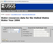
The USGS Water Data Report is now available online and improves on the previous online reports with a new interactive feature designed to make site data retrieval easier and more convenient.

The new report includes a national map interface that can be used to identify an area of interest, locate sites where water data were collected for Water Year, and access most of that data. The annual Water Data Report provides a snapshot of water conditions for a given year. Access the Water Data Report using a text (Opens page in new window. ) or map (Opens page in new window. ) interface.

Hydrologic Tools Now Available

USGS StreaMail Picture of a cell phone

USGS StreaMail is a system for accessing real-time river stage and streamflow from hand-held wireless devices, such as cell phones and Blackberries. All you have to do is send an email or text message to "streamail@usgs.gov" and use a USGS station number in the "Subject" line. In a few minutes you'll get back an email with the most recent stage and streamflow.

Instantaneous Data Archive (IDA)

The USGS collects continuous (measurements from every5 to every 60 minutes) stage, discharge, and other instantaneous time-series data on the Nation's rivers and streams. The Instantaneous Data Archive makes available as much intra-day streamflow data and historical instantaneous data, as possible, often several years' worth of data.

National Water Information System: Mapper

The new NWIS Mapper provides an interactive map interface to all USGS water data (historical and current). (Note: To access data, zoom in on the map to level 11 or greater to make the individual sites clickable.)

USGS Really Simple Syndication (RSS)

Really Simple Syndication (RSS) is a format to provide content feeds from web sites that contain article headlines, summaries and links back to the full article from that web site. RSS is an easy way for you to be alerted when content that interests you appears on your favorite websites.  Podcast/RSS Rss Feed Link


2012 West Virginia Water Research Conference

2012 West Virginia Water Research Conference Website:

Highlighted Publications

The West Virginia Water Science Center produces publications about water resources.

Cover Page of SIR 2012-5121Scientific Investigations Report 2012-5121  Comparison of Base Flows to Selected Streamflow Statistics Representative of 1930-2002 in West Virginia

Cover Page of SIR 2010-5185Scientific Investigations Report 2010-5185  Estimation of Selected Seasonal Streamflow Statistics Representative of 1930-2002 in West Virginia

Cover Page of SIR 2010-5033Scientific Investigations Report 2010-5033  Estimation of Flood-Frequency Discharges for Rural, Unregulated Streams in West Virginia

Cover Page of SIR 2009-5242Scientific Investigations Report 2009-5242  Regional Curves for Bankfull Channel Characteristics in the Appalachian Plateaus, West Virginia

Cover Page of SIR 2009-5145

Report Series 2009-5145
Hydrogeologic Factors Affecting Base-Flow Yields in the Jefferson County Area, West Virginia, October-November 2007

Cover Page of OF 2009-1199Open-File Report 2009-1199 Summary of West Virginia Water-Resource Data through September 2008

Cover Page of SIR 2009-5153Scientific Investigations Report 2009-5153 Hydrogeology and Ground-Water Flow in the Opequon Creek Watershed area, Virginia and West Virginia


yellow iconSearch our publications


USGS Home Water Resources Biology Geography Geology Geospatial

Accessibility FOIA Privacy Policies and Notices

Take Pride in America logo USA.gov logo U.S. Department of the Interior | U.S. Geological Survey
URL: http://wv.usgs.gov/
Page Contact Information: WV_Webmaster
Page Last Modified: Wednesday, 10-Oct -2012 09:55:00 EDT

03058000: Flow=362cfs,Stage=9.30ft,2012-10-19 01:00,High,WEST FORK R BL STONEWALL JACKSON DAM NR WESTON, WV 03052500: Flow=27cfs,Stage=2.10ft,2012-10-19 01:00,>90,SAND RUN NEAR BUCKHANNON, WV 03198000: Flow=2140cfs,2012-10-19 01:30,Stage=18.13ft,2012-10-19 01:00:00,Floodstage=37ft,<10,KANAWHA RIVER AT CHARLESTON, WV 03061000: Flow=432cfs,Stage=2.50ft,2012-10-19 01:00,76-90,WEST FORK RIVER AT ENTERPRISE, WV 01619500: Flow=196cfs,Stage=2.68ft,Floodstage=8ft,2012-10-19 00:30,76-90,ANTIETAM CREEK NEAR SHARPSBURG, MD 01617800: Flow=8.5cfs,Stage=1.18ft,2012-10-19 00:15,76-90,MARSH RUN AT GRIMES, MD 01616500: Flow=156cfs,Stage=2.42ft,Floodstage=10ft,2012-10-19 02:00,76-90,OPEQUON CREEK NEAR MARTINSBURG, WV 01614000: Flow=73cfs,Stage=2.62ft,2012-10-19 01:30,76-90,BACK CREEK NEAR JONES SPRINGS, WV 03197000: Flow=190cfs,2012-10-19 02:00,Stage=3.96ft,2012-10-19 01:00:00,Floodstage=19ft,10-24,ELK RIVER AT QUEEN SHOALS, WV 03110000: Flow=11cfs,Stage=1.18ft,2012-10-19 02:00,10-24,Yellow Creek near Hammondsville OH 01608500: Flow=121cfs,Stage=1.55ft,Floodstage=15ft,2012-10-19 01:30,10-24,SOUTH BRANCH POTOMAC RIVER NEAR SPRINGFIELD, WV 01601500: Flow=27cfs,Stage=1.71ft,Floodstage=10ft,2012-10-19 00:00,10-24,WILLS CREEK NEAR CUMBERLAND, MD 03214500: Flow=348cfs,Stage=2.79ft,Floodstage=38ft,2012-10-19 02:00,25-75,TUG FORK AT KERMIT, WV 03213700: Flow=297cfs,Stage=2.99ft,Floodstage=27ft,2012-10-19 02:00,25-75,TUG FORK AT WILLIAMSON, WV 03213500: Flow=4.8cfs,Stage=2.59ft,2012-10-19 02:00,25-75,PANTHER CREEK NEAR PANTHER, WV 03206600: Flow=3.2cfs,Stage=4.59ft,2012-10-19 01:30,25-75,EAST FORK TWELVEPOLE CREEK NEAR DUNLOW, WV 03203600: Flow=214cfs,Stage=4.84ft,Floodstage=23ft,2012-10-19 01:30,25-75,GUYANDOTTE RIVER AT LOGAN, WV 03202750: Flow=30cfs,Stage=1.99ft,Floodstage=11ft,2012-10-19 01:30,25-75,CLEAR FORK AT CLEAR FORK, WV 03202400: Flow=93cfs,Stage=3.04ft,Floodstage=17ft,2012-10-19 01:30,25-75,GUYANDOTTE RIVER NEAR BAILEYSVILLE, WV 03200500: Flow=192cfs,Stage=10.14ft,Floodstage=25ft,2012-10-19 01:00,25-75,COAL RIVER AT TORNADO, WV 03198500: Flow=110cfs,Stage=1.74ft,Floodstage=17ft,2012-10-19 01:30,25-75,BIG COAL RIVER AT ASHFORD, WV 03194700: Flow=89cfs,Stage=3.49ft,2012-10-19 01:30,25-75,ELK RIVER BELOW WEBSTER SPRINGS, WV 03193000: Flow=3230cfs,Stage=2.90ft,Floodstage=27ft,2012-10-19 02:00,25-75,KANAWHA RIVER AT KANAWHA FALLS, WV 03192000: Flow=651cfs,Stage=2.03ft,Floodstage=20ft,2012-10-19 01:00,25-75,GAULEY RIVER ABOVE BELVA, WV 03191500: Flow=14cfs,Stage=5.07ft,2012-10-19 01:30,25-75,PETERS CREEK NEAR LOCKWOOD, WV 03190400: Flow=48cfs,Stage=2.87ft,2012-10-19 01:30,25-75,MEADOW RIVER NEAR MT. LOOKOUT, WV 03190000: Flow=21cfs,Stage=3.23ft,2012-10-19 01:15,25-75,MEADOW RIVER AT NALLEN, WV 03189100: Flow=231cfs,Stage=10.26ft,2012-10-19 01:30,25-75,GAULEY RIVER NEAR CRAIGSVILLE, WV 03187500: Flow=54cfs,Stage=2.46ft,2012-10-19 01:30,25-75,CRANBERRY RIVER NEAR RICHWOOD, WV 03186500: Flow=70cfs,Stage=1.46ft,Floodstage=10.5ft,2012-10-19 01:00,25-75,WILLIAMS RIVER AT DYER, WV 03185000: Flow=32cfs,Stage=2.27ft,2012-10-19 01:30,25-75,PINEY CREEK AT RALEIGH, WV 03184000: Flow=255cfs,Stage=1.08ft,Floodstage=16ft,2012-10-19 01:30,25-75,GREENBRIER RIVER AT HILLDALE, WV 03183500: Flow=226cfs,Stage=2.42ft,Floodstage=14ft,2012-10-19 01:00,25-75,GREENBRIER RIVER AT ALDERSON, WV 03180500: Flow=44cfs,Stage=0.92ft,Floodstage=7ft,2012-10-19 01:00,25-75,GREENBRIER RIVER AT DURBIN, WV 03179000: Flow=69cfs,Stage=2.33ft,Floodstage=10ft,2012-10-19 01:00,25-75,BLUESTONE RIVER NEAR PIPESTEM, WV 03176500: Flow=1980cfs,Stage=3.23ft,Floodstage=15ft,2012-10-19 01:30,25-75,NEW RIVER AT GLEN LYN, VA 03175500: Flow=53cfs,Stage=2.78ft,Floodstage=10ft,2012-10-19 01:30,25-75,WOLF CREEK NEAR NARROWS, VA 03159540: Flow=9.0cfs,Stage=4.85ft,Floodstage=17ft,2012-10-19 01:30,25-75,Shade River near Chester OH 03155000: Flow=81cfs,Stage=13.79ft,2012-10-19 01:00,25-75,LITTLE KANAWHA RIVER AT PALESTINE, WV 03151400: Flow=26cfs,Stage=4.19ft,2012-10-19 01:30,25-75,LITTLE KANAWHA RIVER NR WILDCAT, WV 03114500: Flow=25cfs,Stage=2.27ft,2012-10-19 01:30,25-75,MIDDLE ISLAND CREEK AT LITTLE, WV 03112000: Flow=24cfs,Stage=1.38ft,Floodstage=7ft,2012-10-19 01:00,25-75,WHEELING CREEK AT ELM GROVE, WV 03111500: Flow=30cfs,Stage=0.70ft,Floodstage=9ft,2012-10-19 02:00,25-75,Short Creek near Dillonvale OH 03109500: Flow=65cfs,Stage=2.32ft,Floodstage=14ft,2012-10-19 01:00,25-75,Little Beaver Creek near East Liverpool OH 03076600: Flow=8.9cfs,Stage=0.84ft,2012-10-19 00:30,25-75,BEAR CREEK AT FRIENDSVILLE, MD 03075500: Flow=33cfs,Stage=2.04ft,2012-10-19 00:15,25-75,YOUGHIOGHENY RIVER NEAR OAKLAND, MD 03072000: Flow=15cfs,Stage=1.36ft,Floodstage=12ft,2012-10-19 01:45,25-75,Dunkard Creek at Shannopin, PA 03070500: Flow=85cfs,Stage=3.99ft,Floodstage=17.5ft,2012-10-19 01:15,25-75,BIG SANDY CREEK AT ROCKVILLE, WV 03069500: Flow=268cfs,2012-10-19 02:00,Stage=2.42ft,2012-10-19 01:00:00,Floodstage=16ft,25-75,CHEAT RIVER NEAR PARSONS, WV 03066000: Flow=42cfs,Stage=1.60ft,Floodstage=20ft,2012-10-19 01:30,25-75,BLACKWATER RIVER AT DAVIS, WV 03065000: Flow=115cfs,Stage=1.96ft,Floodstage=14ft,2012-10-19 01:30,25-75,DRY FORK AT HENDRICKS, WV 03062500: Flow=21cfs,Stage=0.49ft,Floodstage=3ft,2012-10-19 02:00,25-75,DECKERS CREEK AT MORGANTOWN, WV 03061500: Flow=14cfs,Stage=1.95ft,2012-10-19 01:00,25-75,BUFFALO CREEK AT BARRACKVILLE, WV 03057000: Flow=1060cfs,Stage=4.75ft,2012-10-19 01:00,25-75,TYGART VALLEY RIVER AT COLFAX, WV 03056000: Flow=896cfs,Stage=6.06ft,2012-10-19 01:00,25-75,TYGART VALLEY R AT TYGART DAM NR GRAFTON, WV 03054500: Flow=240cfs,2012-10-19 02:00,Stage=3.83ft,2012-10-19 01:00:00,Floodstage=19ft,25-75,TYGART VALLEY RIVER AT PHILIPPI, WV 03053500: Flow=68cfs,Stage=4.27ft,2012-10-19 01:30,25-75,BUCKHANNON RIVER AT HALL, WV 03052000: Flow=27cfs,Stage=1.83ft,Floodstage=10ft,2012-10-19 01:30,25-75,MIDDLE FORK RIVER AT AUDRA, WV 03051000: Flow=66cfs,Stage=2.59ft,Floodstage=14ft,2012-10-19 01:30,25-75,TYGART VALLEY RIVER AT BELINGTON, WV 03050000: Flow=21cfs,2012-10-19 02:00,Stage=0.82ft,2012-10-19 01:00:00,Floodstage=14ft,25-75,TYGART VALLEY RIVER NEAR DAILEY, WV 02011800: Flow=187cfs,Stage=8.84ft,2012-10-19 01:30,25-75,JACKSON RIVER BL GATHRIGHT DAM NR HOT SPGS, VA 02011500: Flow=27cfs,Stage=2.61ft,2012-10-19 01:30,25-75,BACK CREEK NEAR MOUNTAIN GROVE, VA 02011460: Flow=8.8cfs,Stage=2.33ft,2012-10-19 02:00,25-75,BACK CREEK NEAR SUNRISE, VA 02011400: Flow=31cfs,Stage=2.98ft,Floodstage=10ft,2012-10-19 01:30,25-75,JACKSON RIVER NEAR BACOVA, VA 01636500: Flow=799cfs,Stage=1.82ft,Floodstage=10ft,2012-10-19 01:30,25-75,SHENANDOAH RIVER AT MILLVILLE, WV 01613000: Flow=546cfs,Stage=2.83ft,Floodstage=30ft,2012-10-19 00:15,25-75,POTOMAC RIVER AT HANCOCK, MD 01611500: Flow=124cfs,Stage=1.45ft,Floodstage=9ft,2012-10-19 01:00,25-75,CACAPON RIVER NEAR GREAT CACAPON, WV 01610000: Flow=433cfs,Stage=3.63ft,Floodstage=25ft,2012-10-19 00:15,25-75,POTOMAC RIVER AT PAW PAW, WV 01609000: Flow=12cfs,Stage=1.87ft,2012-10-19 00:30,25-75,TOWN CREEK NEAR OLDTOWN, MD 01608000: Flow=31cfs,Stage=2.45ft,Floodstage=10ft,2012-10-19 01:00,25-75,S F SOUTH BRANCH POTOMAC RIVER NR MOOREFIELD, WV 01607500: Flow=16cfs,Stage=1.35ft,Floodstage=10ft,2012-10-19 01:00,25-75,S F SOUTH BRANCH POTOMAC RIVER AT BRANDYWINE, WV 01606500: Flow=111cfs,Stage=3.23ft,Floodstage=14ft,2012-10-19 01:00,25-75,SOUTH BRANCH POTOMAC RIVER NEAR PETERSBURG, WV 01606000: Flow=37cfs,Stage=3.96ft,2012-10-19 01:00,25-75,N F SOUTH BRANCH POTOMAC RIVER AT CABINS, WV 01605500: Flow=46cfs,Stage=1.94ft,Floodstage=7ft,2012-10-19 01:30,25-75,SOUTH BRANCH POTOMAC RIVER AT FRANKLIN, WV 01604500: Flow=20cfs,Stage=2.76ft,Floodstage=9ft,2012-10-19 01:30,25-75,PATTERSON CREEK NEAR HEADSVILLE, WV 01603000: Flow=253cfs,Stage=2.36ft,Floodstage=17ft,2012-10-19 00:15,25-75,NORTH BRANCH POTOMAC RIVER NEAR CUMBERLAND, MD 01599000: Flow=14cfs,Stage=3.07ft,Floodstage=8ft,2012-10-19 00:45,25-75,GEORGES CREEK AT FRANKLIN, MD 01598500: Flow=215cfs,Stage=1.39ft,Floodstage=10.5ft,2012-10-19 00:00,25-75,NORTH BRANCH POTOMAC RIVER AT LUKE, MD 01597500: Flow=51cfs,Stage=0.56ft,2012-10-19 00:15,25-75,SAVAGE RIV BL SAVAGE RIV DAM NEAR BLOOMINGTON, MD 01595500: Flow=44cfs,Stage=1.94ft,Floodstage=9ft,2012-10-19 00:15,25-75,NORTH BRANCH POTOMAC RIVER AT KITZMILLER, MD 01595000: Flow=35cfs,Stage=2.15ft,2012-10-19 00:15,25-75,NORTH BRANCH POTOMAC RIVER AT STEYER, MD 380649081083301: Stage=3.75ft,2012-10-19 01:30,Not ranked,NEW RIVER BELOW HAWKS NEST DAM, WV 03216000: Stage=34.14ft,Floodstage=52ft,2012-10-19 02:00,Not ranked,OHIO RIVER AT ASHLAND, KY 03215000: Stage=3.59ft,Floodstage=49ft,2012-10-19 01:30,Not ranked,BIG SANDY R AT LOUISA, KY 03212980: Flow=49cfs,Stage=2.65ft,Floodstage=10ft,2012-10-19 02:00,Not ranked,DRY FORK AT BEARTOWN, WV 03212750: Flow=91cfs,Stage=3.20ft,Floodstage=17ft,2012-10-19 01:30,Not ranked,TUG FORK DOWNSTREAM OF ELKHORN CREEK AT WELCH, WV 03207020: Stage=3.89ft,2012-10-19 01:00,Not ranked,TWELVEPOLE CREEK BELOW WAYNE, WV 03206000: Stage=25.46ft,Floodstage=50ft,2012-10-19 02:00,Not ranked,OHIO RIVER AT HUNTINGTON, WV 03204250: Stage=21.75ft,2012-10-19 01:00,Not ranked,MUD RIVER AT PALERMO, WV 03204000: Stage=3.73ft,Floodstage=30ft,2012-10-19 01:30,Not ranked,GUYANDOTTE RIVER AT BRANCHLAND, WV 03203000: Stage=3.73ft,Floodstage=15ft,2012-10-19 01:00,Not ranked,GUYANDOTTE RIVER AT MAN, WV 03201500: Stage=25.05ft,Floodstage=40ft,2012-10-19 02:00,Not ranked,OHIO RIVER AT POINT PLEASANT, WV 03201405: Flow=3.4cfs,Stage=4.93ft,2012-10-19 01:00,Not ranked,HURRICANE CREEK AT HURRICANE, WV 03198350: Flow=12cfs,Stage=11.35ft,Floodstage=20ft,2012-10-19 01:30,Not ranked,CLEAR FORK AT WHITESVILLE, WV 03197990: Stage=19.21ft,2012-10-19 01:30,Not ranked,KANAWHA R AT CHARLESTON, WV AUXILIARY (UPPER) 03197910: Stage=40.12ft,2012-10-19 01:00,Not ranked,UNNAMED TRIB TO ELK TWOMILE CR NR CHARLESTON, WV 03196800: Stage=0.61ft,Floodstage=18ft,2012-10-19 01:00,Not ranked,ELK RIVER AT CLAY, WV 03196600: Stage=1.63ft,Floodstage=18ft,2012-10-19 01:00,Not ranked,ELK RIVER NEAR FRAMETOWN, WV 03196500: Flow=50cfs,Stage=2.76ft,2012-10-19 01:15,Not ranked,BIRCH RIVER AT HEROLD, WV 03195500: Stage=11.34ft,2012-10-19 01:30,Not ranked,ELK RIVER AT SUTTON, WV 03189600: Stage=7.93ft,2012-10-19 01:30,Not ranked,GAULEY RIVER BELOW SUMMERSVILLE DAM, WV 03188900: Flow=34cfs,Stage=2.50ft,2012-10-19 01:15,Not ranked,LAUREL CREEK NEAR FENWICK, WV 03187000: Stage=1.95ft,Floodstage=19ft,2012-10-19 02:00,Not ranked,GAULEY RIVER AT CAMDEN ON GAULEY, WV 03185400: Flow=2620cfs,Stage=3.44ft,2012-10-19 01:30,Not ranked,NEW RIVER AT THURMOND, WV 03184500: Stage=1.95ft,Floodstage=15ft,2012-10-19 01:00,Not ranked,NEW RIVER AT HINTON, WV 03182888: Stage=46.50ft,2012-10-19 01:00,Not ranked,DRY CREEK AT TUCKAHOE, WV 03182500: Flow=99cfs,Stage=2.15ft,Floodstage=15ft,2012-10-18 12:30,Not ranked,GREENBRIER RIVER AT BUCKEYE, WV 03182050: Stage=29.53ft,2012-10-19 01:00,Not ranked,MARLIN RUN AT MARLINTON, WV 03178150: Stage=18.45ft,2012-10-19 01:00,Not ranked,MIDDLE FORK BRUSH CREEK AT EDISON, WV 03177710: Flow=28cfs,Stage=1.33ft,Floodstage=7ft,2012-10-19 01:45,Not ranked,BLUESTONE RIVER AT FALLS MILLS, VA 03177480: Flow=15cfs,Stage=0.52ft,2012-10-19 01:00,Not ranked,INDIAN CREEK AT RED SULPHUR SPRINGS, WV 03177120: Flow=10cfs,Stage=2.93ft,2012-10-19 01:00,Not ranked,EAST RIVER AT WILLOWTON, WV 03159750: Stage=46.29ft,2012-10-19 01:00,Not ranked,TUG FORK AT STATTS MILLS, WV 03155405: Stage=42.07ft,2012-10-19 01:00,Not ranked,NORTH FORK HUGHES RIVER NEAR CAIRO, WV 03155220: Flow=2.3cfs,Stage=3.70ft,2012-10-19 01:00,Not ranked,SOUTH FORK HUGHES RIVER BELOW MACFARLAN, WV 03154000: Stage=3.76ft,2012-10-19 01:30,Not ranked,WEST FORK LITTLE KANAWHA RIVER AT ROCKSDALE, WV 03153500: Stage=6.35ft,Floodstage=36ft,2012-10-19 02:00,Not ranked,LITTLE KANAWHA RIVER AT GRANTSVILLE, WV 03152000: Stage=2.58ft,Floodstage=23ft,2012-10-19 01:30,Not ranked,LITTLE KANAWHA RIVER AT GLENVILLE, WV 03151600: Stage=3.24ft,2012-10-19 01:00,Not ranked,LITTLE KANAWHA RIVER AT BURNSVILLE, WV 03151550: Stage=62.26ft,2012-10-19 01:00,Not ranked,SALTLICK CREEK NEAR FLATWOODS, WV 03151000: Stage=19.14ft,Floodstage=36ft,2012-10-19 02:00,Not ranked,OHIO RIVER AT PARKERSBURG, WV 03150700: Stage=15.42ft,Floodstage=35ft,2012-10-19 01:00,Not ranked,OHIO RIVER AT MARIETTA, OH 03114280: Stage=12.71ft,Floodstage=35ft,2012-10-19 02:00,Not ranked,OHIO RIVER AT HANNIBAL LOCK AND DAM (LOWER), OH 03112500: Stage=16.24ft,Floodstage=36ft,2012-10-19 01:00,Not ranked,OHIO RIVER AT WHEELING, WV 03111955: Flow=24cfs,Stage=2.55ft,2012-10-19 01:30,Not ranked,WHEELING CREEK NEAR MAJORSVILLE, WV 03111950: Stage=40.55ft,2012-10-19 01:00,Not ranked,DUNKARD FORK NEAR MAJORSVILLE, WV 03111548: Flow=25cfs,Stage=1.00ft,Floodstage=6ft,2012-10-19 01:30,Not ranked,Wheeling Creek below Blaine OH 03111520: Stage=13.05ft,Floodstage=37ft,2012-10-19 02:00,Not ranked,OHIO R AT PIKE ISLAND LOCK & DAM (LOWER), WV 03111515: Stage=13.14ft,2012-10-19 02:00,Not ranked,OHIO R AT PIKE ISLAND DAM NR WHEELING (UPPER), WV 03110830: Flow=6.9cfs,Stage=1.22ft,2012-10-19 01:30,Not ranked,KINGS CREEK AT WEIRTON, WV 03110690: Stage=13.18ft,Floodstage=36ft,2012-10-19 02:00,Not ranked,OHIO R AT NEW CUMBERLAND LOCK & DAM (LOWER), OH 03076500: Flow=462cfs,Stage=3.01ft,2012-10-19 00:45,Not ranked,YOUGHIOGHENY RIVER AT FRIENDSVILLE, MD 03071600: Stage=6.33ft,2012-10-19 01:00,Not ranked,CHEAT RIVER AT LAKE LYNN, PA 03071590: Stage=868.34ft,2012-10-19 01:00,Not ranked,CHEAT LAKE NEAR STEWARTSTOWN, WV 03070260: Flow=425cfs,Stage=10.54ft,Floodstage=27ft,2012-10-19 01:30,Not ranked,CHEAT RIVER AT ALBRIGHT, WV 03068800: Flow=90cfs,Stage=3.83ft,Floodstage=13ft,2012-10-19 01:30,Not ranked,SHAVERS FORK BELOW BOWDEN, WV 03067510: Flow=74cfs,Stage=4.76ft,Floodstage=20ft,2012-10-19 02:00,Not ranked,SHAVERS FORK NR CHEAT BRIDGE, WV 03065400: Flow=15cfs,Stage=0.95ft,2012-10-19 01:00,Not ranked,BLACKWATER RIVER NEAR DAVIS, WV 03063000: Stage=10.10ft,Floodstage=26ft,2012-10-19 01:15,Not ranked,Monongahela R L&D8 (Lower Pool) @ Point Marion, PA 03062450: Stage=9.93ft,Floodstage=22ft,2012-10-19 01:00,Not ranked,MONONGAHELA R AT MORGANTOWN LOCK & DAM (LOWER), WV 03062445: Stage=9.68ft,2012-10-19 01:00,Not ranked,MONONGAHELA R AT MORGANTOWN LOCK & DAM (UPPER), WV 03062250: Stage=9.68ft,2012-10-19 01:00,Not ranked,MONONGAHELA R AT HILDEBRAND LOCK & DAM (LOWER), WV 03062245: Stage=9.97ft,2012-10-19 01:00,Not ranked,MONONGAHELA R AT HILDEBRAND LOCK & DAM (UPPER), WV 03062225: Stage=10.02ft,2012-10-19 01:00,Not ranked,MONONGAHELA R AT OPEKISKA LOCK & DAM (LOWER), WV 03062224: Stage=9.62ft,2012-10-19 01:00,Not ranked,MONONGAHELA R AT OPEKISKA LOCK & DAM (UPPER), WV 03061430: Stage=12.81ft,2012-10-19 01:00,Not ranked,WHETSTONE RUN NEAR MANNINGTON, WV 03058975: Flow=510cfs,Stage=4.93ft,2012-10-19 01:00,Not ranked,WEST FORK RIVER NEAR MOUNT CLARE, WV 03058500: Stage=2.38ft,2012-10-19 01:30,Not ranked,WEST FORK RIVER AT BUTCHERVILLE, WV 03058020: Stage=7.53ft,Floodstage=17ft,2012-10-19 01:30,Not ranked,WEST FORK RIVER AT WESTON, WV 03057900: Stage=1065.69ft,2012-10-19 01:00,Not ranked,STONEWALL JACKSON LAKE NEAR WESTON, WV 03057300: Stage=4.58ft,2012-10-19 01:30,Not ranked,WEST FORK RIVER AT WALKERSVILLE, WV 03056250: Flow=31cfs,Stage=2.82ft,2012-10-19 01:30,Not ranked,THREE FORK CREEK NR GRAFTON, WV 03055500: Stage=1060.98ft,2012-10-19 01:00,Not ranked,TYGART LAKE NR GRAFTON, WV 03052450: Stage=4.79ft,Floodstage=23ft,2012-10-19 01:30,Not ranked,BUCKHANNON R AT BUCKHANNON, WV 03052120: Flow=24cfs,Stage=4.86ft,Floodstage=19ft,2012-10-19 01:00,Not ranked,BUCKHANNON RIVER AT ALTON, WV 03050500: Stage=1.69ft,2012-10-19 01:30,Not ranked,TYGART VALLEY RIVER NEAR ELKINS, WV 03049930: Stage=94.92ft,2012-10-19 01:00,Not ranked,ELKWATER FORK NEAR SPANGLER, WV 02011490: Flow=2.6cfs,Stage=0.85ft,2012-10-19 01:45,Not ranked,LITTLE BACK CREEK NEAR SUNRISE, VA 02011470: Flow=17cfs,Stage=4.05ft,2012-10-19 01:30,Not ranked,BACK CREEK AT SUNRISE, VA 01636690: Flow=27cfs,Stage=1.45ft,2012-10-19 01:15,Not ranked,PINEY RUN NEAR LOVETTSVILLE, VA 01636464: Flow=9.5cfs,Stage=1.50ft,2012-10-19 01:30,Not ranked,BULLSKIN RUN BELOW KABLETOWN, WV 01618100: Flow=11cfs,Stage=1.02ft,2012-10-19 01:30,Not ranked,ROCKYMARSH RUN AT SCRABBLE, WV 01617000: Flow=7.7cfs,Stage=2.49ft,2012-10-19 01:30,Not ranked,TUSCARORA CREEK ABOVE MARTINSBURG, WV 01616400: Flow=5.6cfs,Stage=1.42ft,2012-10-19 01:45,Not ranked,MILL CREEK AT BUNKER HILL, WV 01616100: Flow=2.5cfs,Stage=1.42ft,2012-10-19 01:15,Not ranked,DRY MARSH RUN NEAR BERRYVILLE, VA 01613525: Flow=44cfs,Stage=1.77ft,2012-10-19 00:00,Not ranked,LICKING CREEK AT PECTONVILLE, MD 01613095: Flow=15cfs,Stage=2.07ft,2012-10-19 00:45,Not ranked,TONOLOWAY CREEK NEAR HANCOCK, MD 01613030: Flow=5.2cfs,Stage=1.98ft,2012-10-19 01:45,Not ranked,WARM SPRINGS RUN NEAR BERKELEY SPRINGS, WV 01613020: Stage=44.32ft,2012-10-19 01:00,Not ranked,UNNAMED TRIB TO WARM SPR RUN NR BERKELEY SPR, WV 01610400: Flow=4.0cfs,Stage=3.21ft,2012-10-19 01:00,Not ranked,WAITES RUN NEAR WARDENSVILLE, WV 01610195: Stage=48.78ft,2012-10-19 01:00,Not ranked,PARKER HOLLOW RUN AT NEEDMORE, WV 01610155: Flow=6.3cfs,Stage=0.65ft,2012-10-19 01:00,Not ranked,SIDELING HILL CREEK NEAR BELLEGROVE, MD 01607300: Stage=46.50ft,2012-10-19 01:00,Not ranked,BRUSHY FORK NEAR SUGAR GROVE, WV 01606900: Stage=8.92ft,2012-10-19 01:00,Not ranked,SOUTH MILL CREEK NEAR MOZER, WV 01605002: Stage=18.40ft,2012-10-19 01:30,Not ranked,PAINTER RUN NEAR FORT ASHBY, WV 01595800: Flow=147cfs,Stage=2.70ft,2012-10-19 00:15,Not ranked,NORTH BRANCH POTOMAC RIVER AT BARNUM, WV Go to WaterWatch (offsite) for a larger map with additional options