to the National Atlas Home page
About | Fact Sheets | Contact Us | Partners | Products | Site Map | FAQ | Help | Follow us on Twitter 
AgricultureBiologyBoundariesClimateEnvironmentGeologyGovernmentHistoryMappingPeopleTransportationWater
to the Interactive Map MakerMap LayersPrintable MapsWall MapsDynamic MapsArticlesMapping Professionals


Map Layer Info


Breeding Bird Survey Route Locations for the Lower 48 States

What this map layer shows:

More than 3,000 routes followed by volunteers who participate in the annual survey of birds during the bird breeding season.
opens the U.S. Geological Survey home page
Background Information
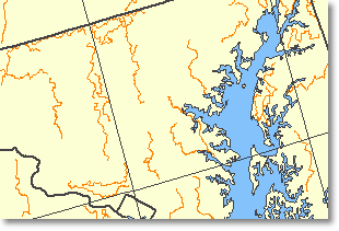
Sample map Sample Map
The Breeding Bird Survey Route Locations map layer shows the current routes used for conducting the North American Breeding Bird Survey (BBS) in the conterminous United States. The BBS is a cooperative effort between the Patuxent Wildlife Research Center of the U.S. Geological Survey and the Canadian Wildlife Service's National Wildlife Research Centre to monitor the status and trends of North American bird populations. Routes are randomly located to sample habitats that are representative of an entire region. The BBS was established in 1966 and collects data for more than 400 bird species. Each year, during the height of the avian breeding season (June for most of the United States and Canada), participants skilled in avian identification collect bird population data along roadside survey routes. Each survey route is approximately 24.5 miles long and contains 50 stops located at 0.5-mile intervals. At each stop, a 3-minute count is conducted. During the count, every bird seen within a 0.25-mile radius or heard is recorded. The resulting data are used by conservation managers, scientists, and the general public to estimate population trends and relative abundances and to assess bird conservation priorities. Detailed information on the BBS is available on the Breeding Bird Survey home page. This map layer was compiled by the Patuxent Wildlife Research Center.

The BBS Route map layer shows the locations of 3,229 BBS routes in the conterminous United States. Only those routes considered active in 1998 are included. Descriptive information includes the route name, route number, and length in meters. Some routes are longer than 24.5 miles (39,429 meters) because they contain sections where no survey is conducted because of traffic, noise, or other conditions.


Biology
Map Maker Sample
Breeding Bird Survey Routes